
A CHILLY START TO MARCH
Good morning! It’s a clear and crisp Sunday morning across North and Central Alabama. A dry front moved through overnight, reinforcing the cool air already in place. Temperatures at sunrise range from the mid-30s in Birmingham to the upper 20s in Huntsville, with light winds making it feel even colder. Expect a gradual warm-up through the morning, but it will remain cool and dry throughout the day.
YESTERDAY’S WEATHER RECAP
Saturday brought another dry and mild day across the region. High temperatures reached the low to mid-60s across most of Central Alabama, with slightly cooler conditions in North Alabama. Skies remained clear throughout the day, allowing for plenty of sunshine. The passage of a weak dry front during the afternoon reinforced the cool air in place, leading to our chilly start this morning. Winds were gusty out of the northwest overnight but are relaxing this morning.
HIGH PRESSURE HOLDS STEADY FOR NOW
Surface high pressure remains in control today, leading to another quiet weather day. Expect mostly sunny skies with highs reaching the mid-50s in North Alabama and near 60°F in Central Alabama. Winds will remain light out of the northeast. Overnight, temperatures will once again dip into the mid-30s for Birmingham and low 30s for Huntsville, keeping the early March chill intact.
SEVERE WEATHER POSSIBLE TUESDAY NIGHT
A significant severe weather outbreak is a possibility across the Lower Mississippi Valley on Tuesday afternoon into Tuesday night, before shifting into Alabama Tuesday night. A strong upper-level trough will eject eastward from the Rockies, bringing a surge of moisture and instability into the region. This setup is typical of early spring severe weather outbreaks and should be monitored closely.
A squall line of strong to severe thunderstorms is expected to develop by midday Tuesday across eastern Oklahoma, Arkansas, and Louisiana. By late Tuesday afternoon, these storms will reach the Mississippi River from southeastern Missouri down through northern Louisiana and western Mississippi, where they will encounter very strong wind shear and favorable instability. This environment supports a significant severe weather event, with widespread damaging winds and embedded tornadoes, some of which could be strong. There is also potential for discrete supercells ahead of the main squall line, which could enhance the tornado threat further.
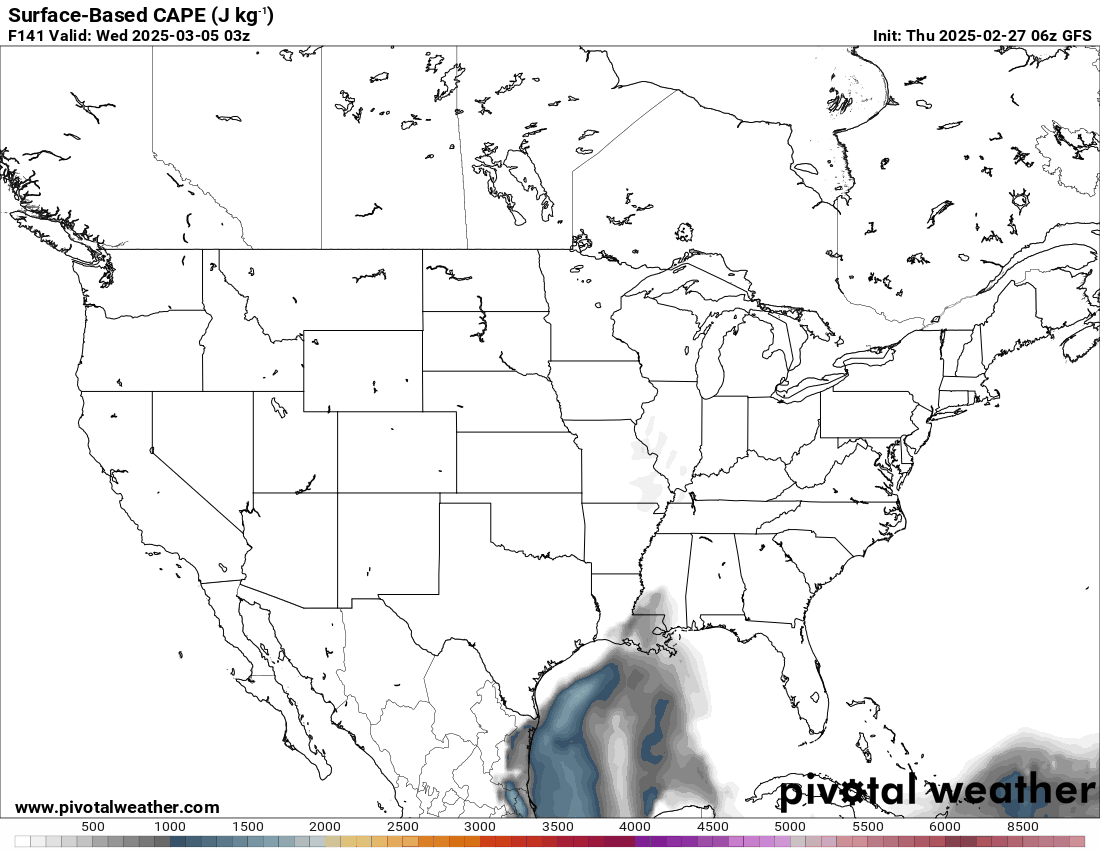
GFS Model Trends for the Surface Based CAPE Parameter for 9 pm CST Tuesday Night
This system will continue pushing eastward into Alabama late Tuesday night into early Wednesday morning. The primary concerns remain damaging winds and tornadoes, particularly in Central Alabama. Current model guidance suggests the system may be less capable of producing severe weather than the current Level 2 out of 5 severe weather risk would indicate. But the details will become more apparent in the coming 36 hours. The most likely timeframe for severe storms in Alabama is between 10 PM Tuesday and 6 AM Wednesday, which means much of this event will occur overnight, making it especially dangerous. Residents should ensure they have multiple ways to receive warnings, including NOAA Weather Radios and smartphone alerts.
RAIN & WIND FOLLOW THE STORMS
Once the main squall line moves east Wednesday morning, gusty post-frontal winds will linger into the afternoon. Rainfall amounts of 0.5 to 1.5 inches are expected, with localized higher totals possible. Winds will shift out of the northwest at 15-25 mph, with gusts up to 35 mph, leading to a sharp temperature drop by late Wednesday.
Thursday will be cooler and breezy, with highs struggling to reach the mid-50s. Morning lows will fall into the low 30s, potentially bringing a light freeze to portions of North Alabama.
A PEEK AT NEXT WEEKEND
After a midweek rollercoaster, tranquil conditions return next weekend. High pressure will settle in, bringing mostly sunny skies with highs in the mid-60s on Saturday and upper 60s by Sunday. Dry conditions should prevail, making for a great weekend to enjoy the outdoors.
WEEK TWO GLANCE
Long-range trends indicate a gradual warming pattern into the second week of March. Highs should return to the low 70s, with rain chances increasing around midweek as another system approaches. For now, no major cold outbreaks are expected beyond Thursday’s cool-down.
THIS DAY IN WEATHER HISTORY
On March 2, 1960, northeastern Alabama experienced one of its most severe ice storms on record, particularly affecting the Sand Mountain and Lookout Mountain areas. The storm caused extensive damage to timber, poultry industries, and public utilities, resulting in millions of dollars in losses. The combination of ice, sleet, snow, and strong winds led to widespread devastation. The weight of the accumulated ice brought down trees and power lines, leading to prolonged power outages and disrupted communication services.
This ice storm was part of a larger weather system that impacted multiple states. Freezing rain and high winds were reported across Tennessee and the Carolinas, causing additional damage to infrastructure and essential services. The 1960 ice storm remains a significant event in Alabama’s weather history, highlighting the potential for severe winter weather in the region.
WEATHERBRAINS PODCAST UPDATE
WeatherBrains records live Monday night at 7:00 PM CT, where you can watch on YouTube or listen later on your favorite podcast platform. Tune in for an in-depth discussion with retired NWS forecaster Pete Wolf on radar interpretation, NWS modernization, and budget cuts. Don’t miss this informative episode!
Category: Alabama’s Weather, ALL POSTS, Social Media