
A CHILLY BUT SUNNY MIDDAY
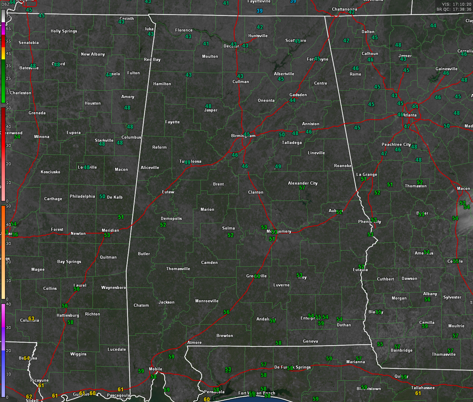
Temperatures are climbing under sunny skies across North and Central Alabama, although it remains slightly unseasonably cool. At 11 AM, Birmingham sat at 45°F, with Huntsville at 43°F. Winds are light from the northeast, and dry conditions persist.
WARMING TREND CONTINUES INTO MONDAY
High pressure remains in control today, ensuring another dry and pleasant afternoon. Highs will peak in the mid-to-upper 50s in North Alabama and low 60s in Central Alabama. Tonight will be chilly again, with lows in the upper 20s to mid-30s. By Monday, southeast winds will return, and temperatures will begin to climb into the upper 60s, with a few spots reaching 70°F.
EYES ON SEVERE WEATHER TUESDAY NIGHT
A developing storm system will bring an increasing risk of severe weather late Tuesday into early Wednesday morning. A deepening low-pressure system in the Plains will push a strong cold front toward the region, with a Level 2 out of 5 risk for severe thunderstorms across all of Central Alabama.
STRONG WINDS AND ISOLATED TORNADOES POSSIBLE
A line of thunderstorms will approach the Mississippi River by Tuesday afternoon and move into Alabama late Tuesday night. Wind shear is very strong, but instability is in question, which could limit the tornado threat. However, damaging straight-line winds and embedded tornadoes remain possible, especially in QLCS surges along the main squall line. Heavy rainfall of 1 to 1.5 inches is also expected, with locally higher totals.
STORM ARRIVAL TIMING
Current models suggest that storms will begin impacting western Alabama after 10 PM Tuesday and continue through early Wednesday morning, exiting the state before sunrise. Given the overnight nature of this event, residents should have multiple ways to receive warnings, including NOAA Weather Radios and smartphone alerts.
POST-FRONTAL CHILL RETURNS MIDWEEK
Once the storms clear out, gusty northwest winds will bring a sharp cooldown. Highs on Wednesday will struggle to reach the mid-50s, with a brisk wind making it feel even colder. Thursday morning lows will drop into the low 30s, possibly leading to a light freeze in North Alabama.
STILL WATCHING THE NEXT SYSTEM NEXT WEEKEND
Rain chances return by next weekend, but uncertainty remains on the track of the next storm system. Long-range models suggest another chance for showers and possibly storms by Saturday or Sunday, though details are still unclear.
CHECK BACK FOR UPDATES
Confidence in the severe weather forecast is increasing, but there are still uncertainties regarding instability and overall storm intensity. Expect refinements to the timing and threats over the next 24-36 hours.
Category: Alabama’s Weather, ALL POSTS, Severe Weather, Social Media