Updated. Originally Posted 24th October 2019
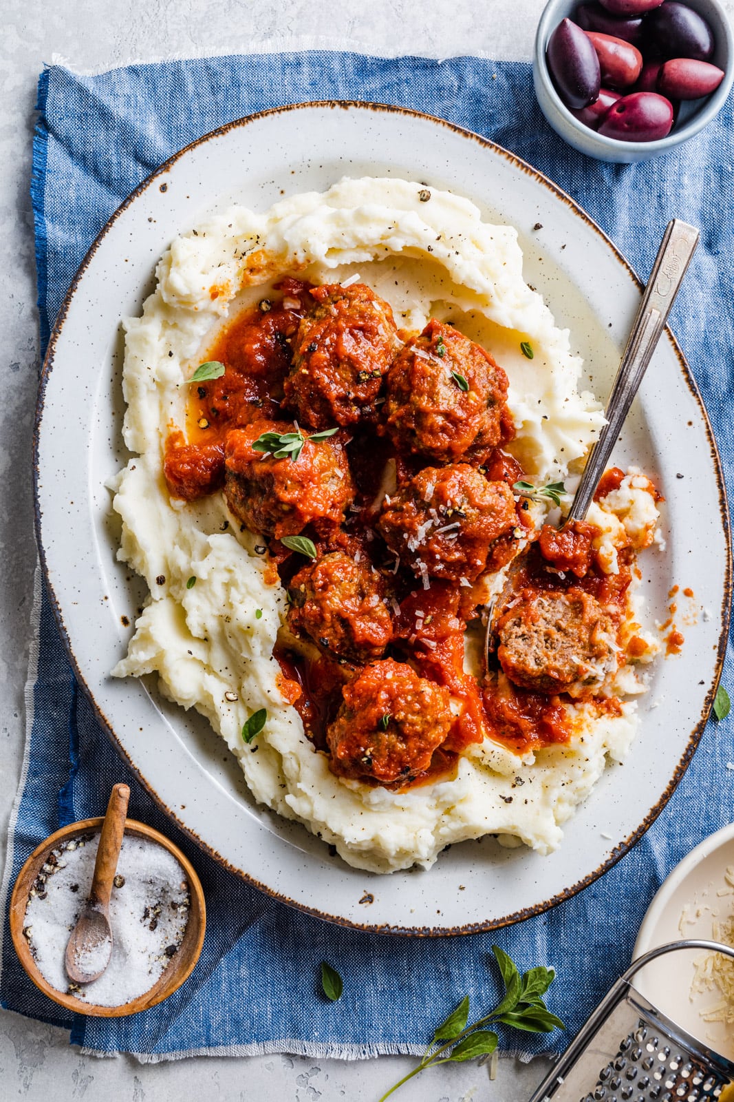
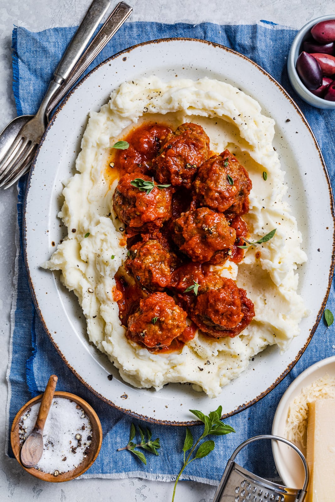
These super tender Cumin spiced Greek Meatballs σουτζουκάκια (soutzoukakia) are a staple in most Greek homes. My mom always serves them with buttery rice or crusty bread. They are aromatic and flavor packed and so delicious. This is my very favorite slow cooker/ crockpot recipe for them but I have included the stove top and oven baked version below. If you have a crockpot though I very strongly recommend making them in the slow cooker – you will not get more tender meatballs. It’s so practical and it’s also great for all of us that don’t have all day to spend in the kitchen. It’s something you can set and forget while you continue on in your busy day.
What Are Soutzoukakia?
Soutzoukakia are a meatball dish of Greek / Turkish origin and comes from Smyrna (modern day Izmir). These meatballs are often more oblong shaped than the rounder keftethes/ although I often make them round. Apart from the shape, another difference between soutzoukakia and keftethes is that soutzoukakia are flavoured with cumin and often made in a tomato based sauce whereas keftethes are made with other herbs or spices and no sauce.
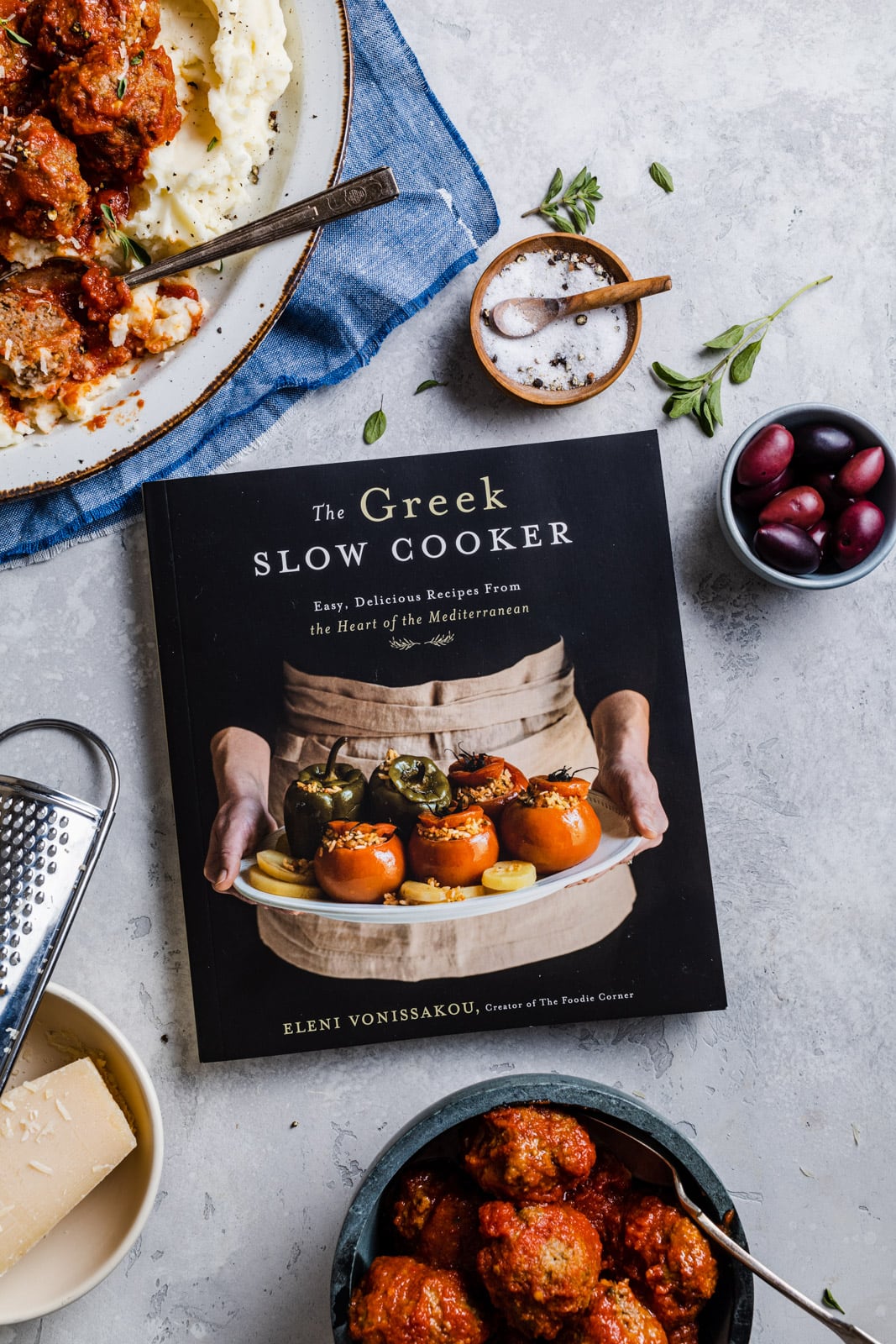
This a beloved recipe from my friend Eleni Vonissakou’s cookbook called The Greek Slow Cooker. I was so happy to receive a copy of her book and even happier to meet her in person while I was visiting Athens a few years ago. Eleni is an amazing food stylist and photographer and all the the beautiful images in her book are styled and photographed by her. For more of her beautiful work you must follow her blog and instagram page. She is the creator of the The Foodie Corner. In this lovely book Eleni has put together 75 authentic and flavour packed classic dishes of her Greek heritage using a slow cooker. There are 8 chapters in the book from No-Fuss, Succulent Poultry, Fall-Apart Tender Meat, Seafood, Veggies, Legumes (my personal fav) to Eggs and Creamy Dairy, Bread and even some very tasty Sweets. All the chapters are chock full of incredible, modern and traditional Greek dishes all using a slow cooker. You will love the book and all the recipes.
Soutzoukakia Recipe Ingredients
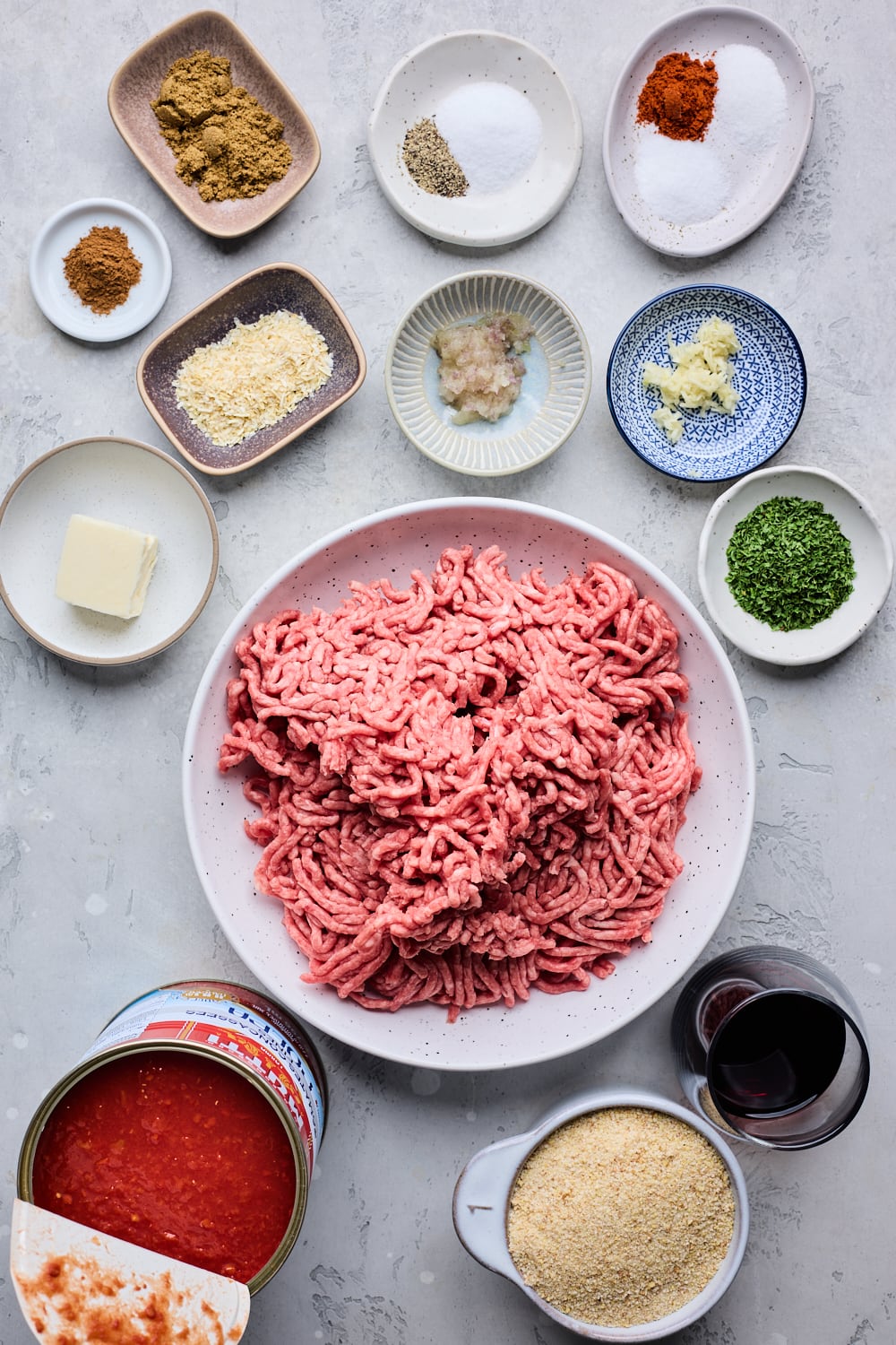
- GROUND BEEF: I use lean ground beef but you can also use a combination of ground beef and ground pork or even ground lamb for more flavor. I have not tested this recipe with ground chicken or ground turkey but it should work.
- BREAD CRUMBS: I use plain bread crumbs in this recipe
- RED WINE: I strongly recommend using the red wine for this recipe it adds such fantastic flavour to the meatballs. Another option is using broth or a mixture of half broth or water and red wine vinegar.
- GARLIC: Feel free to use ready made garlic paste or mince or grate fresh garlic cloves
- SHALLOT: This was not in the original recipe so it is optional but I love the flavor and moisture it adds to the meatballs. You could use a very small yellow or red onion in its place or ¼ of a large onion.
- PARSLEY: Feel free to use fresh chopped parsley or dried parsley
- SPICES: Salt, pepper, cumin, cinnamon, onion powder or dried /dehydrated onion flakes, and paprika are what I use in this recipe for that authentic flavor.
- CANNED TOMATOES: You will need a large can of finely diced tomatoes. If you want a lot of extra sauce for the meatballs I would add an extra small can of diced tomatoes.
- BUTTER: This adds richness to the sauce and helps balance the acidity of the tomatoes – I usually use unsalted butter.
- SUGAR: Balances the acidity of the tomatoes – use white sugar or brown sugar or even honey
- EXTRA ADD INS: Some recipes also add 1 bay leaf, pinch of all spice, and dried oregano to the sauce or the meatballs too (minus the bay leaf). If you prefer to use ½ the breadcrumbs you can and simply add 2 eggs to make up for the binding ingredients.
How To Make Easy Slow Cooker Soutzoukakia (oven baked and stove top instructions below)
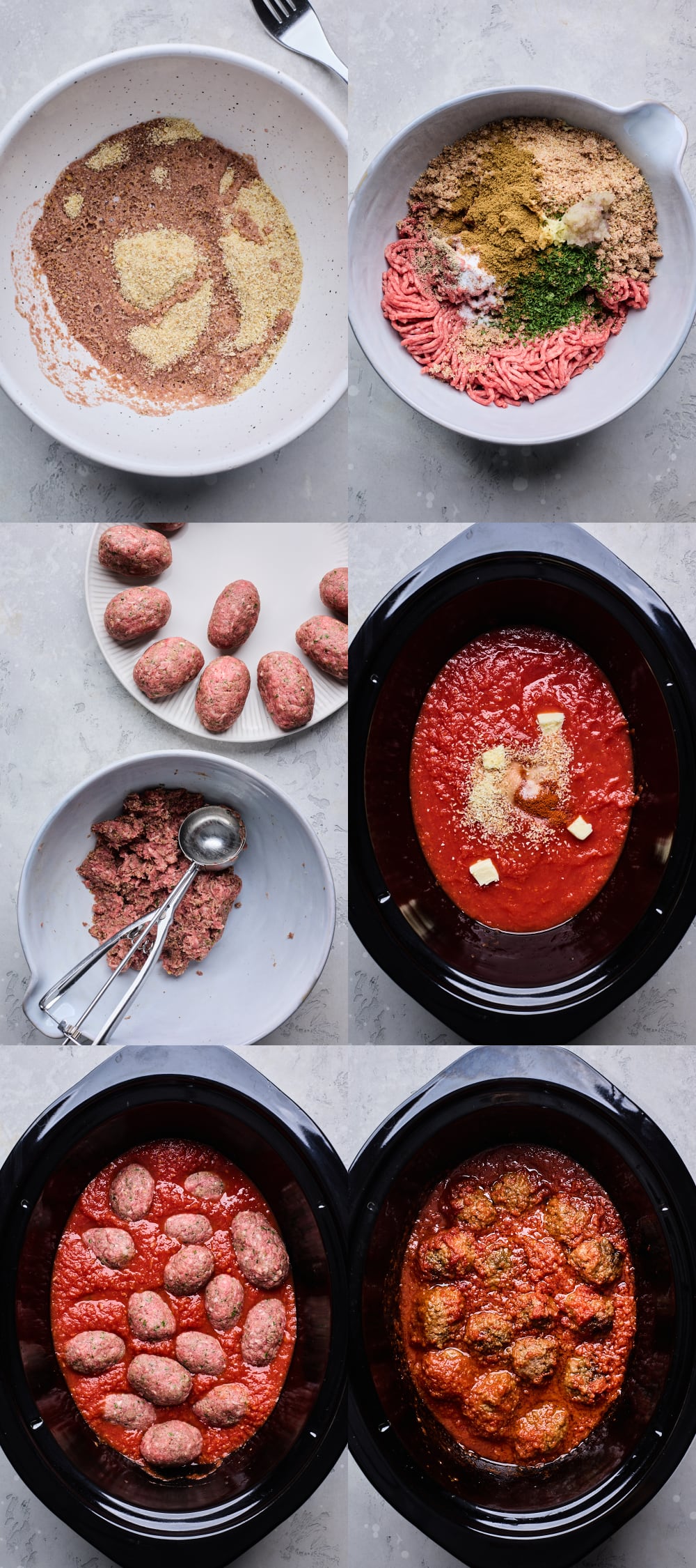
- Moisten Bread Crumbs: Toss the bread crumbs with the red wine
- Combine Meatball Ingredients: Combine the meat with the bread crumb mixture along with the remaining meatball ingredients
- Shape Meatballs: Scoop out the meatball mixture – I like to use a large cookie scoop then shape meatballs into round meatballs or more traditionally into longer oval shaped meatballs.
- Combine Sauce Ingredients: Add all the sauce ingredients to the crockpot and stir to combine.
- Add Meatballs to Crockpot: Place the meatballs over the sauce gently
- Slow Cook Meatballs: Cook in the crock pot for 5½ – 7 hours on low heat.
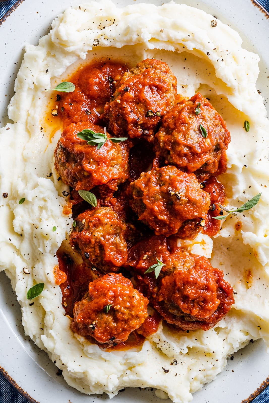
- Serve: Serve the meatballs with the sauce over rice or mashed potatoes or with crusty bread.
Make Ahead, Storage & Freezing Soutzoukakia
- MAKE AHEAD MEATBALLS: You can refrigerate raw meatball mixture overnight and shape it the next day, or freeze the raw mixture for up to three months. Thaw in the fridge before shaping into meatballs if freezing.
- STORAGE: The meatballs and sauce can be stored in the fridge for 2-3 days and reheated on the stove-top. If the sauce is a little too thick, just add a touch of water or broth to loosen it up.
- FREEZING SAUCE WITH MEATBALLS: The cooked meatballs can be frozen, in their sauce, for up to 3 months. When ready to serve, thaw overnight in the refrigerator and reheat on the stovetop until the meatballs are warmed through in the center.