The good news is that the storms over Southwest Alabama have weakened in the past 30 minutes.
This has allowed the NWS in Mobile to expire the tornado warnings that have been in effect.
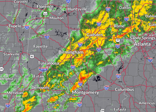
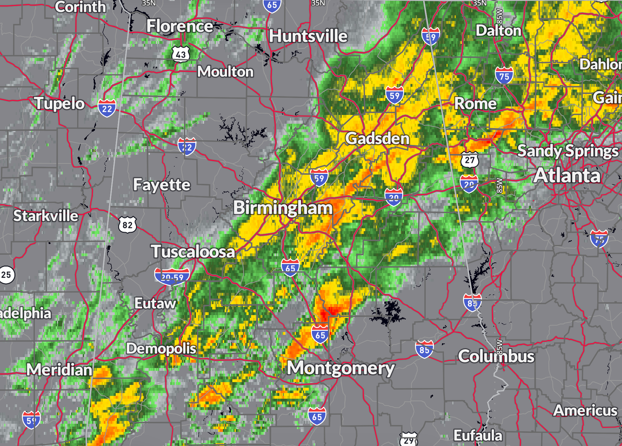
A tornado watch has been issued for portions of Central and Southern Alabama, including Marengo, Autauga, Elmore, Lee, and areas southward, valid through 3 AM CST. Multiple rounds of severe thunderstorms continue to move across the region, bringing the threat of damaging winds and tornadoes overnight.
Residents in the tornado watch area should remain weather-aware and be prepared to take cover if warnings are issued for spin up tornadoes along the developing QLCS. Avoid flooded roadways and continue to monitor updates as storms track through the region overnight.
Meanwhile, flash flooding earlier this evening caused significant issues in Hoover, with floodwaters entering homes at 3124 Carousel Court and 5121 Crown Chase Parkway. Hoover Fire Department responded to these locations, along with flooding over roads at 2406 Tyler Road and Highway 150 near the Holiday Inn. Conditions have since improved as the heaviest rain has shifted eastward, but lingering high water may still be present in some low-lying areas.
A well-organized convective system continues to impact the South tonight, with multiple bands of strong to severe thunderstorms producing heavy rainfall and an increasing risk for flash flooding. A 40 to 50+ knot southwest low-level jet is transporting deep moisture into the region, with MUCAPE values of 1000 to 2000 J/kg supporting continued storm development. This setup is leading to training thunderstorms, where storms repeatedly pass over the same areas, enhancing rainfall totals. The heaviest rain so far has been observed across southern Mississippi and central Alabama, with concerns shifting eastward into northwest Georgia later tonight.
Over the next several hours, storms are expected to organize into a quasi-linear convective system (QLCS), with embedded supercells continuing to produce both severe weather and torrential rainfall. Forecast models indicate an additional 2 to 4 inches of rain, with localized amounts exceeding that where training occurs. Rainfall rates of 1 to 2+ inches per hour will further heighten the flash flood risk, particularly in urban areas. Flash flooding is already ongoing in some locations, and areas like Atlanta and other metro regions in Georgia may experience additional flood impacts overnight. Residents in flood-prone areas should remain alert, as conditions will continue to evolve through the early morning hours.
Category: Alabama’s Weather, ALL POSTS, Severe Weather, Social Media