
Rating: EF1
Estimated Peak Wind: 105 mph
Path Length /statute/: 2.01 miles
Path Width /maximum/: 215 yards
Fatalities: 0
Injuries: 0
Start Date: 02/15/2025
Start Time: 11:12 PM CST
Start Location: 1 SW Tuscumbia / Colbert County / AL
Start Lat/Lon: 34.7212 / -87.7166
End Date: 02/15/2025
End Time: 11:13 PM CST
End Location: 1 ENE Tuscumbia / Colbert County / AL
End Lat/Lon: 34.7338 / -87.6877
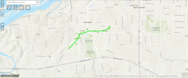
Survey Summary:
NWS Huntsville and Colbert County EMA surveyed damage in the
downtown Tuscumbia area consistent with EF-1 damage.
The tornado touched down near the intersection of Lamar Rd and Frankfort Rd.
The tornado caused immediate and widespread damage in
neighborhoods SW of downtown Tuscumbia. This includes roof damage
to an Elementary school off Glendora Ave. Damage indicators were
mostly a combination of uprooted hard and softwood trees.
Numerous homes had roof damage associated with felled trees. As
the tornado tracked into downtown, power lines and traffic
signals were destroyed. Significant roof damage occurred near 5th
and Main St where a metal roof was completely removed. As the
tornado moved out of the downtown area, numerous trees were again
uprooted along 5th and 6th St. through Commons St. The tornado
lifted east of Commons Street before reaching Kings Ave.
Rating: EF2
Estimated Peak Wind: 115 mph
Path Length /statute/: 3.93 miles
Path Width /maximum/: 170 yards
Fatalities: 0
Injuries: 1
Start Date: 02/15/2025
Start Time: 11:20 PM CST
Start Location: 4 ESE Russellville / Franklin County / AL
Start Lat/Lon: 34.4791 / -87.6587
End Date: 02/15/2025
End Time: 11:27 PM CST
End Location: 6 SE Littleville / Franklin County / AL
End Lat/Lon: 34.5136 / -87.6082
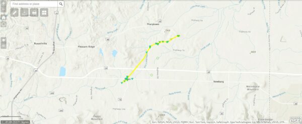
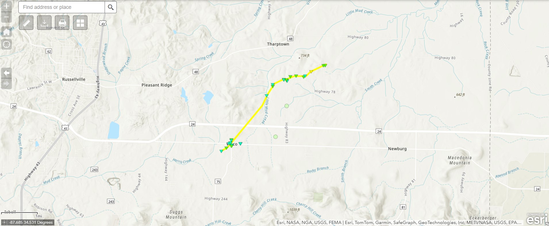
Survey Summary:
An NWS and Franklin County (AL) EMA survey team determined that
an EF-2 tornado caused damage in central Franklin County.
The tornado quickly formed while embedded within the line of severe
thunderstorms late Saturday night. It touched down just south of
Russellville Rd. and east of Harris Creek. There the tornado blew
out the doors of a large, metal storage shed and lofted an ATV
across the property. The tornado shifted ENE just south of
Russellville Rd. and Hwy 75 where it uprooted numerous hardwood
trees, some of which fell on houses. Residents at this location
received advanced NWS warnings and took refuge in their tornado
shelter before their home was impacted. Several homes also
experienced partial roof loss further east on Russellville Rd.
The tornado shifted north Hwy 24 where the vortex contracted and
strengthened. Among uprooted hardwood trees on one property, the
upper quarter of a large silo collapsed. Further east, numerous
trees were uprooted, some on houses and cars. Near Hwy 78 and Hwy
83 junction, a manufactured home was impacted with roof and
siding damage. The resident was thankful for the early warning
from the NWS as it allowed time for her family to safely seek
refuge. The tornado tracked ENE of Hwy 78 and destroyed several
small farm buildings before impacting homes near the McGuire Loop
area. Near McGuire Loop and Rocky Glen Rd., the tornado knocked
down numerous power lines in trees before completely removing the
roof of one single-family residence. This is where the strongest
intensity of the tornado likely occurred with a maximum wind of
115 miles an hour. The tornado traveled to the NE portion of
McGuire Loop where pine trees were snapped. The tornado lifted
west of Hwy 87.
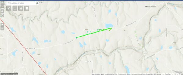
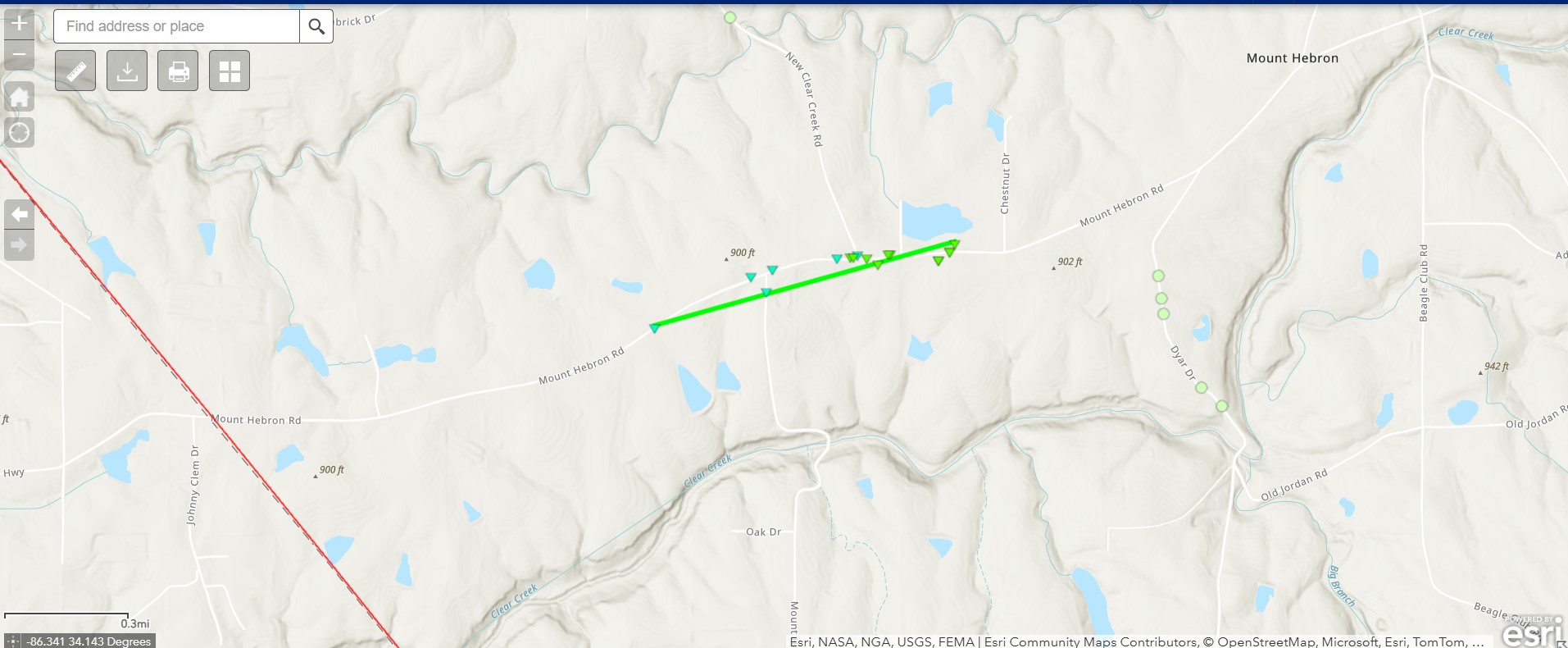
Rating:                 EF1
Estimated Peak Wind:    100 mph
Path Length /statute/:  0.76 miles
Path Width /maximum/:   30 yards
Fatalities:             0
Injuries:               0

Start Date:             02/16/2025
Start Time:             1:05 AM CST
Start Location:         3 SSE Douglas / Marshall County / AL
Start Lat/Lon:          34.133 / -86.3162

End Date:               02/16/2025
End Time:               1:11 AM CST
End Location:           3 SSE Douglas / Marshall County / AL
End Lat/Lon:            34.136 / -86.3035

Survey Summary:
The tornado rapidly developed along a line of severe storms
entering Southwestern Marshall County, first producing damage by
snapping several softwood trees along Mount Hebron Road. The
tornado continued along this road as it approached Mount Hebron
Douglas Road, snapping large softwood branches along its path.
The most concentrated damage occurred just northeast of the
intersection with Mount Hebron Douglas Road, where several farm
outbuildings and barns were destroyed. This was at and
immediately east of the intersection with New Clear Creek Road.
Here, a power pole was snapped about 5 to 7 feet from the top of
the pole. Also at this location, a cattle trailer was overturned
and moved several feet. A well-built farm outbuilding suffered
collapsed walls here at this location, and the combination of
this and the power pole led to the strongest point in this short-
lived tornado: 100mph winds and 30 yards in width. The tornado
continued northeast of this location to the farm next door,
destroying a small hay barn and another farm outbuilding across
the street. This particular building had a covered overhang and
was open on the end where the tornado approached, which
contributed to it's failing here. For this reason, the wind
speeds were lower than at the adjacent farm to the southwest. No
further damage was noted northeast of this hay barn location
between here and Chestnut Drive.

Other damage was noted in the vicinity of Mount Hebron Road to the
north and the south, which was mainly large branches blown down or
sporadic trees here and there that were broken. This was determined
to be related to straight-line winds from the line of storms, as all
damage was noted to be laying in the same direction and not convergent
in nature.