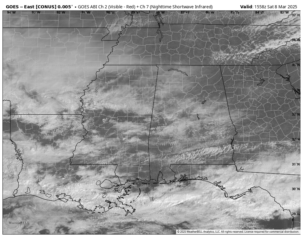
Visible satellite as of 9:58AM CST today.
As we have reached the 10AM hour on this second Saturday in March, we have filtered sunshine across the state as clouds have been streaming in throughout the morning. There may actually be some light showers falling along and south of I-20/59 mainly around Selma and over to Demopolis and up to Eutaw and Pickensville. These showers are associated with activity that stretches back through Central Mississippi and Southern Arkansas, and covering a good portion of Southern Oklahoma and spots of Northern Texas. The rest of Alabama is dry at this point.
There is a big spread in temperatures at this point as well, as we are seeing mid to upper 50s in the extreme northern and northwestern parts of the state, with lower 60s to the lower 70s as you move south. Birmingham was at 64 degrees, with the cool spot being Courtland at 55 degrees, and the warm spot being Andalusia at 73 degrees. High temperatures should top out in the upper 50s to the upper 70s across the state from north to south.
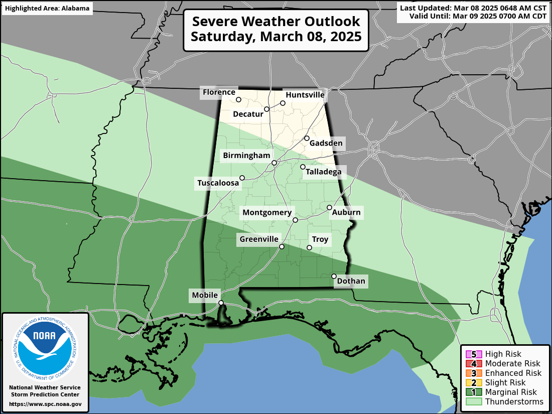
Showers will continue to stream in from the west throughout the remainder of the day, with most of that taking place over the Tennessee Valley. However, later tonight, there will be a wave of cells moving in over the southern portions of the state where there will be thunder and there is currently a Marginal Risk for severe storms. For now, it looks like the threat for severe storms will be along and south of the I-10 corridor, where if any storm becomes surface-based, there is enough shear present for rotating updrafts, and a conditional tornado threat will be in place. However, the surface low is expected to stay offshore (at this point), which would keep the severe weather threat to near zero. We’ll keep an eye on it throughout the day.

Don’t forget it is also Daylight Saving Time! Spring forward and move those clocks ahead one hour before heading to bed (if you still have any devices that require manual adjustments).
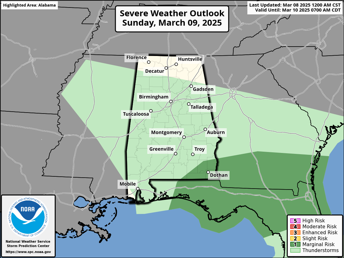
Rain will be widespread across the state as we start Sunday morning, and we could even see a few thunderstorms at times. There is even a low-end severe weather threat over the southeastern corner of the state, where gusty winds and a brief tornado will be possible. Rain will become more scattered during the late morning and into the afternoon hours, with much of the activity located over the northern and northeastern parts of Alabama. Highs will range from the mid 50s in the northeast to the mid 70s in the southwest.
Category: Alabama’s Weather, ALL POSTS, Severe Weather, Social Media