
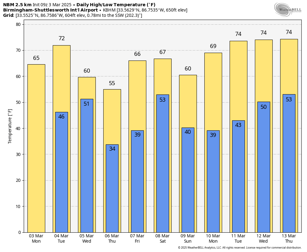
STILL DRY TODAY: With a partly sunny sky we project a high in the 60s across Alabama today. The warm-up continues tomorrow with highs in the low to mid 70s statewide. Strong south winds will increase tomorrow afternoon ahead of a dynamic storm system, gusting to 30 mph in spots. A wind advisory has been issued for all of Alabama except the southeast corner of the state.
A line of strong to severe thunderstorms will sweep through tomorrow night; SPC has much of the state in a “slight risk” (level 2/5) of severe thunderstorms.
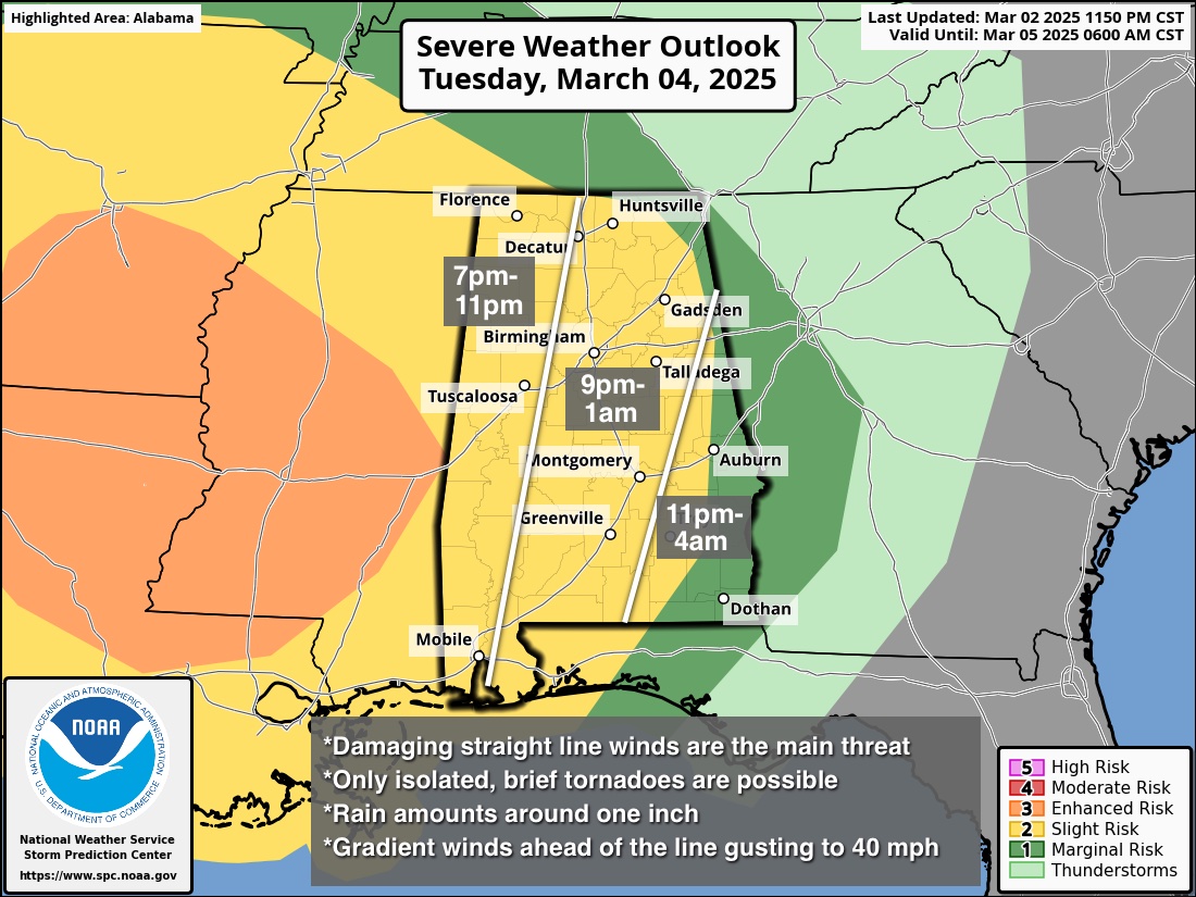
Key messages for tomorrow night…
*There will be very little surface based instability ahead of the line, which will limit the overall magnitude of the event. A brief, isolated tornado is possible within the line, but isn’t likely.
*Wind fields will be impressive with a tight pressure gradient. Ahead of the line, gradient winds (non-thunderstorm) could gust to 40 mph. With the line itself convective winds could be high enough in spots to bring down some trees and power lines.
*This will be a fast moving line of storms; rain amounts will be 1/2 to 1 inch for most places. Flooding issues are not expected.
*The storms should enter the northwest corner of Alabama around 6-7p CT tomorrow, and exit the southeast corner by 3-4a CT Wednesday.
Look for a partly sunny sky Wednesday with a high between 57 and 64 degrees; any showers will be confined to areas near the Tennessee border. Temperatures will drop to near the freezing mark over North Alabama early Thursday morning… followed by a high in the 53-60 degree range with sunshine in full supply.
A warming trend begins Friday; with a mostly sunny sky the high will be in the 60s.
THE ALABAMA WEEKEND: A disturbance will bring back into Alabama Saturday and Saturday night; this one doesn’t look like a severe weather setup. Dry air returns Sunday; highs over the weekend will be in the 60s. See the video briefing for maps, graphics, and more details.
ON THIS DATE IN 2019: A violent and long-tracked EF-4 tornado struck portions of eastern Alabama and western Georgia, causing extreme damage along its path. This tornado was the deadliest tornado in the United States since the 2013 Moore, Oklahoma tornado.
A total of 23 people were killed in Lee County Alabama; the victims ranged in age from 6 to 93. Of those killed, 19 were in mobile homes. Beauregard and Smiths Station were the hardest hit. Five other tornadoes touched down, including an EF-2 near Eufaula.
Look for the next video briefing here by 3:00 this afternoon… enjoy the day!
Category: Alabama’s Weather, ALL POSTS, Weather Xtreme Videos