
DRIER DAY: Rain has pushed out of Alabama early this morning; we will be dry through early afternoon with a gusty west wind; a wind advisory remains in effect for much of the state. Gradient winds won’t be a strong as yesterday, but gusts to 30 mph are very possible.
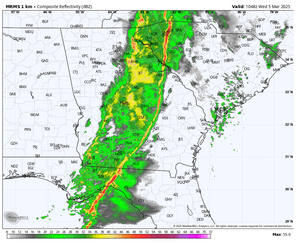
As the upper trough swings through, a few scattered showers will form over the northern half of Alabama this afternoon and early tonight… rain amounts will be light and rather spotty. It is interesting to note high resolution models continue to suggest a few snow flakes are possible early tonight near the Tennessee state line due to very cold air aloft associated with the upper trough. Surface temperatures will be well above freezing, and there won’t be any impact if we see a snow flake or two.
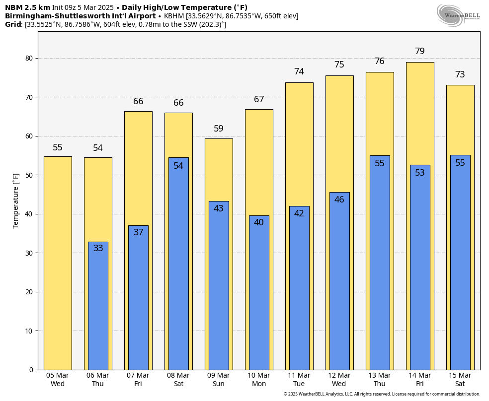
Highs today will be in the 50s over much of Alabama, with low 60s for the southern quarter of the state. We note the average high for Birmingham on March 5 is 64. A freeze is possible early tomorrow morning over parts of North Alabama.
Look for a sunny sky tomorrow and Friday; highs tomorrow will be in the 50s over the northern 2/3 of Alabama, then rising into the 60s Friday. Some South Alabama communities could see low 70s Friday afternoon.
THE ALABAMA WEEKEND: Clouds return late Friday night, and global models suggest we will have periods of rain over the weekend. While some rain is possible by Saturday afternoon, the most widespread rain will likely come Saturday night into Sunday. Severe storms are not expected, and rain amounts will be in the 1/2 to 1 inch range. Highs stay generally in the 60s, although North Alabama could hold in the 50s Sunday.
NEXT WEEK: For now the week looks quiet and generally dry. Models suggest a few showers are possible late Wednesday night or Thursday, but it doesn’t look like a big rain event. Temperatures rise into the 70s over the latter half of the week… See the video briefing for maps, graphics, and more details.
YESTERDAY’S WIND: At one point last night a little over 100,000 in Alabama were without power due to strong gradient winds (not related to thunderstorms). Winds generally peaked in the 40-45 mph range through the afternoon and evening hours. Just sunrise the outage count in Alabama is down to 54,000.
ON THIS DATE IN 1919: A long track tornado moved through South Alabama; based on reports it is possible the tornado was down along a path from near Atmore to Eufaula, almost 140 miles. At least four people were killed.
ON THIS DATE IN 1963: A violent F4 tornado touched down in the southwest part of Bessemer and then moved through the downtown area. From there it then moved to the northeast through parts of Homewood and Mountain Brook. Most of the damage was in the first 2 miles of the tornado’s path in Bessemer. There were 35 injuries and no fatalities; 200+ buildings were damaged, 29 were destroyed, and 25 had major damage.
Look for the next video briefing here by 3:00 this afternoon… enjoy the day!
Category: Alabama’s Weather, ALL POSTS, Weather Xtreme Videos