
WINDY, COLD MARCH DAY: Clouds cover the northern half of Alabama this afternoon… temperatures are only in the mid to upper 40s with a gusty west wind making it feel colder. However, to the south, temperatures are in the 60s for places like Mobile and Dothan where the sun is out in full force. We will mention the chance of a few sprinkles over North Alabama this evening as a deep upper trough passes through… there might even be a snow flake or two near the Tennessee border in Madison and Jackson counties. If that happens there won’t be any impact with surface temperatures well above freezing.
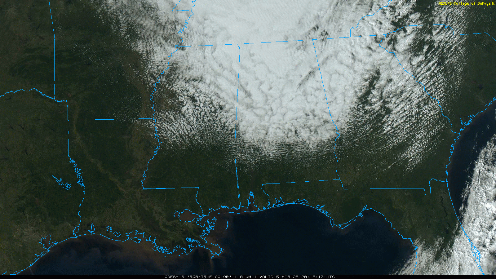
The sky will clear late tonight, and many North Alabama communities will see a light freeze early tomorrow as the wind finally dies down.
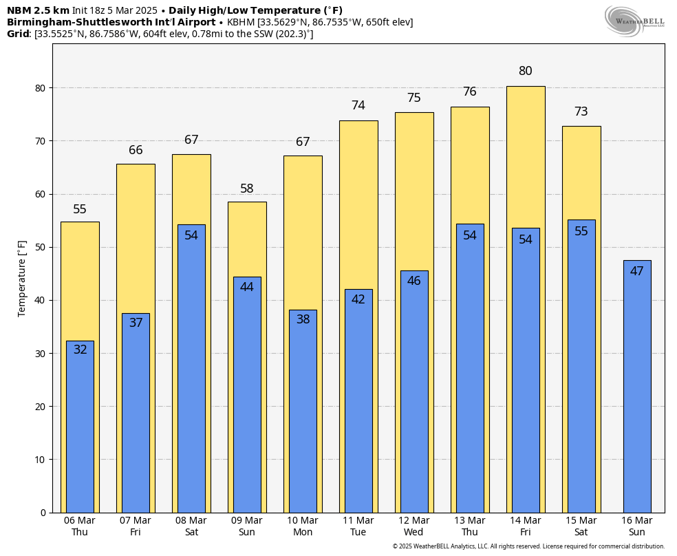
Look for a sunny sky tomorrow and Friday; highs tomorrow will be in the 50s over the northern 2/3 of Alabama, then rising into the 60s Friday. Some South Alabama communities could see low 70s Friday afternoon.
THE ALABAMA WEEKEND: Clouds return late Friday night, and global models suggest we will have periods of rain over the weekend. While some rain is possible by Saturday afternoon, the most widespread rain will likely come Saturday night into Sunday. Severe storms are not expected, and rain amounts will be in the 1/2 to 1 inch range. Highs stay generally in the 60s, although North Alabama could hold in the 50s Sunday.
NEXT WEEK: The first half of the week looks quiet and generally dry. Models suggest a few showers are possible late Wednesday night or Thursday, but it doesn’t look like a big rain event. Global models hint at a more significant system late in the week… See the video briefing for maps, graphics, and more details.
YESTERDAY’S WIND: At one point last night a little over 100,000 in Alabama were without power due to strong gradient winds (not related to thunderstorms). Winds generally peaked in the 40-45 mph range through the afternoon and evening hours. This afternoon the outage count in Alabama is down to 17,000.
ON THIS DATE IN 1919: A long track tornado moved through South Alabama; based on reports it is possible the tornado was down along a path from near Atmore to Eufaula, almost 140 miles. At least four people were killed.
ON THIS DATE IN 1963: A violent F4 tornado touched down in the southwest part of Bessemer and then moved through the downtown area. From there it then moved to the northeast through parts of Homewood and Mountain Brook. Most of the damage was in the first 2 miles of the tornado’s path in Bessemer. There were 35 injuries and no fatalities; 200+ buildings were damaged, 29 were destroyed, and 25 had major damage.
Look for the next video briefing here by 6:00 a.m. tomorrow…