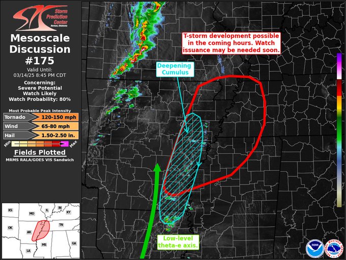
The storm prediction center has issued a new mesoscale discussion west of Alabama indicating that a new tornado watch will likely be issued soon for portions of western TN, northern MS, and eastern AR. The main hazards include damaging winds (up to 80mph), large hail (up to baseball size), and tornadoes, some of which may be strong.
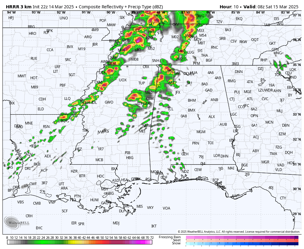
The last run of the HRRR model depicts scattered supercell storms in northeast MS and northwest AL early tomorrow morning around 4am. Any of these storms could be tornadic, with strong tornadoes possible along with large hail and damaging winds. But the main round as we have been saying, comes after 12pm on Saturday.
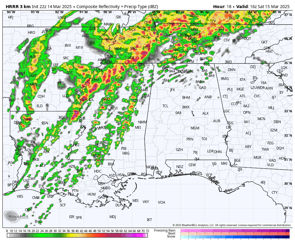
One of the concerns we have is that the HRRR has trended towards less showers and storms in the morning, leading to a wide open and uninhibited warm sector during the afternoon. This will prime the atmosphere for a dangerous, likely violent tornado and severe weather outbreak with a number of large and dangerous tornadoes likely.
More updates will follow later this evening and into tonight.
Category: Alabama’s Weather, ALL POSTS, Social Media