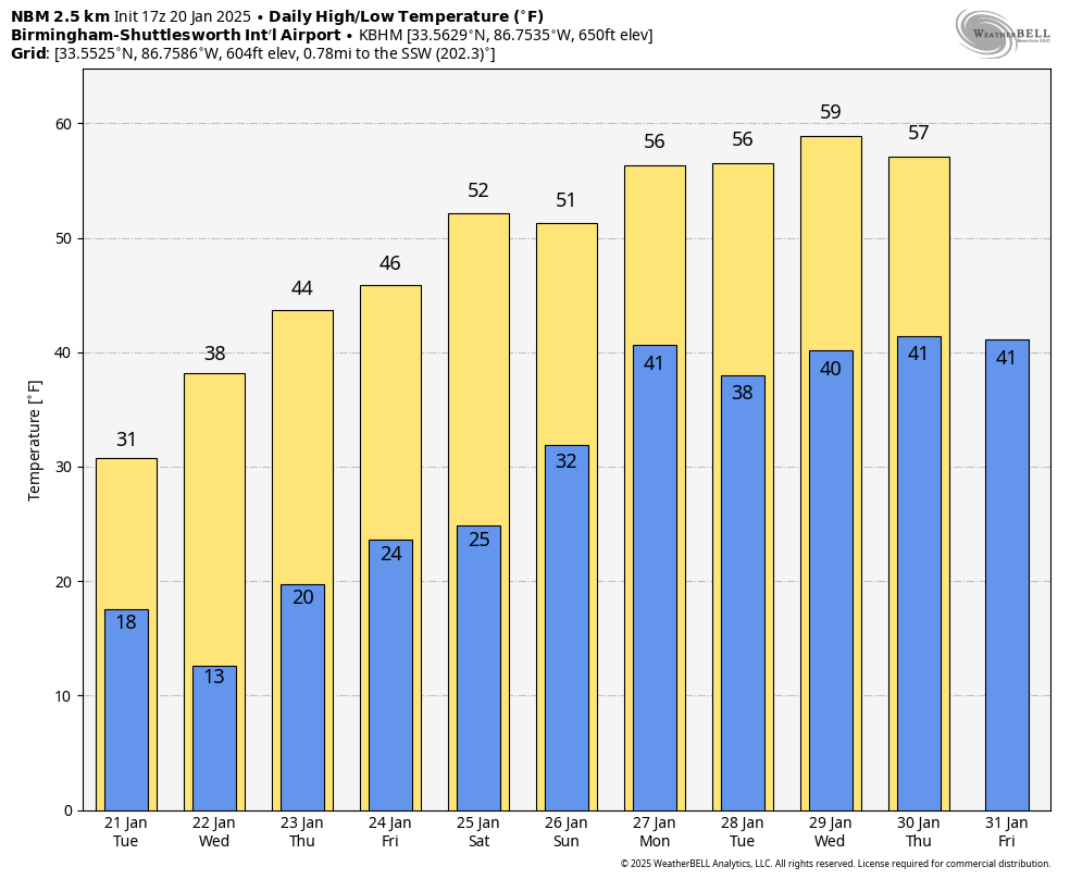
FRIGID AIR: Temperatures are below freezing over the northern half of Alabama this afternoon despite a sunny sky. South Alabama communities are in the mid to upper 40s. Clouds will increase statewide late tonight.
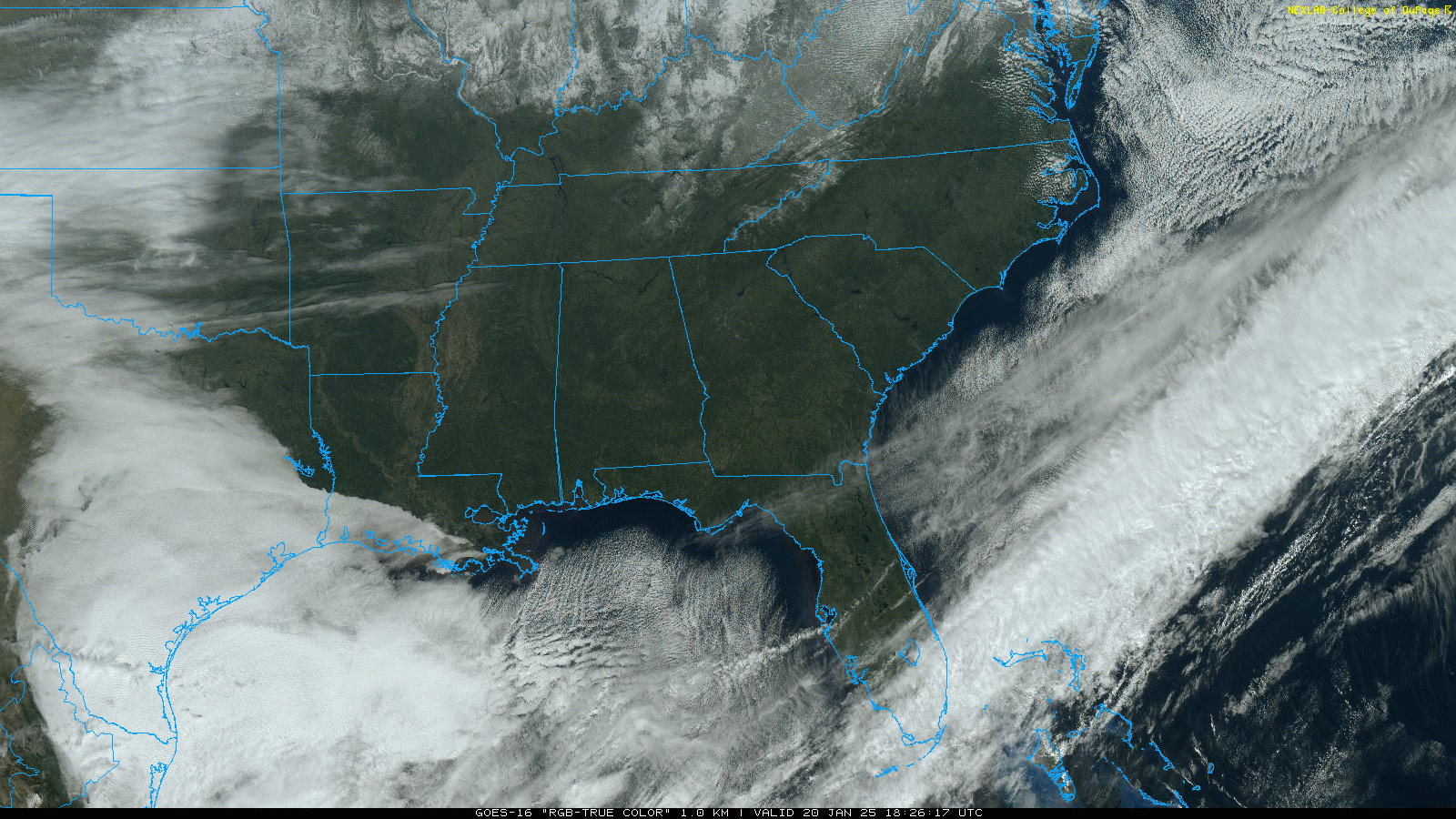
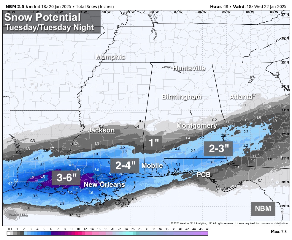
WINTER STORM WARNING: A winter storm will impact the southern U.S. from Southeast Texas to eastern North Carolina later tonight through Wednesday. In Alabama, the snow will come tomorrow over the southern counties of the state.
*A winter storm warning is in effect tomorrow for areas south of a line from near Butler to Demopolis to Selma to Montgomery to Phenix City. The NWS is holding on to a winter storm watch north of the warning area, as far north as Moundville, Centreville, and Wedowee. But, this watch could be canceled soon as the meaningful snow will likely remain over South Alabama.
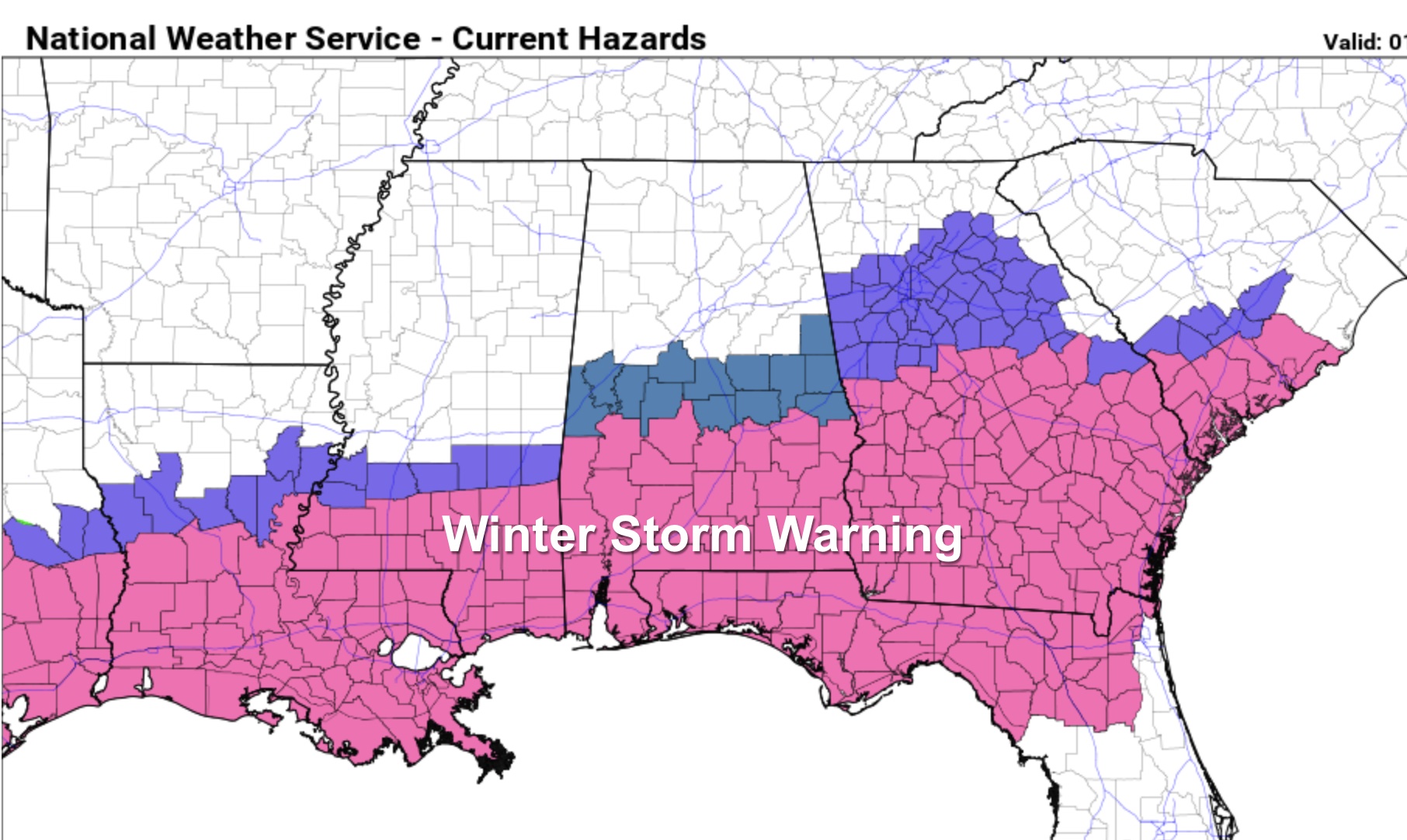
*Snow will begin by mid to late morning over Southwest Alabama, becoming widespread during the afternoon and evening hours over the southern third of the state. Some communities in the winter warning over South Alabama could see 2-3 inches of snow, including places like Mobile, Foley, Atmore, Andalusia, Enterprise, and Dothan. The snow should be over by 9:00 tomorrow night.
*With the very cold air in place and the cold infrastructure, roads will become hazardous quickly where snow falls across South Alabama. Icy travel will continue into Wednesday morning. Temperatures will rise to near 40 degrees across the southern counties of the state Wednesday afternoon with some improvement, but another freeze is likely Thursday morning with ice still very possible on some roads.
*Some light snow is possible across southern parts of Central Alabama (places like Demopolis, Prattville, Alexander City, Auburn, and Roanoke), but accumulation (if any) should be very light. For the I-20 corridor (Tuscaloosa, Birmingham, and Anniston) odds are high that there will be no snow at all tomorrow. But keep in mind any unexpected northward shift in the Gulf low could bring some light snow, and in this very cold airmass even amounts of 1/4 to 1/2 inch can make roads pretty icy.
*Wednesday morning will be the coldest morning this week; lows will be in the teens statewide, and colder spots could dip into the single digits. Thankfully afternoon highs will be in the 40s Thursday and Friday as a warning trend begins.
*With any winter system like this, you watch to watch for surprises, so keep an eye on updates over the next 24 hours.
THE ALABAMA WEEKEND: While most places will be in the 20s early Saturday morning, highs over the weekend will be in the 50s, very close to seasonal averages for late January. Global models suggest rain will return to the state Sunday, Sunday night, and possibly into Monday.
Temperatures next week look seasonal… See the video briefing for maps, graphics, and more details.
ON THIS DATE IN 1937: The wettest Inaugural Day of record with 1.77 inches of rain in 24 hours. Temperatures were only in the 30s as Franklin D. Roosevelt was sworn in for his second term.
Look for the next video briefing here by 6:00 a.m. tomorrow…