Midday Nowcast: Cloudy With Some Showers; Remaining Warm Through The Weekend : The Alabama Weather Blog

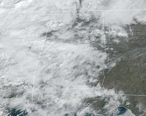
WARM WINTER DAYS: More sun than clouds in the Alabama sky today and it remains unseasonably warm with highs in the low to mid 70s. Some showers are ongoing across the northern and central portions of the state today, but rain amounts for the most part will be light.
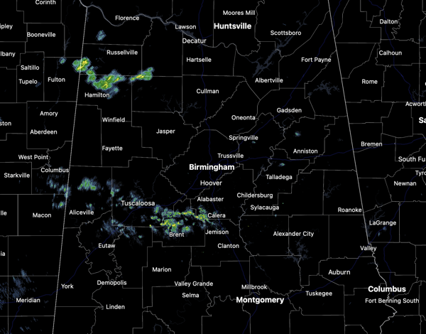
A few rumbles of thunder are possible as well, especially over the Tennessee Valley of the state, but there is no threat of severe storms today. Tonight will feature lingering showers with lows in the upper 50s and lower 60s.
BIRMINGHAM ALMANAC: For February 5th, the average high for Birmingham is 57° and the average low is 36°. The record high is 76° set in 1927, while the record low is 6° set in 1996. We average 0.16” of precipitation on this date and the record value is 3.01” set in 1940.
Tomorrow and Friday some isolated showers remain possible over the northern half of the state, but rain amounts, if any, will be light and very spotty, and most locations will remain dry. Highs these two days will continue to be in the mid to upper 70s.
USA BRIEF: Unsettled weather to persist across the Western U.S. through the end of the week including a new threat of heavy rainfall for California on Thursday. A winter storm will impact the Midwest and Great Lakes region through the Ohio Valley, Mid-Atlantic and Northeast with a combination of snow, sleet and freezing rain later today through Thursday. Record high temperatures are expected across much of the Southern U.S. over the next few days.
THE WEEKEND: Saturday will be mainly dry and warm with highs in the upper 70s and some lower 80s expected across South Alabama. On Sunday, clouds begin to increase and we will bring the chance of rain back to the forecast ahead of a front that will start to bring cooler weather back to Alabama. Rain amounts will be light across the state on Sunday. Highs Sunday will fall into the upper 60s to lower 70s.
ACTIVE PATTERN NEXT WEEK: The front stalls across the state on Monday, and the weather will remain wet through Tuesday as a wave of low pressure tracks along the front. Rain amounts these two days could be in the 1-2 inch range for the northern half of the state.
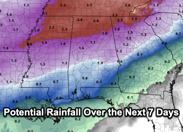
The front will slowly sag southward on Wednesday taking the better rain chances to the south. As the front moves farther south, cooler air will continue to creep into the state. Highs to start to the week will be in the low 60s, but should drop into the 50s on Wednesday, pretty close to average values for the second week of February. Thursday looks dry, but another round of rain looks to return to the state for Valentine’s Day and the following weekend. No signs for Arctic air for Alabama the next 10-14 days, and for now, the overall threat for severe weather looks low as well. But of course, we are in severe weather season, and will have to watch any storm system.
WORLD TEMPERATURE EXTREMES: Over the last 24 hours, the highest observation outside the U.S. was 116.8F at Morawa Airport, Australia. The lowest observation was -67.2F at Ilirnej, Russia.
CONTIGUOUS TEMPERATURE EXTREMES: Over the last 24 hours, the highest observation was 93F at Rio Grande Village, TX. The lowest observation was -22F at Philadelphia, NY.
WEATHER ON THIS DATE IN 1887: San Francisco experienced its greatest snowstorm of record. Nearly four inches was reported in downtown San Francisco, and the western hills of the city received seven inches. Excited crowds went on a snowball throwing rampage.
Category: Alabama’s Weather, ALL POSTS, Social Media