Midday Nowcast: Warm Days With Isolated Showers; Soaking Rains Next Week : The Alabama Weather Blog

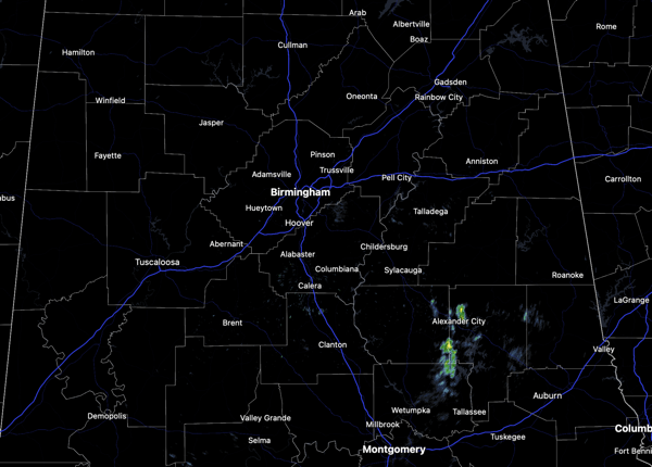
Today and tomorrow we are seeing more clouds than sun with some isolated showers possible at just about any time, especially over the northern half of the state. Rain amounts, if any, will be light and very spotty and most locations will remain dry. Highs these two days will continue to be in the mid to upper 70s, which are nearly 20 degrees above average for this time of year.
BIRMINGHAM ALMANAC: For February 6th, the average high for Birmingham is 57° and the average low is 36°. The record high is 77° set in 2019, while the record low is 15° set in 1988. We average 0.17” of precipitation on this date and the record value is 3.78” set in 2020.
USA BRIEF: A winter storm to impact the Great Lakes, northern Mid-Atlantic and Northeast with a combination of snow, sleet and freezing rain today. The next round of unsettled weather to enter the West today with the threat of heavy rainfall/snows for California before snowfall chances spread across the Northern Rockies and Northern Plains into Saturday. Also, more record high temperatures are expected across much of the Southern U.S. over the next few days.
WEEKEND WEATHER: Saturday will be dry and warm with highs in the upper 70s to lower 80s. On Sunday, clouds increase and we will bring the chance of rain back to the forecast ahead of a front that will start to bring cooler weather back to Alabama. Rain amounts will be light across the state on Sunday. Highs Sunday will fall into the upper 60s to lower 70s.
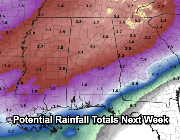
WET PATTERN NEXT WEEK: The front stalls across the state on Monday, and the weather will be wet at times much of next week as a wave of low pressure tracks along the stalled front. Expect periods of rain Tuesday, Wednesday, and Thursday with rainfall potential in the 3-4 inch range for North Alabama and 1-2 inches across South Alabama. With the rain and clouds, highs will be in the low to mid 60s much of the week, while lows fall back into the 40s. The rain looks to push out of the area by Valentine’s Day.
Still no signs of Arctic air for Alabama the next 10-14 days, and for now, the overall threat for any severe weather looks low as well. But of course, we are in severe weather season, and will have to watch any storm system.
WORLD TEMPERATURE EXTREMES: Over the last 24 hours, the highest observation outside the U.S. was 116.1F at Telfer, Australia. The lowest observation was -68.1F at Ilirnej, Russia.
CONTIGUOUS TEMPERATURE EXTREMES: Over the last 24 hours, the highest observation was 94F at Rio Grande Village, TX. The lowest observation was -27F at Havre, MT.
Category: Alabama’s Weather, ALL POSTS, Social Media