RADAR CHECK: Early this morning we have areas of mostly light rain across parts of Central Alabama; rain is much more widespread just north and west of the state. Occasional rain is likely through tonight statewide.
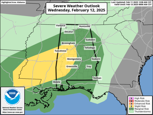
Rain continues tomorrow; the rain could be heavy at times. A few thunderstorms will be involved; SPC has defined a “slight risk” (level 2/5) of severe thunderstorms for much of West Alabama… the rest of the state is in a “marginal risk” (level 1/5).
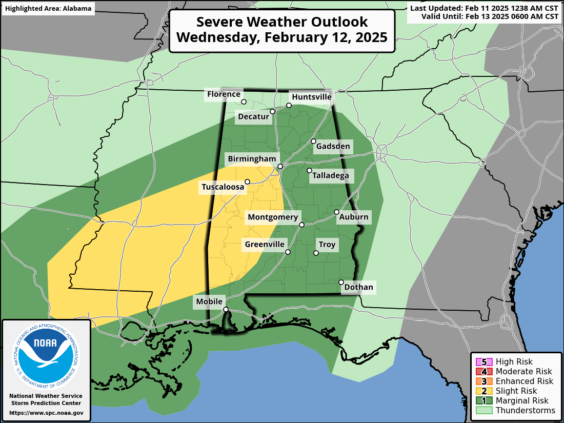
Heavier storms across Alabama tomorrow afternoon/night could produce strong, gusty winds. A brief, isolated tornado or two can’t be ruled out as well, mainly over the southern half of the state where surface based instability will be available. Rain amounts of 2-4 inches are likely over the northern counties of Alabama over the next 48 hours… most South Alabama communities will see around one inch.
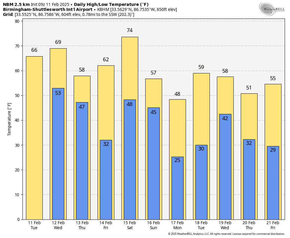
Rain ends early Thursday as drier air pushes into the state; Friday will be rain-free with a good supply of sunshine. Temperatures will dip into the 27-32 degree range over the northern third of Alabama early Friday morning, but temperatures there rise into the low 60s. South Alabama will see mid to upper 60s Friday.
THE ALABAMA WEEKEND: A dynamic weather system will bring another round of rain and storms to Alabama over the weekend. SPC has much of the state in a severe weather risk in their “Day 5” outlook, which runs from Saturday through 6:00 a.m. Sunday.
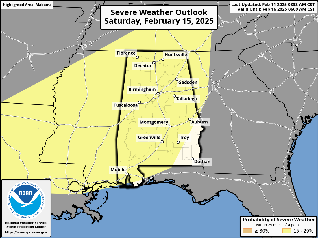
Temperatures will rise into the 70s Saturday, and the air becomes unstable ahead of the approaching system. The latest global model runs suggest the main threat of severe storms and heavy rain will come Saturday night into the pre-dawn hours Sunday. Once we get the mid-week system out of here, we can be much more specific about the magnitude of the threat, the timing, and the tornado risk.
Rain totals between now and Sunday could exceed 5 inches over North Alabama, so we will be watching for any potential flooding issues.
Sunday will be dry and cooler; temperatures drop into the 20s over most of North Alabama by Monday morning. Then, another big rain event is likely around the middle of next week (Wednesday February 19)… See the video briefing for maps, graphics, and more details.
ON THIS DATE IN 1965: A tornado moved through Aliceville, in Pickens County. Twelve homes were demolished and another 42 homes suffered varying degrees of damage. A church, motel, cotton mill, and several commercial buildings were heavily damaged. One farm suffered extensive damage. Several injuries occurred in and near Aliceville, but no fatalities were reported. The tornado was rated an F3 on the Fujita Damage Intensity Scale.
ON THIS DATE IN 1983: Called the “Megalopolitan blockbuster snowstorm,” this major snowstorm impacted the Mid-Atlantic and southern New England. Snowfall up to 25 inches fell at Allentown, Pennsylvania. Snowfall amount of 35 inches occurred in parts of the Blue Ridge Mountains of West Virginia at Glen Cary. Windsor Locks, Connecticut, recorded a record 19 inches in 12 hours.
Look for the next video briefing here by 3:00 this afternoon… enjoy the day!
Category: Alabama’s Weather, ALL POSTS, Weather Xtreme Videos