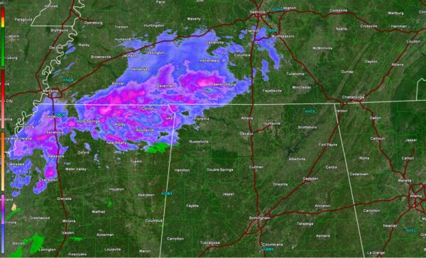

As of 11:00PM, it would appear based on the radar out of Columbus Mississippi that some light wintry precipitation is falling over the northwest corner of Alabama. The air is still fairly dry, so some of this may be evaporating before reaching the surface, but its not out of the question that some of this is making it to the surface in the form of light snow or sleet. This precipitation will overspread extreme northern Alabama overnight tonight.
Temperatures are still well above freezing across the area, so its likely that anything that’s falling now is not sticking. However, the colder air is not that far away, with upper 20s already in central TN which has supported several inches of snow accumulation. So, the colder air is coming and will allow for light accumulations tonight into tomorrow morning.
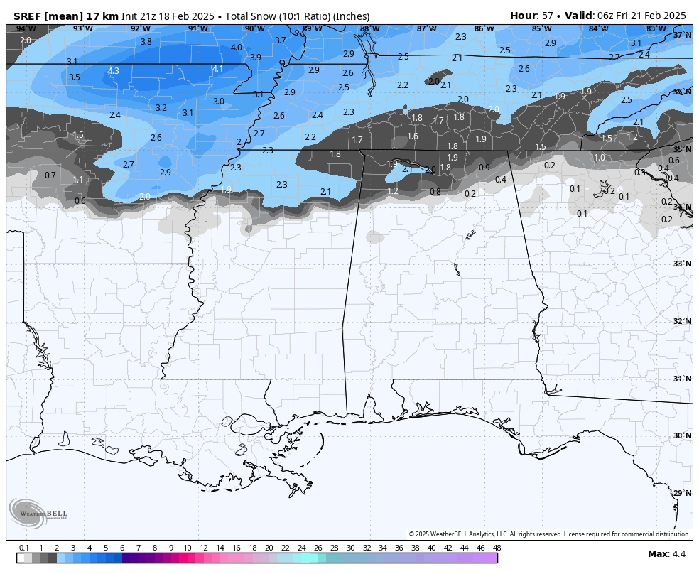
The forecast for snow accumulations remains largely unchanged. Any accumulation is likely to be confined to the far northern part of the state, where a coating-2″ could fall. This could lead to some travel impacts once the temps drop, so please check out the post prior to this which discusses a few winter driving safety tips!