Intact forests cover about a tenth of the world’s surface. That’s a lot of vegetation for deforestation-watchers to keep track of, but recent leaps in satellite imagery have made the job much easier.
Far from the grainy Landsat 5 and 7 satellite images of the past—which were nonetheless essential to saving the Amazon from total destruction in the late 90s—modern satellites can basically spy on orangutans from space.
But our latest investigation doesn’t zoom in on orangutans as they forage for lychee or use simple tools. Instead, we get up close and personal with illegal oil palm producers in Indonesia’s Rawa Singkil Wildlife Reserve, the orangutan capital of the world.
The high level of detail in these images helps us show that these oil palm producers are cutting down forests within time periods that corporations and even the E.U. care about, which we can determine based on the age of individual oil palms.
The following ultra-high resolution images, provided by the Airbus Pléiades Neo, are the first of their kind for the Rawa Singkil Wildlife Reserve, and can be found in full on Nusantara Atlas.
- Before and after images show differences in forest cover between 2016 and 2024 in a small boundary section of the Rawa Singkil Wildlife Reserve, a process happening across the park’s periphery. These images helped us determine that 1,915 hectares of forest clearing happened after key regulatory cut off dates.

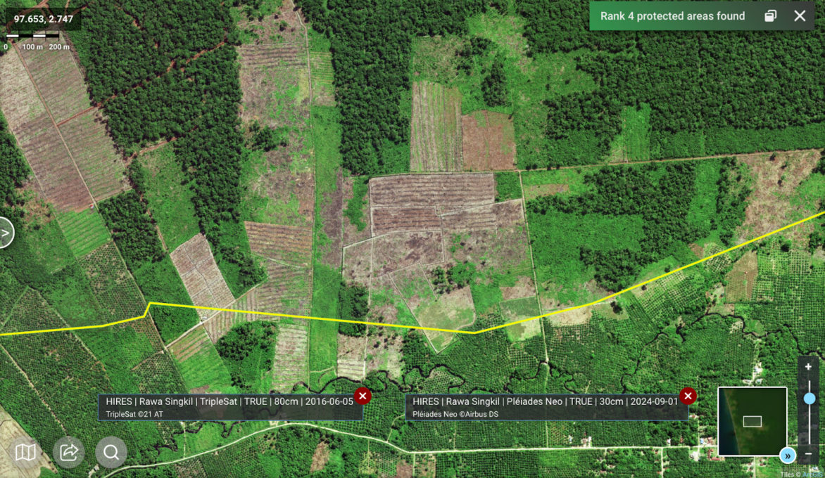
- The zoomed-in tile at the bottom of this image shows an oil palm plantation with an “open canopy,” meaning its oil palms are young, between .5 and 3 meters in diameter, and not yet producing fruit. We discovered 652 hectares of active oil palm plantations inside the reserve.
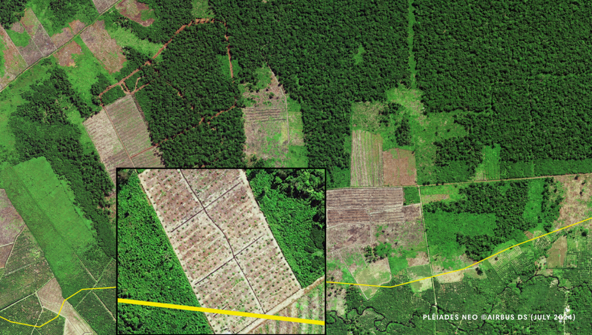
- A nearby plot shows oil palms with a “semi-closed canopy,” which are about 3-years-old, 4-6 meters in diameter, and starting to bear fruit. We determined that there are 453 hectares of productive plantations in the reserve—a sign that illegal oil palm is already entering global supply chains.

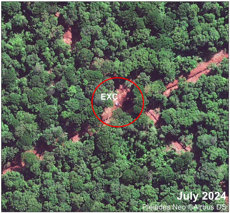
- Zooming in even more, the satellite captures an excavator next to an illegal canal. Excavators dig canals to drain peatlands, creating drier conditions for planting oil palms—a practice that releases high concentrations of trapped carbon dioxide into the atmosphere. Previous satellites could not achieve this level of resolution.
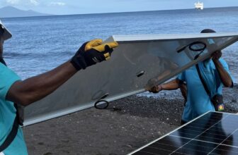
Images like these are not just cool, they’re essential to exposing the elites tearing down standing rainforests in remote parts of Indonesia—often illegally, and always with a sense of impunity that comes from anonymity.
Credits: Imagery provided by Airbus DS Pléiades Neo (July 2024) and Triple Satellites @21 (June 2016)