

Who knew ACT’s high country looked like this? At an impressive 1,855 metres and only an hour’s drive from Canberra, Mt Gingera makes for the perfect out-and-back overnighter for those times you need to squeeze in a quick trip to the mountains to get away from it all.
We Are Explorers acknowledges that this adventure is located on the traditional Country of the Ngunnawal people who have occupied and cared for the lands, waters, and their inhabitants for thousands of years. We pay our respects to them as the Traditional Custodians and recognise that sovereignty was never ceded.
Mt Gingera Quick Facts
Distance: Approximately 20km
Duration: Less than 24 hours if you pack light!
Elevation: The trail rises from 1,020m to 1,855m, and has a total (knee-jarring) elevation gain of 1,383 m
Quick Overview
Mt Gingera trial is a 20km intermediate-level return hike located in Namadgi National Park in the Australian Capital Territory. The hike takes less than 24 hours to complete if you pack light.
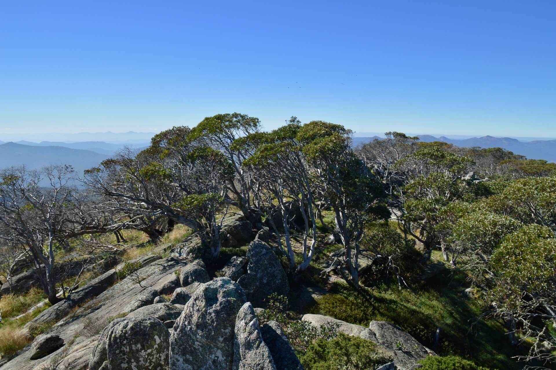
Snow gums and granite on the Mt Gingera Summit
About Mt Gingera
Rising to an impressive 1,855 metres, Mt Gingera is the second-highest peak in the ACT and a stunning feature of Namadgi National Park. Just an hour’s drive from Canberra, this hike offers breathtaking mountain views, secluded camping spots, and a mix of rugged granite outcrops and delicate snow gum forests.
In winter time, the summit is often dusted with snow, while warmer months bring a burst of wildflowers across the alpine meadows.
Whether you’re tackling the steep Stockyard Spur route or taking the gentler ascent via Mount Franklin Road, Mt Gingera is an unforgettable adventure for those looking to escape into the mountains.
History of Mt Gingera
Mt Gingera and the surrounding Namadgi National Park hold deep cultural significance for the Ngunnawal people, the Traditional Owners of this land. For thousands of years, the area was used for seasonal gatherings, where Indigenous groups would come together to hunt, and trade. The alpine regions of the ACT were particularly important during bogong moth migrations, as these nutrient-rich insects were an essential food source.
Today, Mt Gingera remains a place of cultural and ecological significance, with ongoing efforts to protect its fragile environment and honour its Indigenous heritage. It became part of Namadgi National Park in 1984 to preserve its natural beauty for future generations.
How To Get There
The bush walk we took starts from the Corin Dam car park which is in the northern half of Namadgi National Park. Corin Dam is about an hour’s drive south of Canberra.
You can also head up Mt Gingera along the more gentle Mt Franklin Road, near Ginini Car Park. (This is actually the most popular approach!) If you go this way you’ll encounter a locked gate. It blocks cars but is fine for hikers to walk around to continue the trail.
Skill Level
Intermediate
The trail has great signs and is easy to follow, but the steepness means it’s not for the faint-hearted. Bushwalking experience is recommended and if you haven’t walked 20km distances or done a significant amount of up or downhill hiking before, it’s not the best option for your first hike.
Wth so much downhill track there’s plenty of opportunity for injury or an unexpected emergency so it’s a good one to take a mate one – no matter how experienced you are.
Essential Gear
- Jetboil Stash
- Dehydrated food
- Bivvy and other ultralight camping gear
- First aid kit, including a snake bandage
- Enough water for a day, and a filtration device/purification tablets to collect water just after Pryors Hut.
- Camping permit from ACT Parks and Conservation — they’re free and you can get one by calling the visitor’s centre.
Read more: Packing List for an Overnight Hike
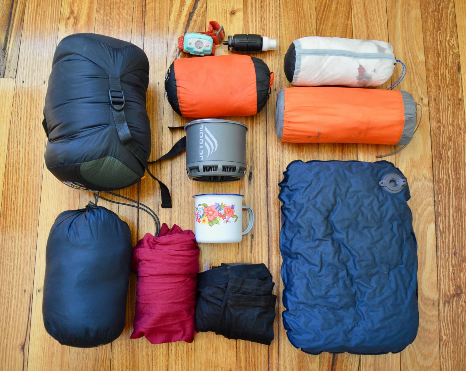
Just the essentials
What It’s Like to Hike Mt Gingera
The Ascent
Straddling the border with NSW, Mt Gingera in Namadgi National Park is the ACT’s second-highest peak. While most people head to the summit via the Franklin route mentioned above, the full 835-metre climb from Corin Dam up the infamously steep Stockyard Spur makes for a great fast and light overnighter.
With the mornings starting to cool off, my boyfriend and I decided the Canberra Day long weekend would be the perfect time to head into the mountains and enjoy the last of the summer weather.
To save our knees, and make sure we’d be back in time for our Saturday afternoon plans, we opted to go ultralight. We traded the tent for bivvies, dehydrated our own food, and ruthlessly culled anything that wasn’t essential.
Including our compact stove setup, the new Jetboil Stash, my gear weighed in at just under 6kg and fit snugly into my day pack.
Corin Dam to Pryors Hut via Stockyard Spur
We hit the trail at 3:30pm, with the goal of reaching Pryors Hut before sunset. Our first job was to tackle Stockyard Spur. There’s no easing into it with this section of the walk — the gruelling 2km climb starts with a series of stairs and steep switchbacks, which gradually give way to an even steeper kangaroo trail.
By the time we reached the emergency services helipad that marks the end of this section my calves were on fire and I was grateful we’d opted for light packs.
The scenery changes dramatically after the short introduction to the spur; tall eucalypts are replaced by short, wavy snow gums, and the single track widens into an overgrown fire trail that makes for some pleasant walking. Even though you continue uphill, the track rolls fairly gently up and down for the next 4km until you arrive at a rocky platform with spectacular views out towards Mt Ginini.
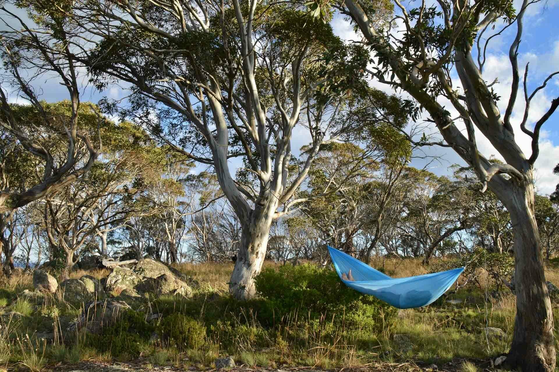
A Lookout Bivvy for Sunset
We initially planned to camp at Pryors Hut, but the lookout was so beautiful we decided to pull up stumps and enjoy the sweeping views in the last of the golden light. After a quick look around to make sure we’d picked the best spot, Pat set up the hammock and I set to work on dinner.
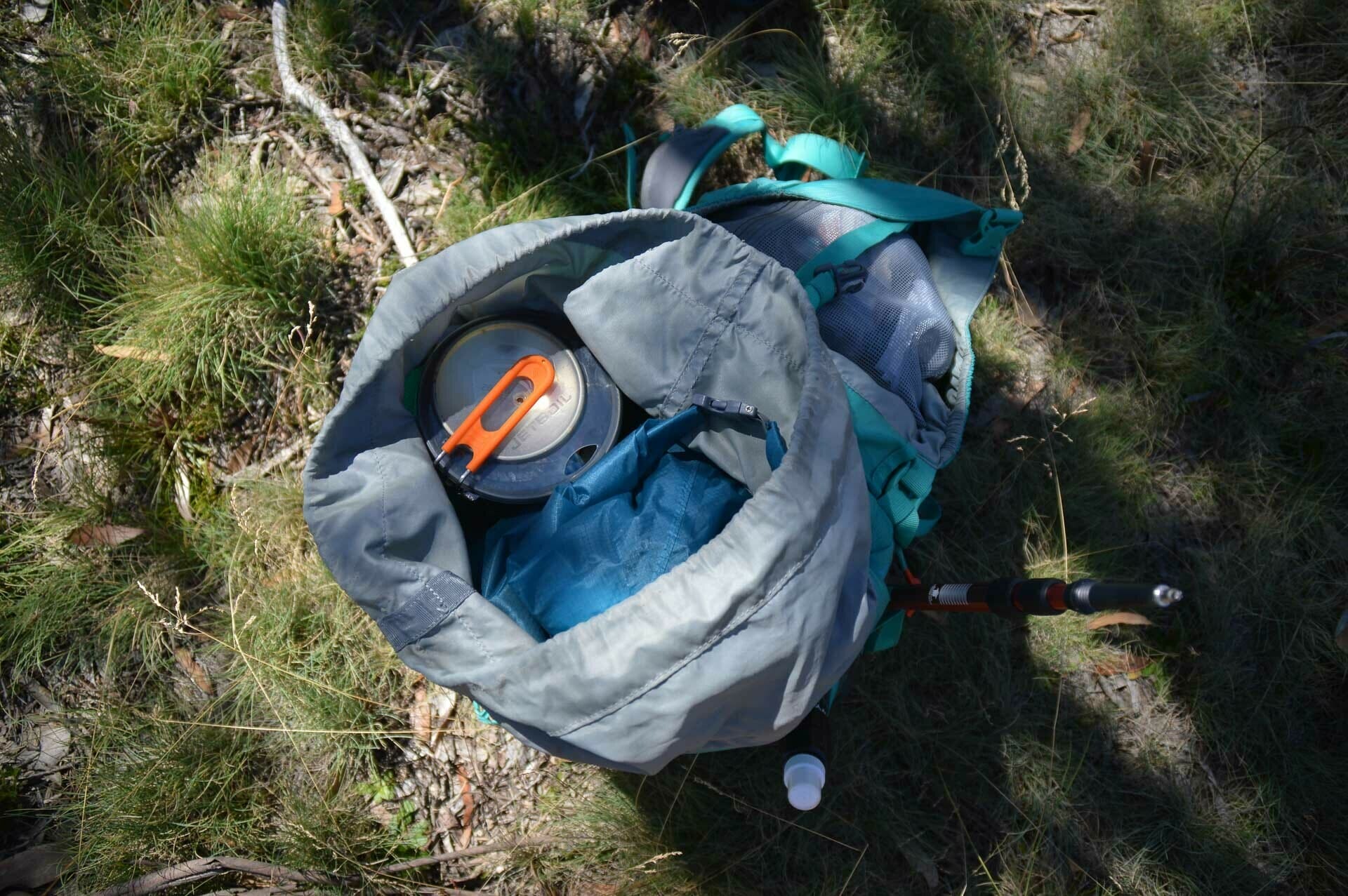
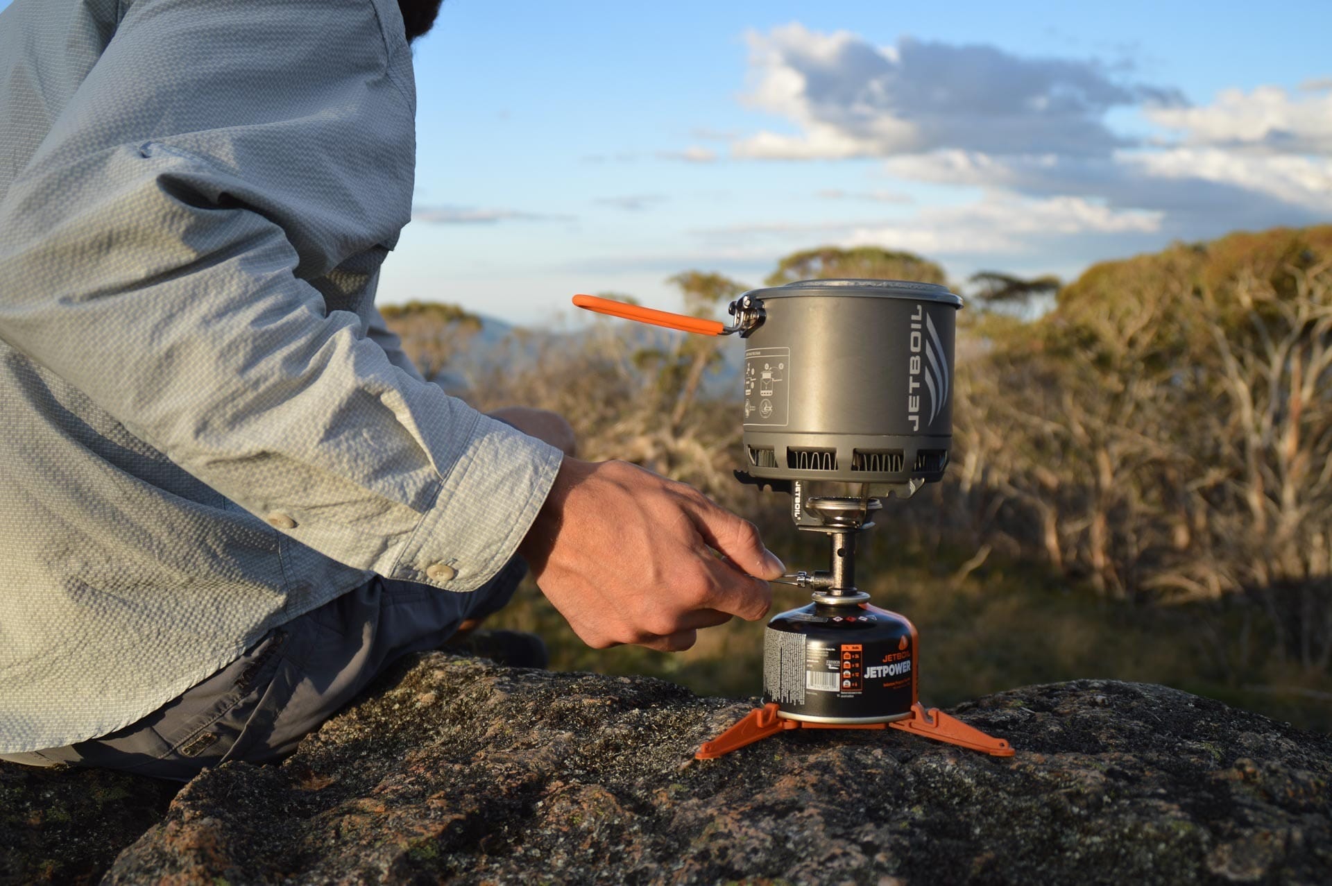
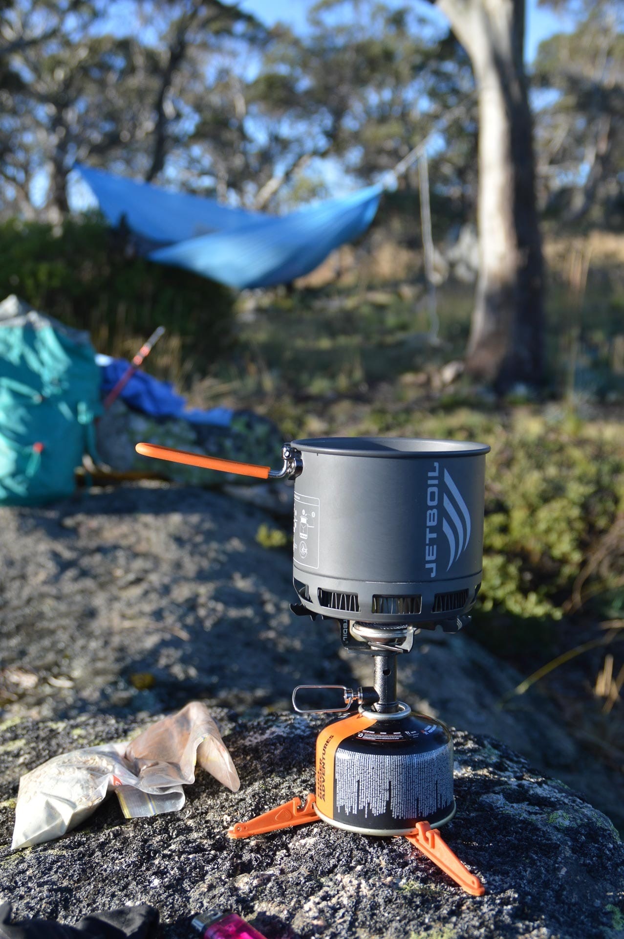
Your food and stove are often some of the heaviest things you’ll carry on a hike, but they’re also the easiest to make ultralight. We were using the new Jetboil Stash, which weighs in at 200g thanks to its titanium burner, and leaves plenty of space in the backpack for snacks.
For dinner I’d made spicy beans and rice the day before and dehydrated them so all I had to do was add some water and cold-soak the food for about half an hour, before heating it in the stove.
Opting for a lightweight sleeping set-up is another easy way to shave grams off your pack weight. With the weather forecast to be clear, we left the tent behind and bivvied instead so we could enjoy the stars.
A bivvy is a bit like an ultralight swag — it’s a bag you place over your sleeping gear to protect it from the ground, and keep the wind and dew out. It’s fast to set up and pack down, and gives you the freedom to camp wherever you want!
Sunrise in the Mountains
After a quiet night under the stars we woke to a gorgeous sunrise over the mountains. We had a lot of ground to cover this morning — it was another 4km to the top of Mount Gingera, and then we had to hightail it back down to the car so we could be in Victoria by dinner-time.
While Pat packed up camp, I made coffee. Even though it was a bit windy, the Jetboil did a great job and we were enjoying a hot brew with our oats in under five minutes.
Bean machine, coffee and legumes it’ll take ’em all
We had about a kilometre of easy walking along overgrown fire trail before we reached Mt Franklin Road, which takes you to the Mt Gingera summit trail. We were the first people on the trail for the day, and the morning light was the perfect reminder of why taking the effort to get out early pays off.
After conquering the spur the day before, the summit trail felt easy. It’s a narrow track through waist-high grass that winds its way up to a series of granite boulders on the summit.

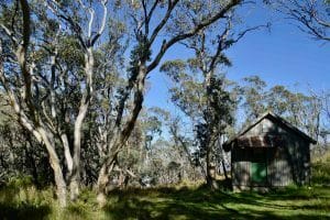
Pryors Hut, the traditional campsite for this hike
Along the way we passed brightly coloured robins and the last of the summer’s wildflowers, which made a stark contrast to the area’s recent fire damage. When we got to the top we were joined by a group of swifts, whipping through the air in search of some morning tea!
The Return Journey
We spent about half an our at the summit soaking in the panoramic views across the Bimberi Wilderness, before the short walk back down, bracing ourselves to tackle the knee-jarring descent down Stockyard Spur.
We made it to the car just in time for lunch, and were back in Canberra early arvo, with the whole weekend still left to enjoy!
Read more: Dr Kate Grarock’s Top 7 Places to Explore Canberra Like a Local
FAQs Hiking Mt Gingera in Namadgi National Park
How long does it take to hike Mt Gingera in Namadgi National Park?
The Mt Gingera hike takes less than 24 hours to complete if you pack light. Most hikers do it as a day hike, but it’s also a great overnight adventure.
Where does the Mt Gingera walking track start?
The hike to Mt Gingera starts from the Corin Dam car park in Namadgi National Park, about an hour’s drive from Canberra.
How difficult is the Mt Gingera hike?
The hike is rated intermediate due to its steep sections, particularly the challenging ascent up Stockyard Spur. However, the trail is well-marked and manageable for fit hikers.
Can you camp overnight on the Mt Gingera hike?
Yes! Many hikers camp near Pryors Hut or choose a scenic bivvy spot along the way. A free camping permit from ACT Parks and Conservation is required.
What is the best time of year to hike Mt Gingera?
Mt Gingera can be hiked year-round, but the best time is spring through autumn. In winter, the summit and Mount Franklin Road can be covered in snow, making the hike more challenging.
How do you access Mt Franklin Road on the way to Mt Gingera?
After walking from Corin Dam via Stockyard Spur, you’ll reach Mt Franklin Road, which leads to the summit track for Mt Gingera. The road is also accessible by 4WD from the north.
What wildlife can you see while hiking Mt Gingera?
Expect to see snow gums, bright wildflowers in summer, and native wildlife like wallabies, lyrebirds, and even wedge-tailed eagles soaring above the mountains.
Is the Mt Gingera walking track dog-friendly?
No, dogs are not allowed in Namadgi National Park to protect native wildlife.
What gear do you need for the Mount Gingera hike?
Essentials include a day pack, sufficient water, hiking snacks, a Jetboil or stove, a bivvy or tent for overnight stays, a first aid kit, and warm clothing for the summit.
What hikes are nearby?
Several great hikes surround Mt Gingera, offering stunning views of the Brindabella Mountains and Australian Alps. The Orroral Valley Circuit winds through historic sites and granite formations, while the steep climb to Booroomba Rocks rewards hikers with breathtaking cliff-top views.
For a tougher challenge, Mt Bimberi via Murray’s Gap is the highest peak in the ACT, and Square Rock provides a more moderate hike with epic granite lookouts. Always check road conditions, especially on Corin Road, as closures can occur in bad weather.
More Adventures in the ACT
- A Blast Up Booroomba Rocks in Namadgi National Park
- Bikepacking Through Canberra’s Namadgi National Park on the Boboyan Divide
- Top 5 Places To Cool Off In Canberra Including Namadgi National Park (ACT)
- The Epic Australian Alps Walking Track in Namadgi National Park


