

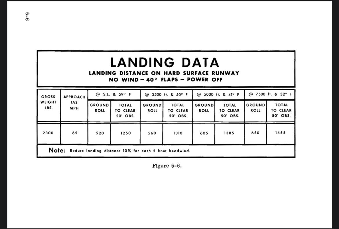
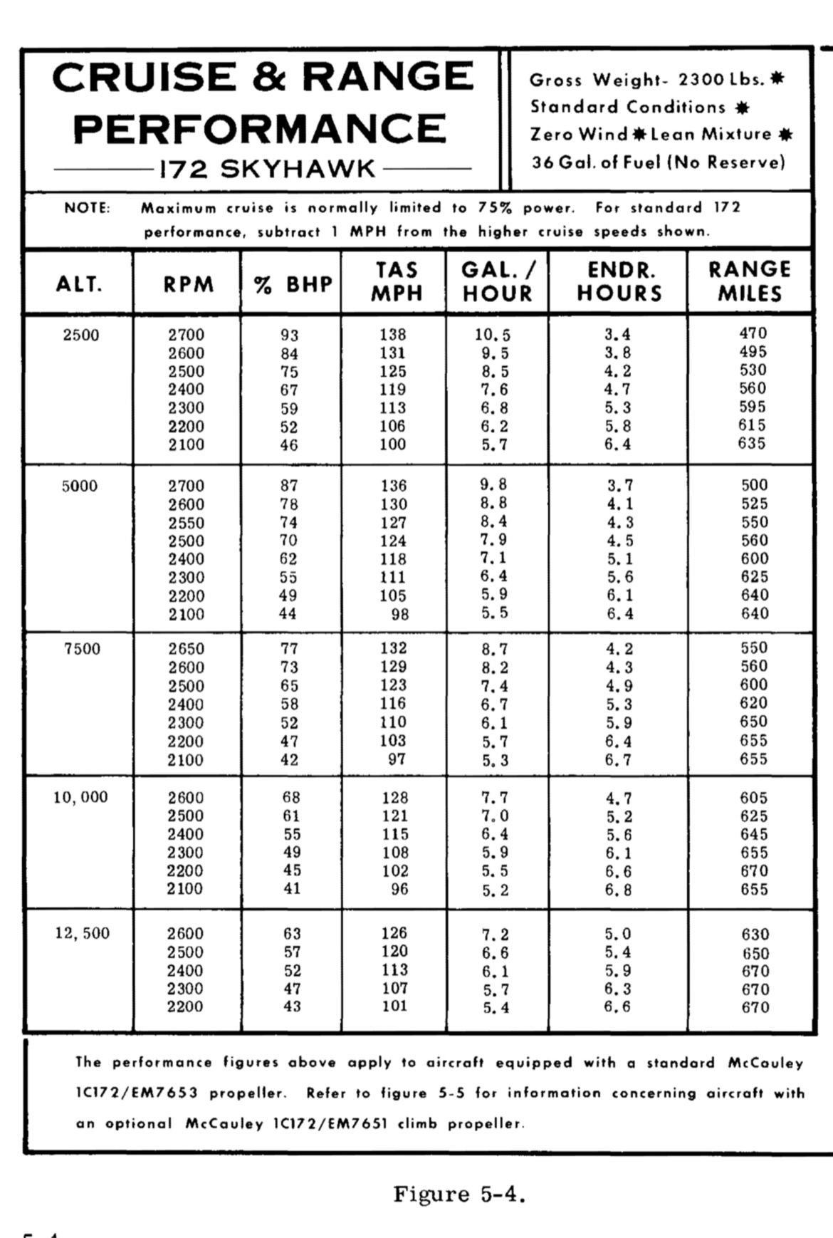
So the above charts are taken from a 172F model. Both charts are standard atmospheric conditions. In reference to the landing data, how would I know what my landing distance would be in say Florida at s.l. when its a 105 degrees as opposed to the 59 degrees on the chart? The same speaks of the cruise chart. These are all standard temps and pressures so how can I apply them to the real world? Thanks in advance!


