
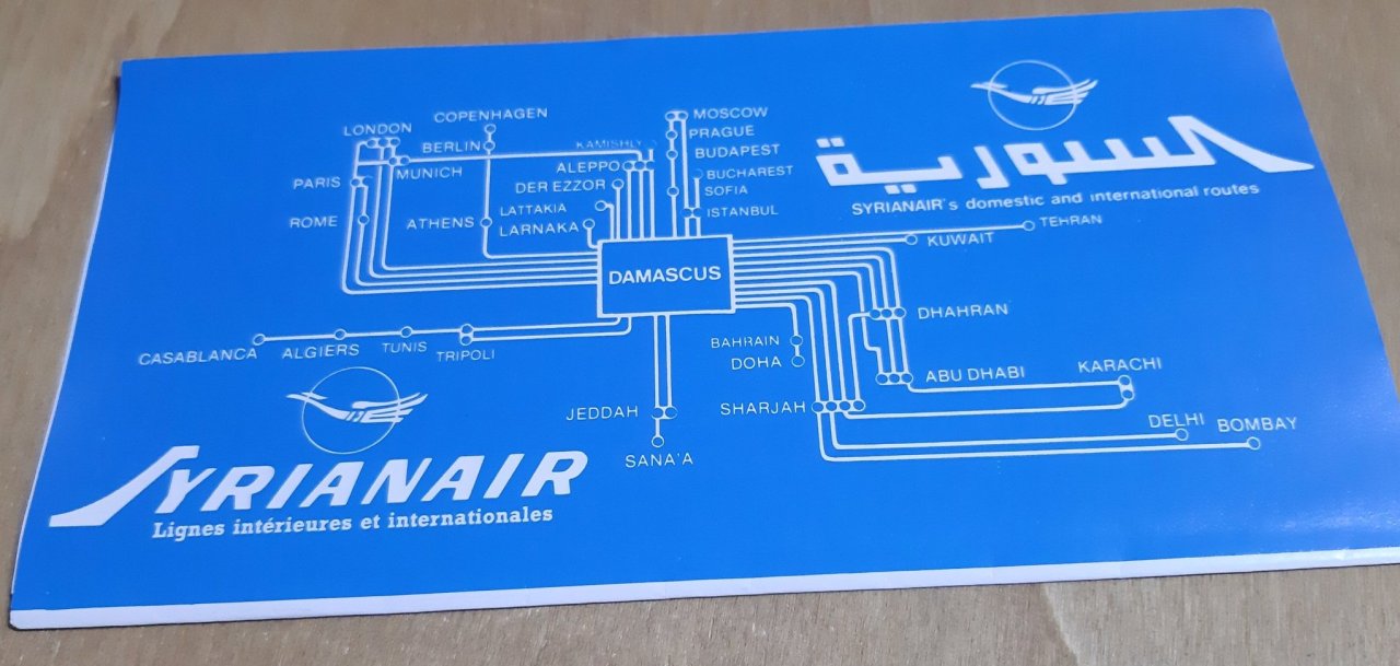

Syrian Air map, 1984
A Syrian Air diagrammatic international lines map from 1984.
We do love a diagrammatic map. Not to say this is a perfect example, but it quite good. There are no random angles, everything is 90 degrees, and, given the size of Syrian’s network, it’s actually quite legible.
Source: @michirova1 on Twitter


