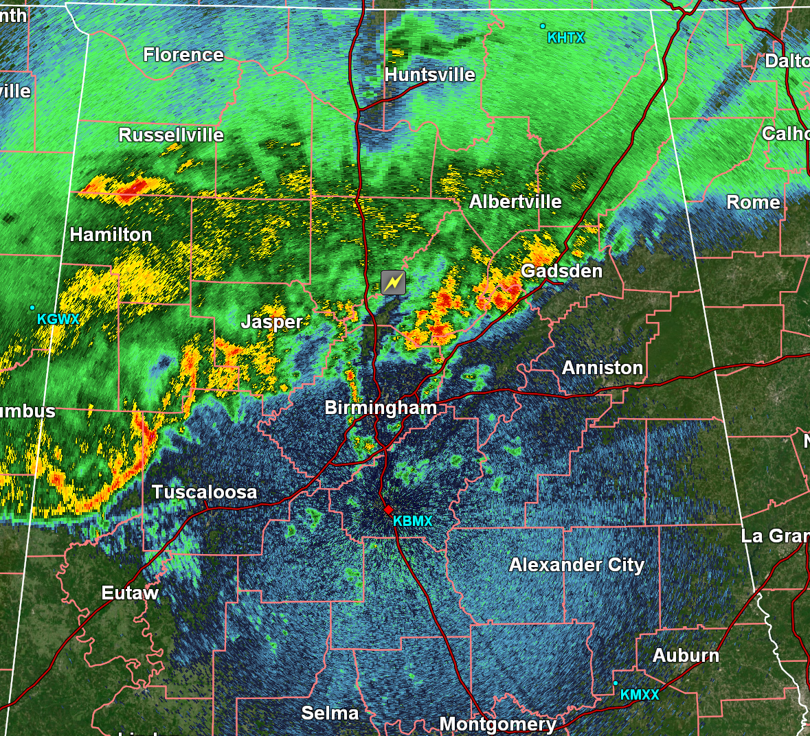
At this time, there are no active severe thunderstorm or tornado warnings in Alabama. There is a Special Weather Statement in effect for Tuscaloosa, Pickens and Fayette Counties through 12:15am. Wind gusts up to 40mph are occurring with this storm. Elsewhere, storms are behaving and remaining below severe limits.
We have seen some pretty heavy rainfall occurring with these storms, and parts of Western Alabama are highlighted in a precipitation discussion. Rainfall rates up to 2-4 inches per hour are possible as these storms continue to push through Alabama. Be weary of any flooding occurring on roadways, and remember that flash flooding can happen almost instantaneously.
The threat for severe weather continues to dwindle as we approach the early morning hours, but we cannot yet rule out any more severe thunderstorms. The severe thunderstorm watch in effect for Northwest Alabama is set to expire at midnight, but isolated severe thunderstorms elsewhere are still possible. If you are heading to bed soon, please have multiple ways to receive weather alerts overnight! We want you to be as prepared as possible in the event a warning is issued for your area.
Current radar imagery: