

If you haven’t been outside yet, you are missing out on an absolutely brilliant day. Other than a few fair-weather clouds dotting the skies over the west-central parts of the state, skies have been completely sunny. Temperatures at 2PM across Central Alabama were in the upper 60s to mid 70s, with Alexander City leading the way at 76º. Haleyville was the cool spot at 68º. Birmingham was sitting at a respectable 70º. We are pretty close to our highs at this point, maxing out in the upper 60s to the mid 70s. Tonight’s overnight lows will not be as chilly, dropping into the upper 30s in the northeast corner, to the lower 50s in the southwest.
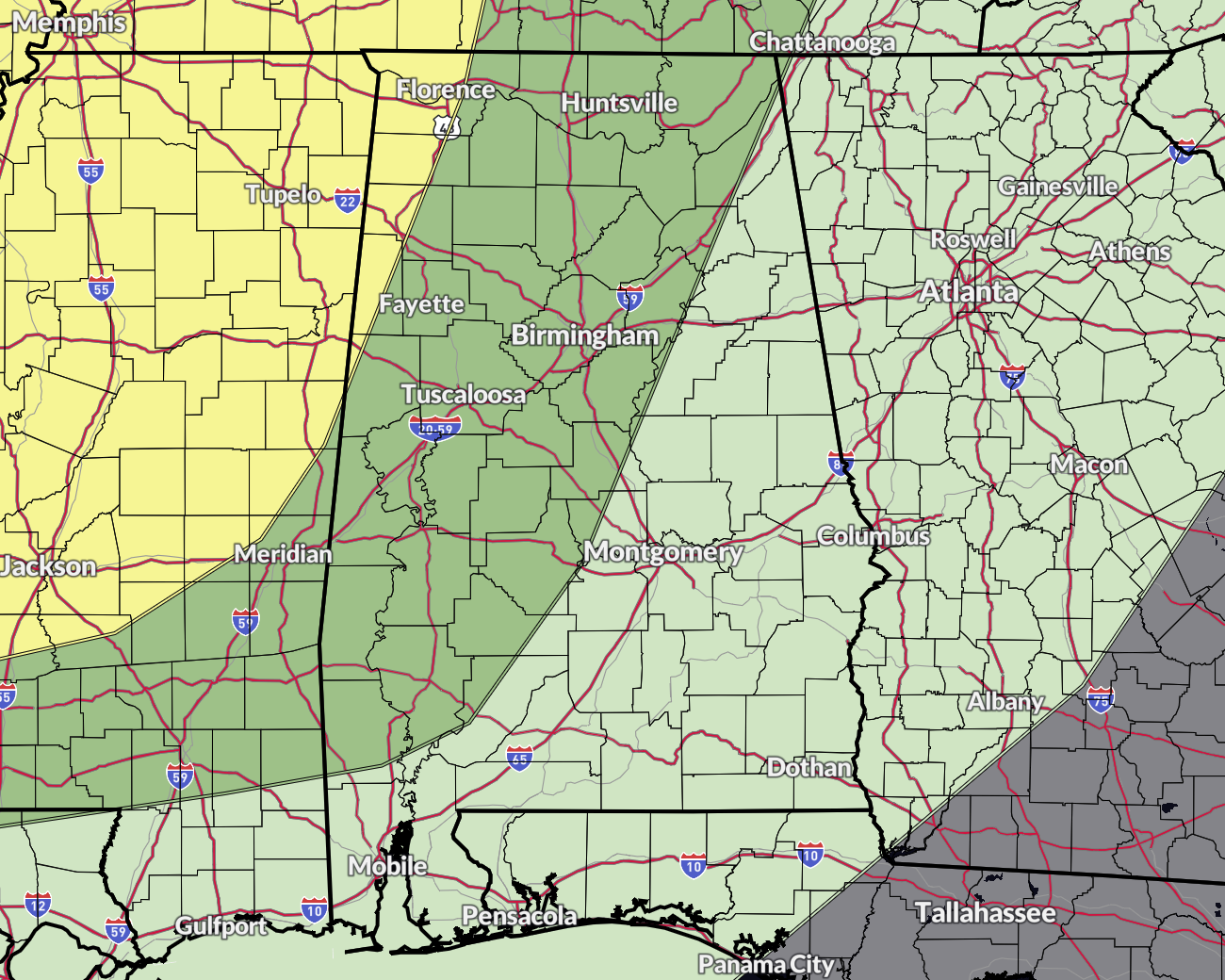
The Slight Risk for storms has now been expanded into the west and northwestern pars of Alabama, including locations west of a line from Killen to Russellville to Hackleburg to Pickensville. The Marginal Risk has also been expanded east to now include locations west of a line from just west of Fort Payne to Childersburg to just west of Monroeville to Deer Park.
The threat will mostly be from damaging winds and large hail, but there is a non-zero risk of a tornado or two. The threat window will start as early as 6PM CDT Sunday evening on the northwestern corner of the state, and should be exiting the southwestern parts of the threat area by 3AM CDT Monday morning.
While this does not appear to be a major severe weather system on the forecast models, we have had a few systems in recent history that appeared to have a similar setup and ended up over achieving with more severe weather in number of warnings and intensity. So, we cannot drop our guard on this one at all. Stay weather-aware Sunday night and have a way to receive alerts while you sleep.
Category: Alabama’s Weather, ALL POSTS, Severe Weather


