
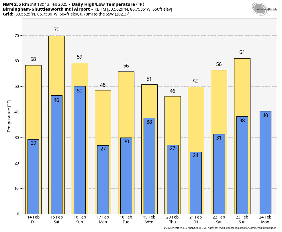
COLDER: Colder, drier air continues to roll into Alabama this afternoon; the sky is partly to mostly sunny. Tonight will be fair and cold.

A freeze is likely early tomorrow morning over the northern half of the state with lows in the upper 20s and low 30s. Tomorrow will feature a good supply of sunshine with highs between 57 and 64 degrees for most places.
STORMY WEEKEND: Saturday will be breezy and warmer with temperature rising into the 70s across much of the state. A dynamic system will bring rain and storms by Saturday night, and SPC has defined an “enhanced risk” (level 3/5) of severe thunderstorms for the western counties of the state, with a “slight risk” (level 2/5) elsewhere.
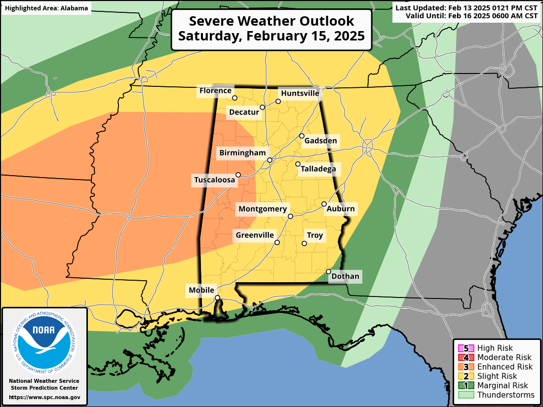
It looks like most of the issues will come from a long line of strong to severe thunderstorms Saturday night into the pre-dawn hours Sunday. Wind fields with this system will be very strong, and storms along the line could produce damaging straight line winds along with a few isolated tornadoes. Instability values look rather limited, but the dynamic nature of the system will still mean a chance of severe storms. For now it looks like the main window for strong to severe storms in Alabama will come between 10:00 p.m. Saturday and 4:00 a.m. Sunday.
The line will be moving quickly; rain amounts will be around one inch for most places. Sunday will feature a clearing sky with highs mostly in the 60s.
NEXT WEEK: A freeze is likely for much of the state early Monday and Tuesday morning, with 20s for the northern half of the state. Rain returns to the state Wednesday; this will be from a low near the Gulf Coast meaning no risk of severe thunderstorms. In fact, this feature could bring some wintry precipitation (mostly light snow) to Tennessee and southern Kentucky. Global models hint at some potential for a quick change to light snow over far North Alabama as the precipitation ends Wednesday night or early Thursday, but it is way too early to know if this happens at all, or if there will be any impact.
Another surge of colder air moves into the state after the mid-week rain… See the video briefing for maps, graphics, and more details.
ON THIS DATE IN 2000: Late in the day and into the early morning hours of the 14th, severe thunderstorms spawned six tornadoes over southwestern Georgia that killed 19, injured 202, and caused $35 million in damages. An F3 tornado hit southern Camilla, killing 11 people and wounding 175 others in the town.
Look for the next video briefing here by 6:00 a.m. tomorrow…