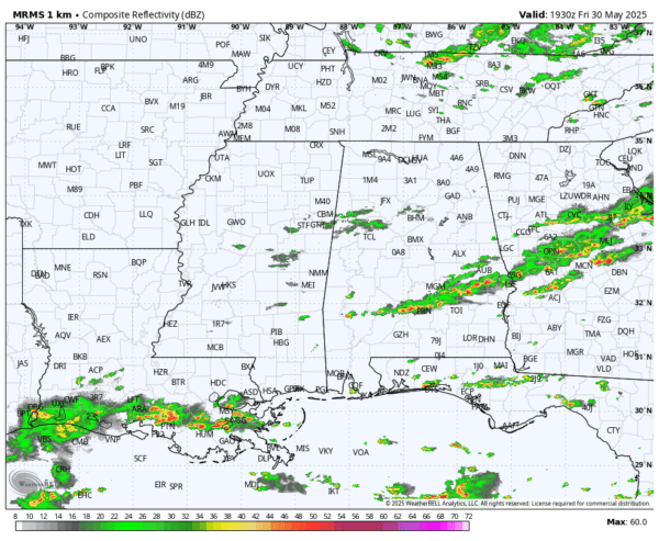
RADAR CHECK: A band of showers and thunderstorms ahead of a cold front is pushing through Southeast Alabama this afternoon. Some of the storms could produce small hail and gusty winds this evening. Much drier air will follow the front, setting the stage for a very pleasant night. The sky becomes mostly clear, and temperatures drop into the 50s over the northern half of the state by daybreak tomorrow.

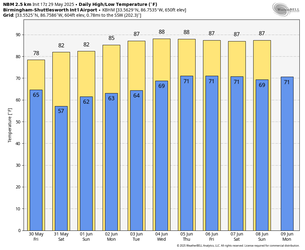
THE ALABAMA WEEKEND: We get a chance to dry out. Sunny and less humid tomorrow with a high in the 80-85 degree range. Most of the state will stay dry Sunday, although we will mention the chance of a few isolated showers over the northern third of the state during the afternoon and evening hours. Highs will remain in the low to mid 80s Sunday.
NEXT WEEK: An upper ridge will build across the region with rising heat levels; highs most days will be in the 85-91 degree range. Humidity levels will rise as well, and while we will could a few spotty showers and storms around, most days will be dry. See the video briefing for maps, graphics, and more details.
ON THIS DATE IN 1982: Two significant tornadoes ripped through southern Illinois. The most severe was an F4 that touched down northeast of Carbondale, Illinois then moved to Marion. The twister had multiple vortices within the main funnel. Extensive damage occurred at the Marion Airport. A total of 10 people were killed, and 181 were injured.
Look for my next video briefing here by 6:00 a.m. Monday… enjoy the weekend!
Category: Alabama’s Weather, ALL POSTS, Weather Xtreme Videos