
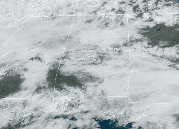
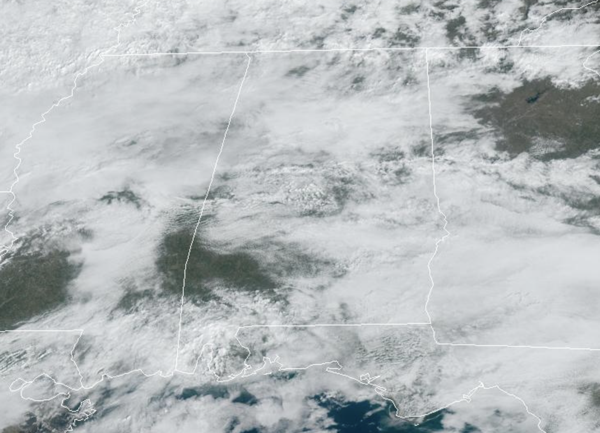
A front has drifted into North Alabama today and will be the near term player in our forecast through the weekend. The front is between Birmingham and Huntsville today, tomorrow the front will life back north into Tennessee as a warm front, and then on Sunday it will move back south into North/Central Alabama on Sunday as a cold front.
Today we are seeing more clouds than sun with some isolated showers possible at just about any time, and rain amounts will be light and spotty with locations remaining dry. Highs north of the front are in the 50s today while 60s, 70s and 80s are showing up south of the front. Tomorrow, will be mainly dry and warm with decreasing clouds; highs will be in the upper 70s to lower 80s. On Sunday, as the front sinks back south into the state, clouds increase and we will bring the chance of rain back to the forecast. Rain amounts will be light across the state on Sunday and it will be cooler with most locations holding in the 60s much of the day.
BIRMINGHAM ALMANAC: For February 7th, the average high for Birmingham is 57° and the average low is 37°. The record high is 79° set in 2019, while the record low is 12° set in 1988. We average 0.16” of precipitation on this date and the record value is 5.60” set in 1903.
USA BRIEF: A Pacific storm will continue to bring strong winds, heavy rain with a risk for flooding to northern and central California, and heavy mountain snow in the Sierras, southern Cascades, and northern Rockies through Friday. There will be moderate to heavy snow across parts of the Northern Intermountain Region and the Northern Rockies with more moderate to heavy snow from the Northern High Plains to the Lower Great Lakes and moderate to heavy snow over parts of the Northeast. Also, rain/freezing rain from the Ohio Valley to the Mid-Atlantic on Saturday.
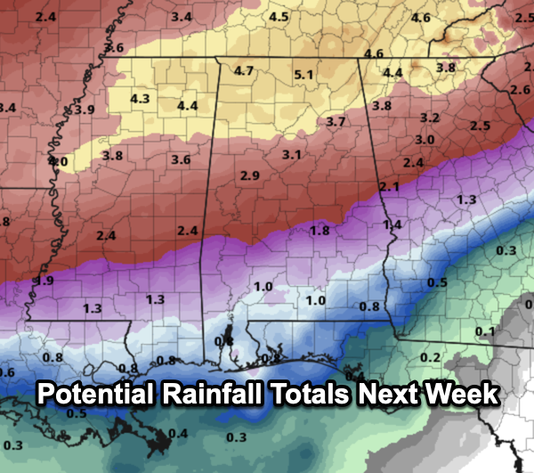
WET PATTERN NEXT WEEK: The front stalls across the state on Monday, and the weather Monday will feature a few showers, but widespread and soaking rains will arrive on Tuesday and will last through Thursday as multiple waves of rain and some storms are expected. For now, severe storms are not expected, but of course that could change in the coming days. The main threat next week will be the threat of flooding. Rainfall potential for the northern half of the state will be in the 2-4 inch range, while 1-2 inches are expected across South Alabama. Isolated higher amounts in the 5-6 inch range are possible over portions of North Alabama.
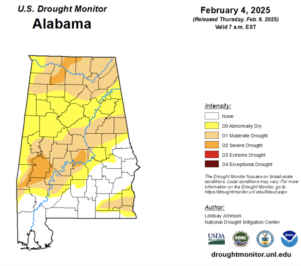
We certainly need the rain as much of the state continues to be in a drought, but this could be too much of a good thing. River flooding could become a big issue late next week.
With the rain and clouds, highs will be in the low to mid 60s much of the week, while lows fall back into the 40s. The rain looks to push out of the area by Valentine’s Day as a drier air mass returns to the state. Still no signs of Arctic air for Alabama the next 10-14 days.
WORLD TEMPERATURE EXTREMES: Over the last 24 hours, the highest observation outside the U.S. was 116.2F at Meekatharra Airport, Australia. The lowest observation was -69.2F at Ilirnej, Russia.
CONTIGUOUS TEMPERATURE EXTREMES: Over the last 24 hours, the highest observation was 97F at Rio Grande Village, TX. The lowest observation was -28F at Poplar, MT.


