

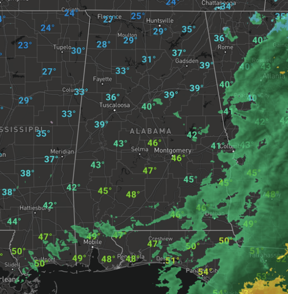
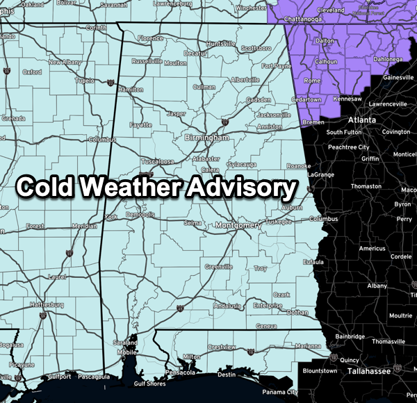
PRECIPITATION OUT, ARCTIC AIR IN: The rain and snow is coming to an end across Alabama, and much colder air is flowing into the state. Temperatures are falling due to an icy, north wind blowing into the state. The areas across North Alabama that saw the snow overnight and this morning, will continue to have icy roads and travel issues the rest of today and tonight. Tonight, temperatures will fall into the upper teens and 20s across the northern half of the state, and with the wind blowing, wind chill values in the single digits are likely tomorrow morning across much of Alabama. A Cold Weather Advisory is in effect for the entire state.
BIRMINGHAM ALMANAC: For February 19th, the average high for Birmingham is 60° and the average low is 39°. The record high is 78° set in 2018, while the record low is 12° set in 1958. We average 0.18” of precipitation on this date and the record value is 2.02” set in 1991.
TOMORROW/FRIDAY: Cold is the word the next two days across Alabama. The sky will become sunny tomorrow, but highs will only be in the low to mid 30s, almost 30 degrees below average for this time of year. Another hard freeze is likely early Friday with 20s all the way down to the Gulf Coast. With sunshine in full supply temperatures reach the 40s and low 50s Friday afternoon.
WARMING TREND: Over the weekend, the warming trend begins with highs returning to the 50s Saturday and Sunday; lows will be in the upper 20s and lower 30s. Both days will be dry and will feature plenty of sunshine.
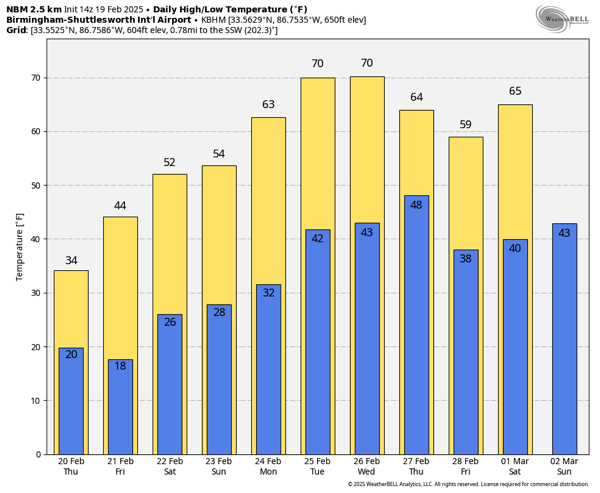
SPRING-LIKE NEXT WEEK: The warm-up continues and temperatures will be climbing well into the mid and upper 60s for much of Alabama with widespread 70s expected as well. Some rain is possible late Wednesday and into Thursday, but there is no risk of severe storms at this time.
WORLD TEMPERATURE EXTREMES: Over the last 24 hours, the highest observation outside the U.S. was 110.1F at Mango, Togo. The lowest observation was -69.7F at Vostok, Antarctica.
CONTIGUOUS TEMPERATURE EXTREMES: Over the last 24 hours, the highest observation was 89F at Rio Grande Village, TX. The lowest observation was -44F at Hettinger, ND.
Category: Alabama’s Weather, ALL POSTS, Social Media


