
Midday Nowcast: Breezy and Cold Start to Spring; Freeze Warning Tonight : The Alabama Weather Blog

WELCOME TO SPRING: The spring equinox occurred at 4:01AM CDT this morning, which is when the sun was directly over the equator and day lengths are approximately 12 hours long everywhere on the planet. The amount of daylight will continue to increase until the summer solstice in June. However, despite it being the first day of spring, much colder air is blowing into Alabama today.
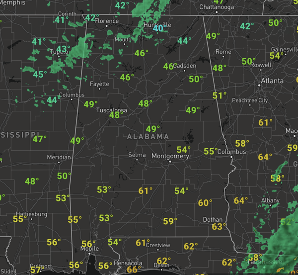
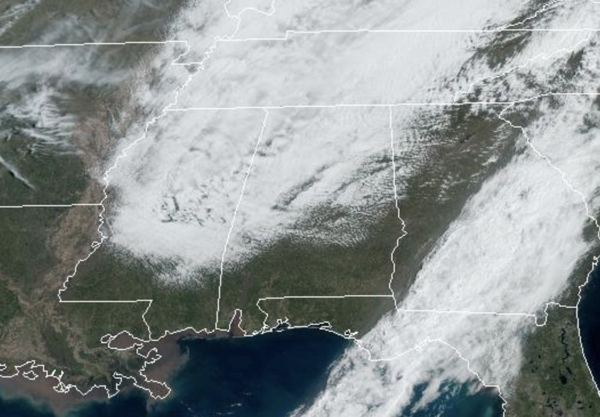
Clouds are hanging tough today, and we are seeing some light rain in pocket across the northern third of Alabama, also, we are feeling a chilly north breeze. Temperature today are in the 40s and lower 50s, much colder than the upper 70s and low 80s many spots had yesterday.
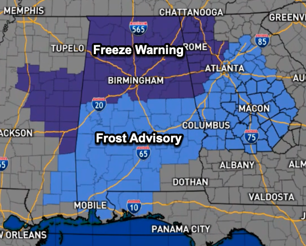
FREEZE WARNING: A freeze warning is in effect for the northern third of Alabama tonight, with a frost advisory all the way down to the coastal counties of Alabama and Northwest Florida. Overnight, we will see lows in the 26-35 degree range, with widespread frost and a late season freeze. After the frosty start to the day, tomorrow will feature sunshine in fully supply with afternoon high generally in the mid to upper 60s.
BIRMINGHAM ALMANAC: For March 20th, the average high for Birmingham is 68° and the average low is 46°. The record high is 87° set in 1907, while the record low is 21° set in 1923. We average 0.18” of precipitation on this date and the record value is 2.06” set in 2006.
ACROSS THE USA: Gusty winds and dry conditions will continue to produce elevated to critical fire weather over the southern High Plains and eastern Florida Peninsula. There are locally critical fire weather areas along the Gulf Coast and the northern Plains. Two Pacific storms will impact the Northwest U.S. with heavy mountain snow and low elevation rain into Saturday.
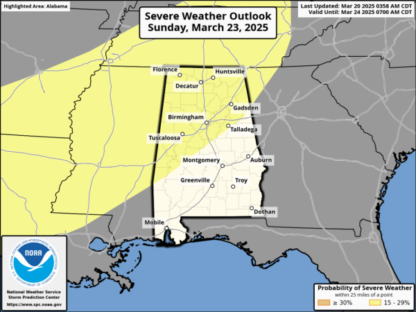
THE ALABAMA WEEKEND: The weekend will be dry for Alabama and will feature more sun than clouds with highs in the low and mid 70s both days. On Sunday, a strong southerly wind begins blowing, and showers and storms will return to Alabama Sunday night into early Monday morning. The SPC has expanded a risk of severe weather into Alabama, for areas north of a line from Demopolis to Calera to Anniston. Models are suggesting very limited instability, which will likely limit the threat, but we will watch model trends closely. For now it looks like the best chance of heavier storms will come from midnight Sunday night through 8:00 a.m. Monday. Gusty winds look to be the main threat.
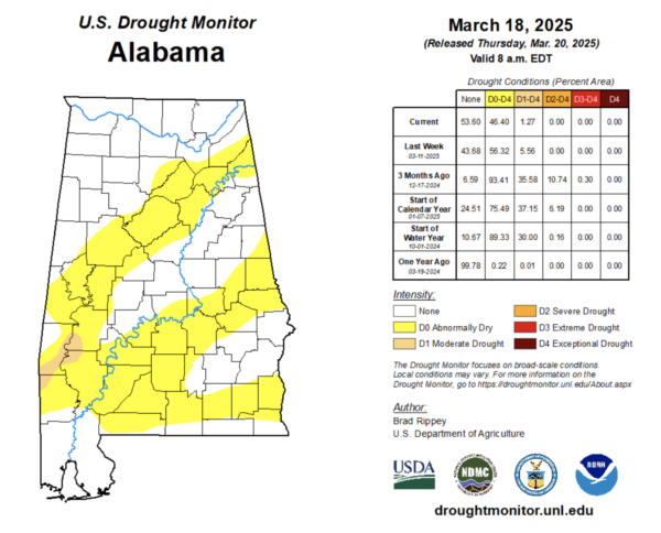
DROUGHT MONITOR: Latest Drought Monitor out shows drought conditions have decreased since last week across Alabama due to recent rains. Last week, 56.32% of the state was Abnormally Dry and that is down to 46.60% this week. Also last week, 5.56% of the state had moderate drought, and that number has decreased to 1.27% this week. We are heading in the right direction, but we need more rain. March is statistically our wettest month of the year across much of Alabama, but the overall pattern the next 10-14 days in unseasonably dry.
NEXT WEEK: Lingering showers are possible over South Alabama Monday, otherwise the week looks dry and pleasant with highs not far from 70 degrees. Lows will be in the 40s and 50s. Both high and low temperatures are pretty close to seasonal average for late March in Alabama.
WORLD TEMPERATURE EXTREMES: Over the last 24 hours, the highest observation outside the U.S. was 120.4F at Kedougou, Senegal. Te lowest observation was -81.2F at Dome C, Antarctica.
CONTIGUOUS TEMPERATURE EXTREMES: Over the last 24 hours, the highest observation was 102F at Rio Grande Village, TX. The lowest observation was -16F at Peter Sinks, UT.
Category: Alabama’s Weather, ALL POSTS, Social Media


