

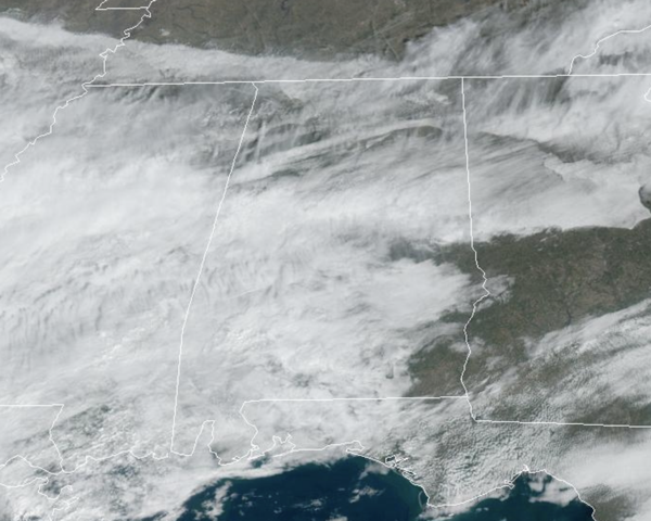
A front is bisecting the state today and is allowing a large temperature range across Alabama today with 50s over the Tennessee Valley, while 70s are common across South Alabama. We are seeing more clouds than sun and we can’t rule out a stray shower or two the rest of today and tonight, but most locations will remain dry.
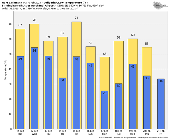
BIRMINGHAM ALMANAC: For February 10th, the average high for Birmingham is 58° and the average low is 37°. The record high is 80° set in 1932, while the record low is 10° set in 1971. We average 0.16” of precipitation on this date and the record value is 2.60” set in 2020.
ACROSS THE USA: Expect heavy snow over the Central Plains and Ohio Valley into the Mid-Atlantic on Tuesday, while rain/freezing rain are expected over parts of the Southern Plains, Lower Mississippi Valley, and Mid-Atlantic/Central Appalachians with 0.25 inches of ice accumulations possible. There is a risk of excessive rainfall over parts of the Lower Mississippi Valley, Tennessee Valley, and Southern Appalachians starting Tuesday. Temperatures will be 25 to 40 degrees below average across the Northern Rockies/Northern High Plains.
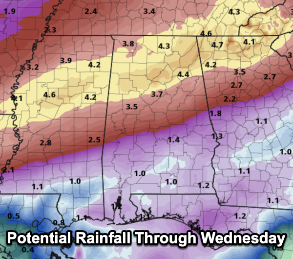
ACTIVE PATTERN AHEAD: As the front meanders about the state this week, we are going to see several waves of low pressure develop and move along it, bringing multiple rounds of rain and storms tomorrow and Wednesday. The rain will be heavy at times, and rain amounts for the northern half of the state will be in the 3-6 inch range, with 1-3 inches for the southern counties. Areas of flooding are possible by Wednesday and Wednesday night and we are likely see areas stream and river flooding develop across the northern half of the state.
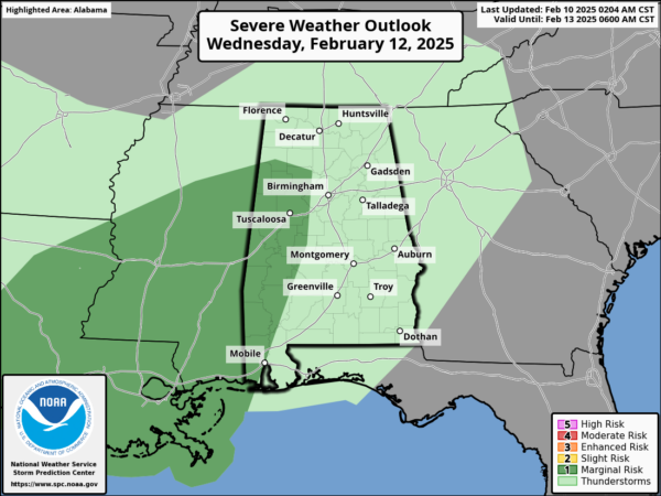
As far as severe weather, we always have to watch things this time of year, and the Storm Prediction Center has defined a low end “marginal risk” (level 1/5) of severe thunderstorms for parts of West Alabama Wednesday; a few storms could produce gusty winds. The chance of a tornado is very low, but not zero.
THURSDAY/FRIDAY: The rain will end early in the day Thursday for most of the state, followed by a clearing sky. Friday will be a mostly sunny day with afternoon highs in the 60s. Lows will be in the 30s and 40s.
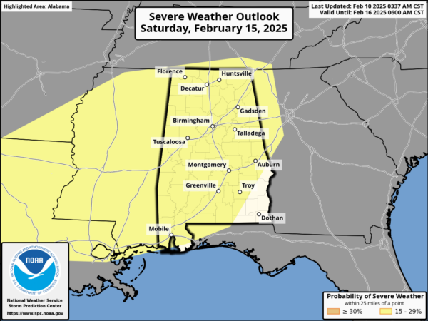
MORE ACTIVE WEATHER: A dynamic system will bring rain and thunderstorms back to Alabama Saturday afternoon, continuing Saturday night. More heavy rain is likely, an additional 1-2 inches. Also, the SPC has defined a severe weather threat for most of Alabama. For now it looks like the core severe weather threat will come from about 3PM through midnight Saturday.
It is too early to know the scope of the threat and potential impacts. We always like to approach the weather one system at a time, so lets get through the mid-week system and then we can focus on the weekend threat. The sky becomes mostly sunny Sunday with a high in the 50s.
WINTER RETURNS: Colder air returns early next week as Monday will be cold and dry. A freeze is likely for much of the state with lows in the 20s and low 30s early next week. It looks like another round of rain returns to the state by the middle of the week.
WORLD TEMPERATURE EXTREMES: Over the last 24 hours, the highest observation outside the U.S. was 115.2F at Warburton Airfield, Australia. The lowest observation was -65.6F at Delyankir, Russia.
CONTIGUOUS TEMPERATURE EXTREMES: Over the last 24 hours, the highest observation was 92F at Zapata, TX. The lowest observation was -35F at Peter Sinks, UT.


