
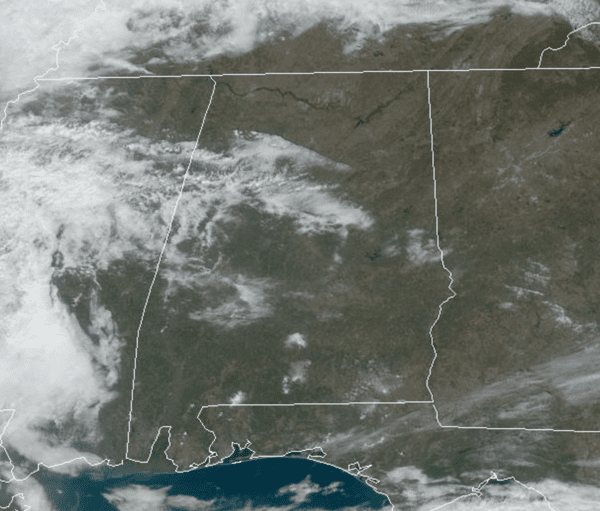
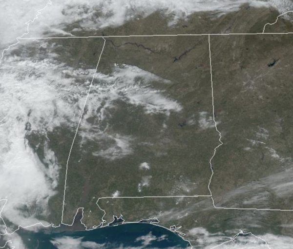
LOVELY VALENTINE’S DAY: Today is a sunny and seasonable day with highs in the upper 50s for most locations this afternoon; right where temperatures should be this time of year. Weather will not be an issue for any evening plans you may have for you and your Valentine. Temperatures will be falling into the 40s tonight, but clouds and some showers will begin to develop after might as southerly winds begin to bring Gulf moisture north.
BIRMINGHAM ALMANAC: For February 14th, the average high for Birmingham is 59° and the average low is 38°. The record high is 79° set in 1989, while the record low is 2° set in 1905. We average 0.18” of precipitation on this date and the record value is 2.30” set in 1932.
TOMORROW: A warm front will surge northward making for a warm and breezy day as temperatures rise into the mid 70s. There will be a some scattered showers through the day, but the main threat of storms will not arrive in Alabama until late tomorrow night and into the early morning hours Sunday.
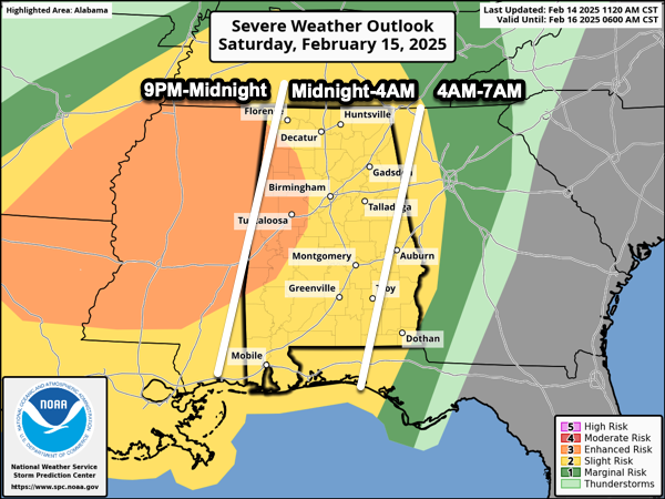
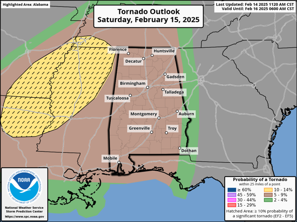
The SPC maintains an “enhanced risk” (level 3/5) for parts of West Alabama, with a “slight risk” (level 2/5) for the rest of the state. The greatest chance for severe storms will be to the west tomorrow, and that is where the tornado threat will be highest, especially across North Mississippi, but the storms to our west will congeal into a line of strong and severe storms.
Latest model trends are a bit slower on the arrival of the storms, but for now the line of storms will likely enter the northwest corner of the state as early as 11PM tomorrow night. It will then move quickly through the rest of the state during the pre-dawn hours Sunday.
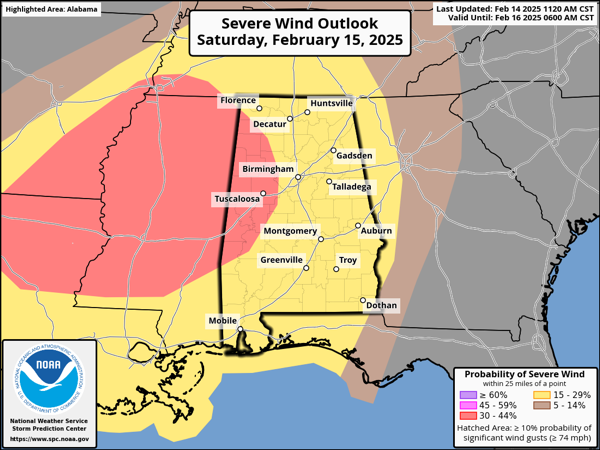
This is a classic cool weather season severe weather threat with limited Instability values, but very strong wind fields. As the line moves through the state, the main threat will come from strong, potentially damaging straight line winds. However, a brief isolated tornado or two is possible as well. This will be a fast moving line, which will reduce the potential for flooding. Rain amounts will be generally around one inch for much of North/Central Alabama. The storm threat will be out of the state by early Sunday morning.
CALL TO ACTION: As a reminder, before any organized severe weather threat, everyone should review their severe weather safety plan. With any severe weather event, especially an overnight event, be ready to act immediately…Have multiple, reliable ways to receive severe weather alerts, NEVER, ever, ever rely on a outdoor siren. Every Alabama home and business needs a NOAA Weather Radio (the most popular model is the Midland WR-120, which is sold in most local big box retailers). The other way is your phone…be sure emergency alerts are enabled (look under settings, and notifications), and install the free ABC 33/40 Weather app.
Know the safe place in your house, and in that safe place have helmets for everyone. Bicycle helmets and batting helmets work well. We also recommend portable air horns and hard soled shoes for everyone. If you live in an apartment complex, you can’t be above the first level. Shelter with a friend on the ground level, or ask management if they can open the clubhouse during a tornado warning.
If you live in a mobile home, you cannot stay there during a tornado warning, they offer little to know protection from severe storms. Know the location of the nearest shelter, or business that is open 24/7. Know how to get there quickly.
Behind the front, Sunday will feature a clearing sky with highs in the upper 50s and low 60s for much of North/Central Alabama. Sunday night lows will fall into the 20s across much of North and Central Alabama.
NEXT WEEK: Another freeze is likely for much of the state again Tuesday morning. On Wednesday a Gulf low develops bring a widespread rain event back to the state. With the low to the south of us, there will be no threat of severe weather. Wednesday night into Thursday morning, the global models continue to suggest some potential for a change to light snow over the northern counties of the state; it remains too early to know if this actually happens, or if there will be any impact. Let’s get through the severe weather threat this weekend, before we focus on possible winter weather mischief next week. For the second half of next week another surge of cold air moves into the state and temperatures look to be well-below average for several days. Lows in the teens and 20s are expected across the northern half of the state.
WORLD TEMPERATURE EXTREMES: Over the last 24 hours, the highest observation outside the U.S. was 105.6F at Carnarvon Airport, Australia. The lowest observation was -65.4F at Vostok, Antarctica.
CONTIGUOUS TEMPERATURE EXTREMES: Over the last 24 hours, the highest observation was 93F at Plant City, FL. The lowest observation was -27F at Forest Center, MN.


