
Midday Nowcast: Warm and Windy Wednesday; Scattered Storms Tonight, Much Colder Tomorrow : The Alabama Weather Blog
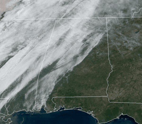
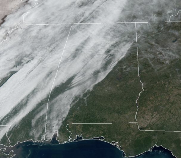
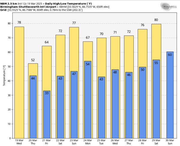
SOME RAIN/STORMS TONIGHT: It is a breezy and warm Wednesday across Alabama and we have a wind advisory for areas north and west of Birmingham where winds could gust to 35 mph. We are seeing clouds increase today with highs in the upper 70s and lower 80s. This evening and tonight, some showers and storms are expected ahead of a cold front. The SPC maintains a low end “marginal risk” (level 1/5) of severe thunderstorms for areas north and west of Birmingham.
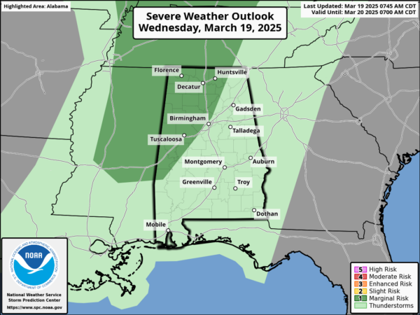
As the front swings through, a few storms along the front could produce small hail and gusty winds, but with little surface based instability and weak dynamic support the overall threat is low, however, always pay attention to the weather anytime there is any risk of severe storms.
BIRMINGHAM ALMANAC: For March 19th, the average high for Birmingham is 68° and the average low is 46°. The record high is 89° set in 1982, while the record low is 22° set in 1923. We average 0.18” of precipitation on this date and the record value is 6.91” set in 1970.
ACROSS THE USA: A Spring blizzard will move from the central High Plains to the Upper Midwest and western Great Lakes today into Thursday. The combination of heavy falling snow and strong winds will create snow-covered roads and near zero visibility at times. Gusty winds and dry conditions will continue critical fire weather today through Friday from southwestern Texas into the southern High Plains.
COLD FIRST DAY OF SPRING: The spring equinox occurs at 4:01AM CDT tomorrow morning, meaning the official arrival of spring. This is when the sun is directly over the equator. As we start spring, much colder, drier air rolls into the Deep South behind tomorrow behind the front. Expect a chilly north breeze tomorrow with highs only in the low 50s with a clearing sky. Areas in the Tennessee Valley will hold in the 40s all day. By Friday morning, we are looking at lows in the 26-35 degree range over the northern half of the state, a widespread frost is likely, while colder spots will see a late season freeze. After the frosty start to the day, Friday will feature sunshine in fully supply with afternoon high generally in the mid 60s.
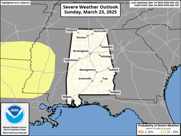
THE ALABAMA WEEKEND: The weekend will be dry for Alabama and will feature more sun than clouds with highs in the low and mid 70s both days. Showers and storms will then move through Sunday night into early Monday morning. The SPC maintains a defined risk of severe weather west of Alabama for Sunday. The air will be relatively stable across Alabama late Sunday night, which will keep the overall severe threat here fairly low. We will watch model trends closely as we approach the weekend.
INTO NEXT WEEK: Lingering showers are possible over South Alabama Monday, otherwise the week looks dry and pleasant with highs not far from 70 degrees. Lows will be in the 40s and 50s. Both high and low temperatures are pretty close to seasonal average for late March in Alabama.
WORLD TEMPERATURE EXTREMES: Over the last 24 hours, the highest observation outside the U.S. was 120.4F at Kedougou, Senegal. Te lowest observation was -81.2F at Dome C, Antarctica.
CONTIGUOUS TEMPERATURE EXTREMES: Over the last 24 hours, the highest observation was 102F at Rio Grande Village, TX. The lowest observation was -16F at Peter Sinks, UT.
Category: Alabama’s Weather, ALL POSTS, Social Media


