

The Storm Prediction Center’s Day 1 Outlook issued early this morning maintains a Slight Risk (Level 2 of 5) for severe thunderstorms this afternoon and evening from northeast Texas across Louisiana, Arkansas, Mississippi, and into western Tennessee. The primary threats will be large hail and damaging wind gusts.
Storms are expected to develop along a cold front moving into a warm and unstable airmass, with the best combination of instability and wind shear focused west of Alabama. Some storms, especially in parts of Arkansas, Louisiana, and Mississippi, could produce hail larger than quarter size and isolated damaging winds. A brief tornado can’t be ruled out, but it’s not the main concern.
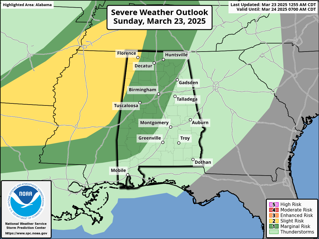
For Alabama, the threat remains low and confined mainly to northwestern parts of the state late tonight—generally after 8 PM. A few storms could be strong to marginally severe with gusty winds and hail, but widespread severe weather is not expected. The outlook has been steady and is not likely to be upgraded further east.
This is a typical early spring setup with modest ingredients for severe weather. It’s a good idea to stay weather aware, especially in areas along and west of I-59 tonight, but at this time, the threat appears limited and short-lived.
Category: Alabama’s Weather, ALL POSTS, Severe Weather, Social Media