
While there is still a small threat of damaging winds or an isolated tornado through 3 a.m. across much of the southern half of Alabama, the main threat has now transitioned to a flooding threat.
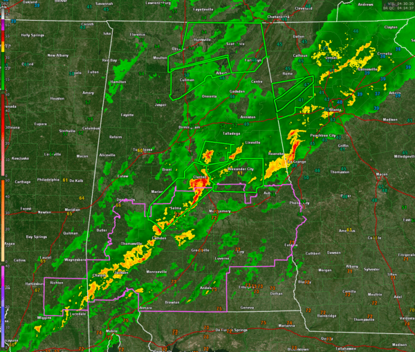
Here is the map at this hour:

The main thunderstorm activity with heavy rain at this hour is across Clay, Talladega, Chilton and Autauga counties.
The activity extends southwestward from there into Washington County in South west Alabama.
Moderate rain now covers much of East Central Alabama.
This will be the last update of the night. Make sure your weatheradio is on overnight if you are in the tornado watch area or in areas that are still receiving or are downstream of the heavy rain.


