
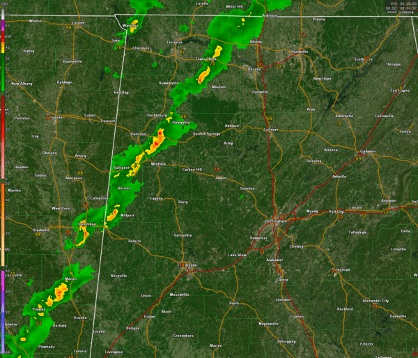
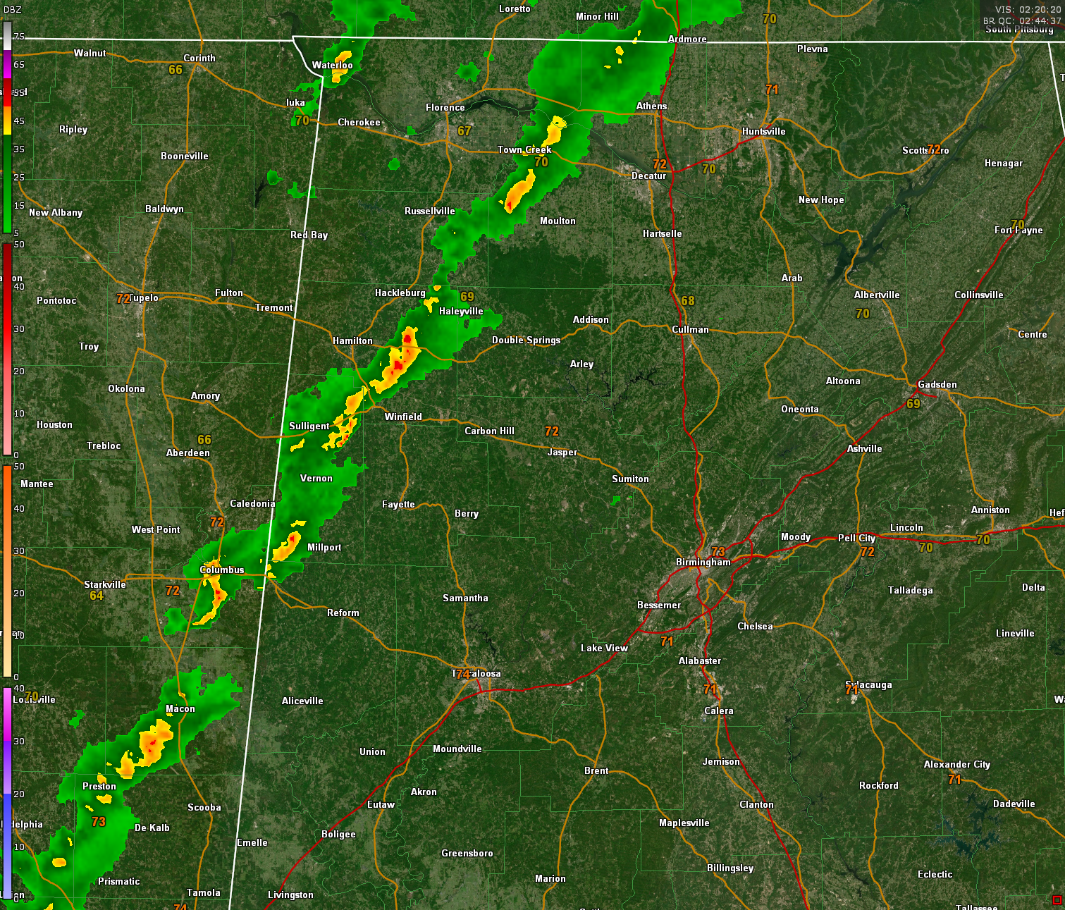
A line of heavy showers is pushing eastward across Northwest and West Central Alabama this evening.
It currently extends from northern Limestone and Lawrence counties into Marion County west of Hamilton into Lamar County near Vernon. It then extends into Mississippi near Macon and on to near Newton along I-20.
It is moving east at 30 mph.
There is still not much if any lightning in Alabama.
The NWS Birmingham does have a significant weather advisory posted for the segment of the line over Marion and Lamar counties. Winds could gust to 40 mph.
The nearest severe thunderstorm warning is southwest of Nashville.
There still could be a warning or two over Alabama, but that chance lessens as the line gets southeast of I-59. Until then, damaging wind gusts are the biggest threat in Alabama.
Category: Alabama’s Weather, ALL POSTS, Severe Weather, Social Media


