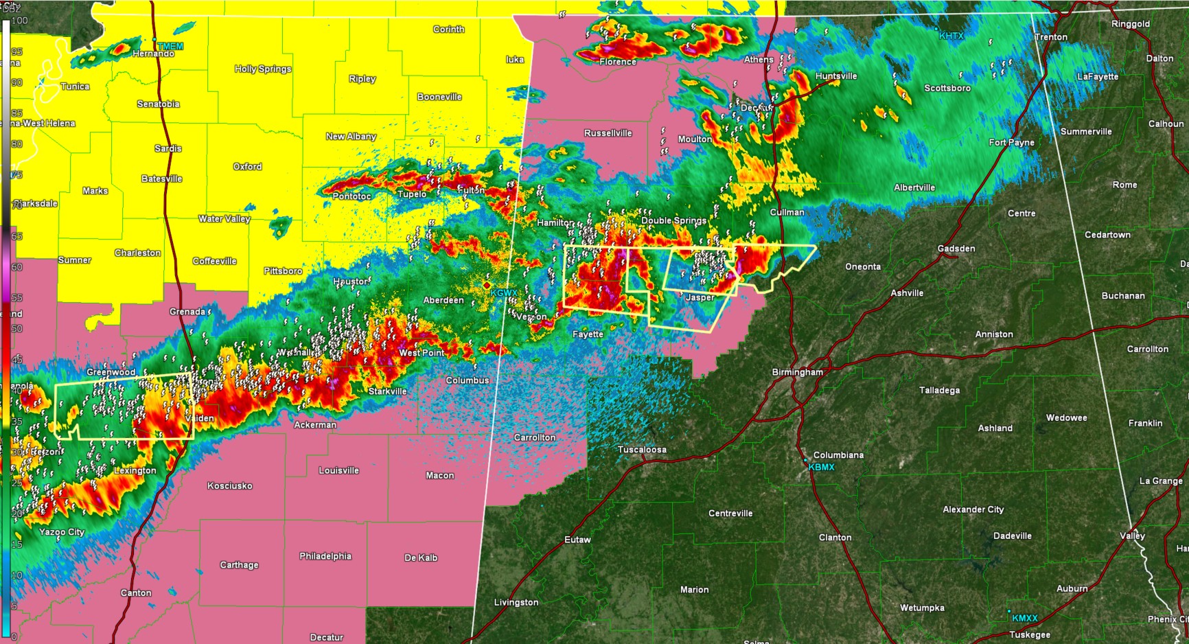
Strong to severe thunderstorms continue across portions of western Alabama, with severe thunderstorm warnings in effect for parts of Cullman, Walker, Fayette, and Winston counties. These are in effect for the possibility of large hail and wind gusts up to 60mph. These storms have had a history of producing both wind damage as well has damaging hail up to tennis ball size.
The severe thunderstorm watch has also been expanded, and now includes Tuscaloosa, Greene, and Sumter counties. The threat of damaging wind and hail will occur with any storm within the watch area. The watch remains in effect for the counties mentioned earlier this evening.
As storms move east with time, they will lose their intensity, and the severe weather threat is much much lower over east and southeast Alabama.
Category: Alabama’s Weather, ALL POSTS, Social Media