
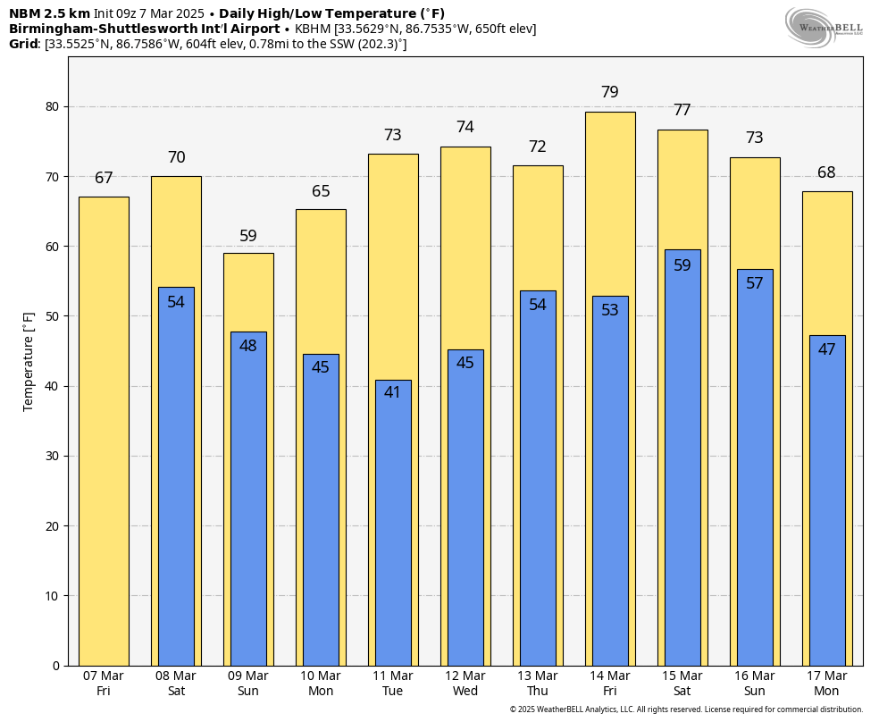
STILL DRY TODAY: After a chilly start early this morning with temperatures in the 30s in many areas, we are forecasting a high in the 67-73 degree range this afternoon with a partly sunny sky. Clouds will increase tonight, and a few spotty showers are possible as moisture levels begin to rise.
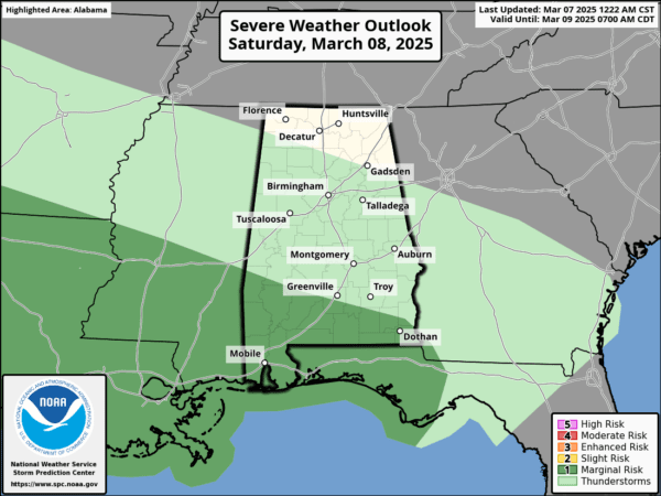
A decent part of Alabama will be dry during the day tomorrow, but showers and a storm or two are very possible near the Gulf Coast. Then, we expect periods of rain statewide tomorrow night into Sunday. A few thunderstorms are possible across far South Alabama; SPC maintains a low end “marginal risk” of severe thunderstorms there tomorrow afternoon/night…
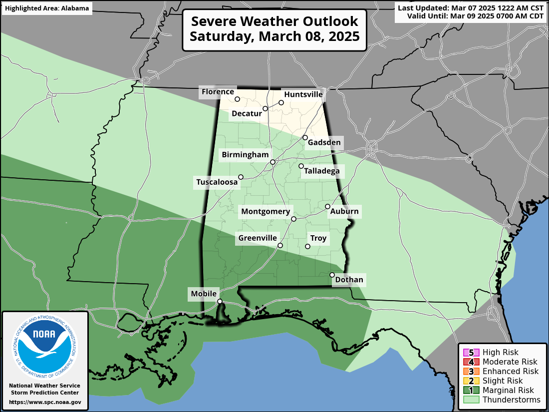
If thunderstorms do develop over far South Alabama, one or two of them could produce gusty winds. The tornado threat is very low, but not zero.
Rain amounts over the weekend will be around 1/2 inch for the northern half of Alabama, with 1/2 to 1 inch for the southern counties. The high tomorrow will be close to 70, followed by a high Sunday in the 57-63 degree range.
NEXT WEEK: The weather looks dry and pleasant for the first half of the week; then a disturbance will bring a chance of showers to Alabama on Thursday. Nothing too heavy; then dry air returns Friday. Global models continue to suggest a chance of showers and storms at some point over the following weekend (March 15-16), but remains too early to know if severe storms will be an issue. See the video briefing for maps, graphics, and more details.
DST RETURNS: We go back on Daylight Saving Time this weekend; the sunset Sunday (at Birmingham) will be at 6:50p CDT.
ON THIS DATE IN 2018: A teacher was struck by lightning outside an Ocean County, New Jersey middle school during a thundersnow event.
Look for the next video briefing here by 3:00 this afternoon… enjoy the day!
Category: Alabama’s Weather, ALL POSTS, Weather Xtreme Videos


