


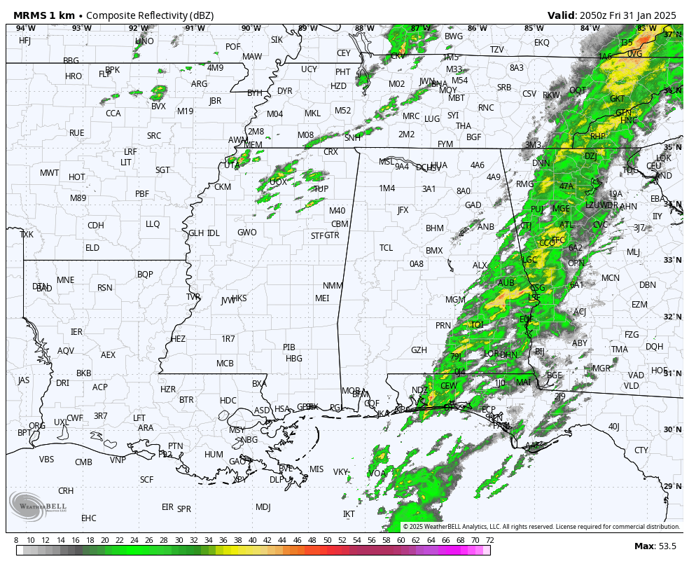
RADAR CHECK: Rain continues over Southeast Alabama this afternoon; a few thunderstorms are involved but SPC has removed the “marginal risk” of severe storms. The sky has cleared over Northwest Alabama, but an upper trough will bring a few scattered showers to the northern half of the state this evening. All of the rain should be over by midnight tonight.
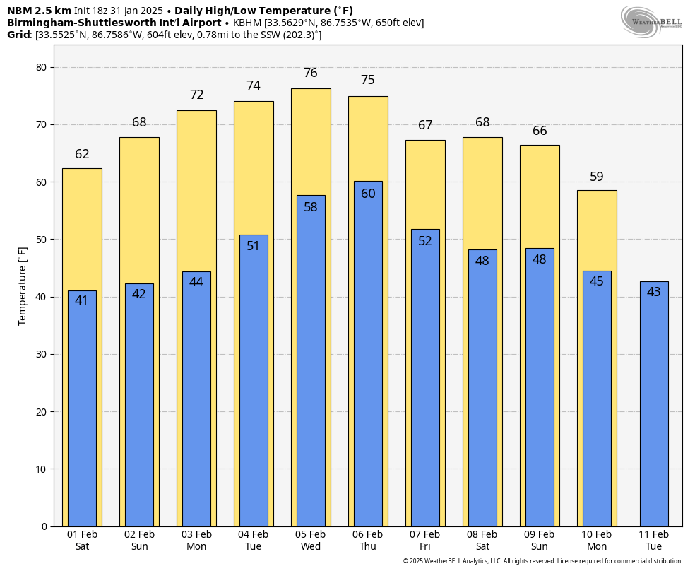
THE WEEKEND: Expect dry weather over the weekend with mostly sunny pleasant days and fair cool nights. Highs will be in the 60s tomorrow, and in the 67-73 degree range Sunday.
NEXT WEEK: It will be the warmest week so far this year, feeling more like April with highs in the 70s. In fact, we will be flirting with record highs on a few days. Global models have trended drier; a few spotty showers are possible during the latter half of the week, but the most widespread rain will likely hold north of Alabama through the week. Some cooler air begins to return around February 10-11, but there is still no evidence of any “Arctic blast” like we experienced earlier this month. See the video briefing for maps, graphics, and more details.
ON THIS DATE IN 1989: The barometric pressure at Norway, Alaska, reached 31.85 inches (1078.4 mb) establishing an all-time record for the North American Continent. The temperature at the time of the record was about 46 degrees below zero. The severe arctic cold began to invade the north-central U.S. The temperature at Grand Fall, Montana, plunged 85 degrees in 36 hours.
Look for my next video briefing here by 6:00 a.m. Monday… enjoy the weekend!
Category: Alabama’s Weather, ALL POSTS, Weather Xtreme Videos


