
Severe Thunderstorm Warning for Pickens, Western Tuscaloosa, and North Central Greene Counties Until 10:00 PM

Severe storms are getting ready to move into the Tuscaloosa area. They will arrive between 930 and 10 p.m.
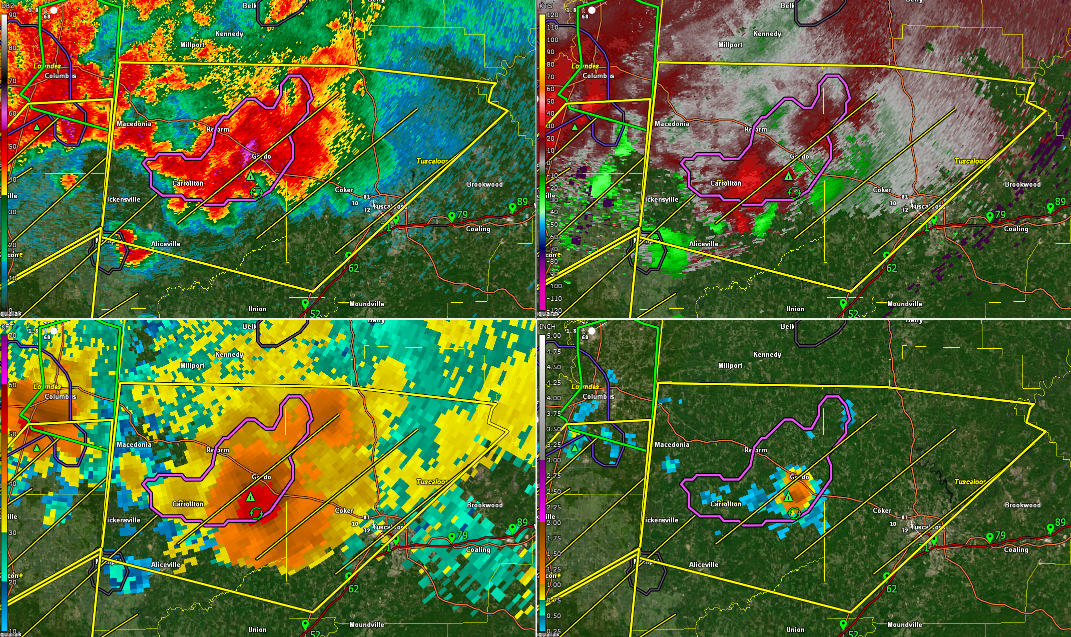
The storms currently have over 50 flashes of lightning per minutes. Hail is at least the size of quarters.
It also has some rotation with relatively higher 0-1km SRH values than we have seen in other areas. Not expecting a tornado but not out of the question.
The storm has a top nearly 52,000 feet into the atmosphere.
The National Weather Service in Birmingham has issued a severe thunderstorm warning for Pickens County, western Tuscaloosa County, and north central Greene County until 10:00 PM CDT.
At 9:00 PM, radar showed severe storms along a line from near Samantha to near McMullen, moving east at 25 mph.
These storms are capable of producing wind gusts up to 60 mph and quarter-size hail. Communities in the path include Northport, Aliceville, Gordo, Reform, Carrollton, and areas near Lake Lurleen State Park and the Tuscaloosa Amphitheater. Seek shelter indoors and stay away from windows.


