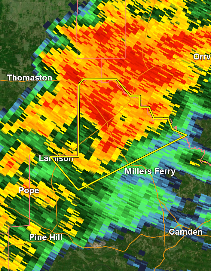
A severe thunderstorm warning has been issued for northwestern Wilcox County. 60mph wind gusts are occurring with this storm. The National Weather Service has tagged this warning with “tornado possible,” so treat this warning seriously and be prepared for the possibility of a tornado warning being issued.
Here is the full messaging from NWS:
The National Weather Service in Mobile has issued a
* Severe Thunderstorm Warning for…
Northwestern Wilcox County in south central Alabama…
* Until 745 PM CST.
* At 721 PM CST, a severe thunderstorm was located 7 miles south of
Consul, or 16 miles northwest of Camden, moving northeast at 45
mph.
HAZARD…60 mph wind gusts.
SOURCE…Radar indicated.
IMPACT…Expect damage to roofs, siding, and trees.
* This severe thunderstorm will remain over mainly rural areas of
northwestern Wilcox County.
PRECAUTIONARY/PREPAREDNESS ACTIONS…
Remain alert for a possible tornado! Tornadoes can develop quickly
from severe thunderstorms. If you spot a tornado go at once into the
basement or small central room in a sturdy structure.
For your protection move to an interior room on the lowest floor of a
building.
A Tornado Watch remains in effect until 1000 PM CST for south central
Alabama.
Category: Alabama’s Weather, ALL POSTS, Severe Weather, Social Media