
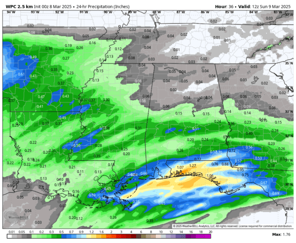
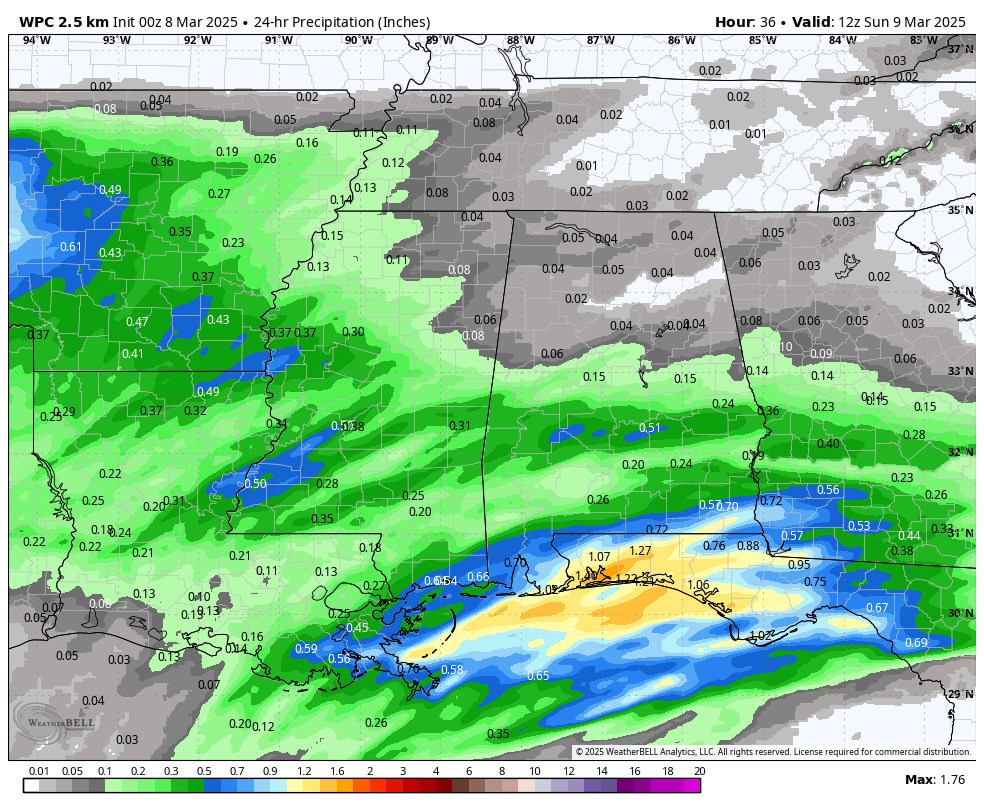
Rainfall amounts from 6AM CST Saturday morning to 7AM CDT Sunday morning.
Looking at our pattern for today, we have a deep trough out to our west with a westerly flow across Alabama for today. We’ll have some moisture begin to work into the Gulf Coast region as early as the pre-dawn hours, with more rain moving in over from the southwest to the northeast starting during the evening hours tonight and through the overnight hours. Rainfall amounts through Sunday morning will be light across much of the area, less than 1/2-inch, while the southern and coastal regions may see amounts up to and over 1 inch, with localized heavier amounts. Much of the day will be partly to mostly cloudy where it is not raining. Highs will top out in the lower 60s to the upper 70s from north to south.
Don’t forget it is also Daylight Saving Time! Spring forward and move those clocks ahead 1 hour before heading to bed (if you still have any devices that require manual adjustments).
Sunday will be a mostly cloudy and cooler day across the state, as we’ll still be dealing with showers throughout the day. The heavier amounts look to be over the southeastern region, with totals up to an inch, while the rest of the area can expect around 1/4 to 1/2-inch of rainfall. Highs in the upper 50s to the lower 70s.
The first part of Monday looks to continue to be wet with showers possible through the midday hour. After that, rain will begin to move out of the state from west to east and some slow clearing will begin, and skies becoming clear by the evening. Almost everyone will see amounts lighter than 1/4-inch. Highs will be back up in the lower 60s to the lower 70s across the state.
Tuesday will be a sunny and nice day across the state, as we’ll have westerly flow over Alabama while a trough will be deepening well off to our west over southern California. We’ll be dry and mild with highs in the lower to mid 70s across the state.
Much of Wednesday will be sunny and mild once again, but we’ll see a disturbance begin to form off to our west that will send a few clouds in our direction late. We stay dry with highs in the 70s.
Thursday arrives with the disturbance beginning to bring showers into the state during the pre-dawn hours and slowly progressing eastward through the entire day. Rain looks to exit the state by midnight. There will be some instability present, but the wind fields do not look all that impressive at this point. Thunder will be possible, and I can’t rule out a few strong storms. I do not believe at this point that this is a severe weather setup, especially with dewpoints in the 40s and 50s. We’ll keep our scanners peeled on this system, especially since we have entered our main severe weather season in Alabama. Highs in the upper 60s to the upper 70s. Rainfall amounts will be light, with most locations seeing less than 1/4 of an inch.
Friday will feature a mix of sun and clouds throughout the day as we’ll have a southwesterly flow over the area, as a deepening trough will be approaching from the west. Dewpoints will begin to rise, and temperatures will actually be warm, reaching the mid 70s to the lower 80s from northeast to southwest across the state.
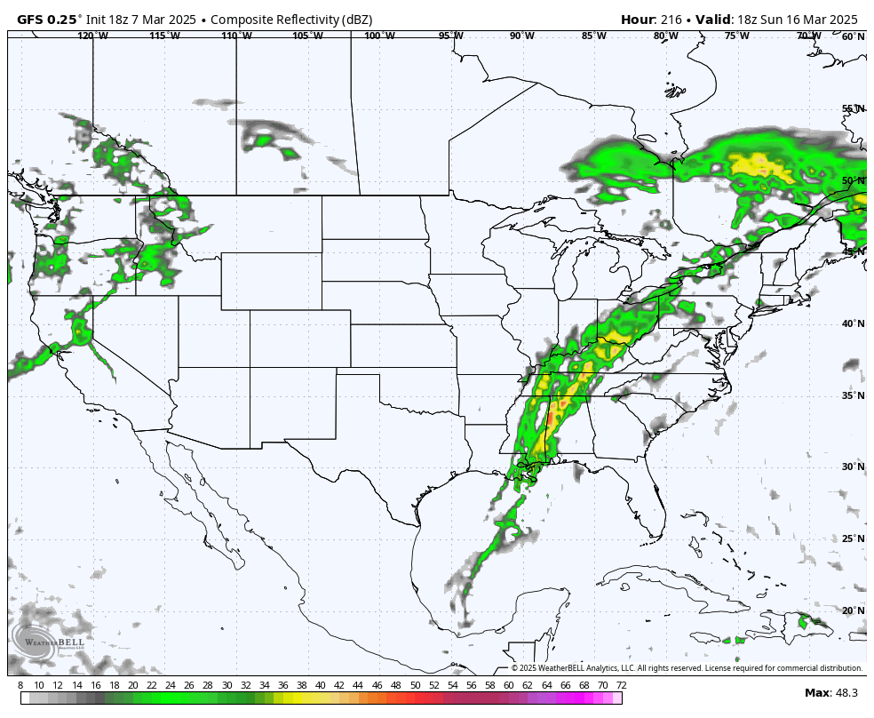
GFS Composite reflectivity valid at 1PM CDT Sunday, March 16th.
Our next potential threat of severe weather looks to take place next weekend as a strong cold front is progged to move through the area during the day on Sunday, March 16th, and leaving the state before midnight. While it is way too early for specifics, the GFS is already painting a decent amount of instability in the area, along with a low-level jet in place. We’ll get a better look at this system later in the week, and we’ll see if it is even a possibility as these models change a lot.


