
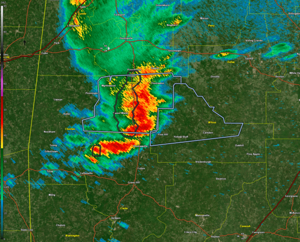

A thunderstorm is moving eastward over Marengo County tonight.
It is not severe, but it did produce a wind gust to 40 mph at Meridian, so similar wind gusts are possible.
It will move into Wilcox County next.
It has a little bit of lightning.
There is another smaller storm to the south over Clarke County northeast of Coffeeville.
Light to moderate rain will spread across Central Alabama tonight, with the highest chances occurring during the overnight hours. Most areas will see light to moderate rainfall, with localized totals exceeding one inch possible. While a few thunderstorms may develop, lightning chances remain low to moderate, and severe weather is not expected.
For South Alabama, the primary threat tonight remains large hail with any storms that develop. Closer to the coast, where some surface-based instability will be present, a damaging wind gust or tornado cannot be ruled out, mainly in the vicinity of and south of the I-10 corridor. Moderate to heavy rain is expected, with most areas receiving up to an inch. Along and south of I-10, training thunderstorms could lead to localized totals of 1 to 3 inches, with flooding concerns limited to urban and poor drainage areas.
Category: Alabama’s Weather, ALL POSTS, Social Media


