


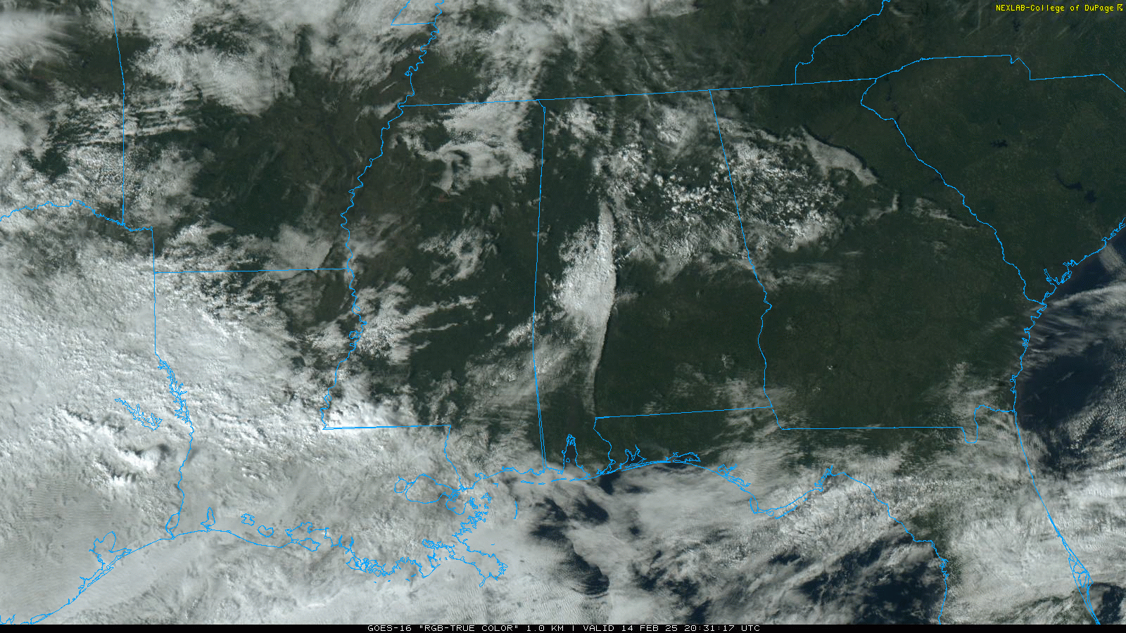
PLEASANT WINTER DAY: Temperatures are in the 50s and 60s across Alabama this afternoon with a good supply of sunshine. Clouds will increase overnight; the low early tomorrow will be in the 45-55 degree range.
STORMY WEEKEND: Tomorrow will be a breezy, mild day with temperatures reaching the low to mid 70s by afternoon. A few scattered showers are possible during the day, but the main event comes tomorrow night when a line of storms will pass through the state. SPC maintains an “enhanced risk” (level 3/5) for parts of West Alabama, with a “slight risk” (level 2/5) for the rest of the state.
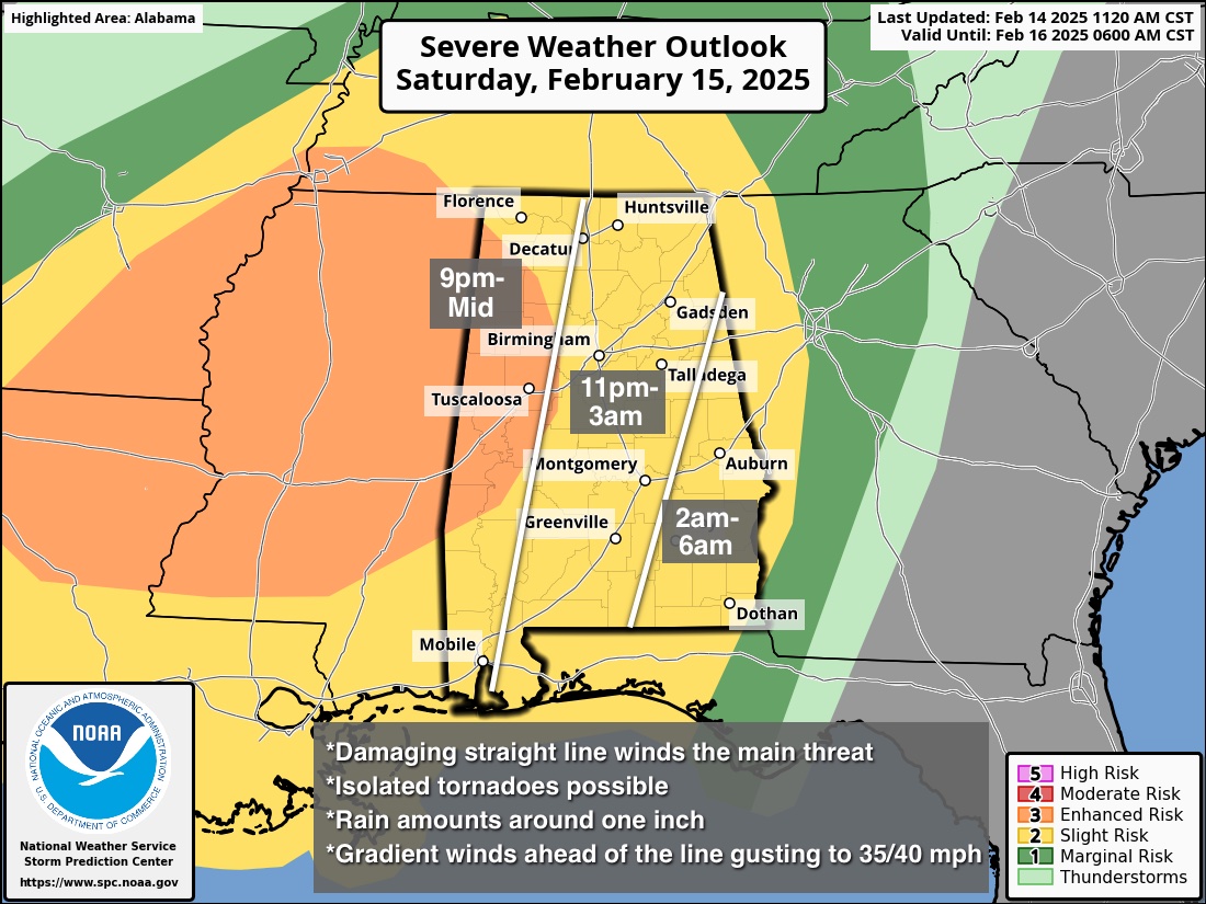
A line of strong to severe thunderstorms will likely enter the northwest corner of the state around 9:00/10:00 tomorrow night… it will move through the rest of the state during the late night/pre-dawn hours. Instability values are limited, but wind fields are strong.
*The main threat will come from strong, potentially damaging straight line winds. However, a brief isolated tornado or two is possible as well.
*This will be a fast moving line, which will reduce the potential for flooding. Rain amounts will be generally around one inch.
*The line of storms should weaken after 3:00 a.m. as it moves into Southeast Alabama; it will be out of the state by 6:00 a.m. Sunday.
*Gradient winds (not related to thunderstorms) could gust to 35/40 mph ahead of the line.
Sunday will feature a clearing sky with highs in the upper 50s and low 60s for most communities.
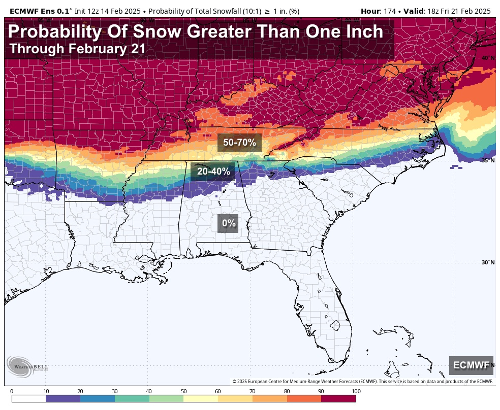
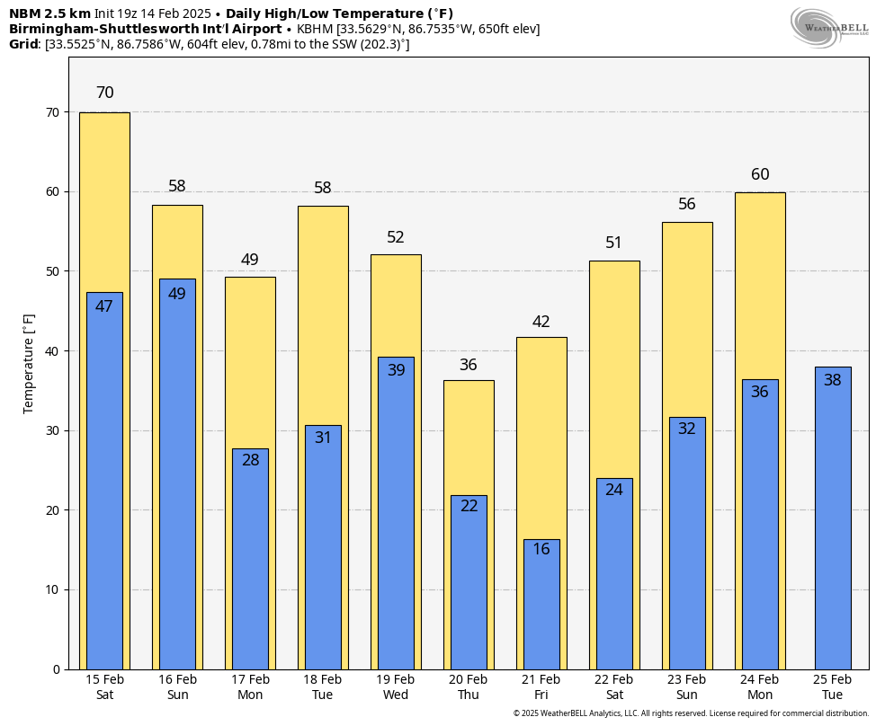
NEXT WEEK: A freeze is likely for North/Central Alabama both Monday and Tuesday morning as a cold, dry airmass will be in place. Then, a mid-week system will bring some rain to the state by late Tuesday night and Wednesday. Global models continue to suggest some potential for a change to light snow over the northern counties of the state late Wednesday or Wednesday night; it remains too early to know if this actually happens, or if there will be any accumulation or impact.
Very cold air follows this system; guidance is trending colder and we believe much of North Alabama will drop into the teens by Friday morning. See the video briefing for maps, graphics, and more details.
ON THIS DATE IN 1958: February 14, 1958 was a Friday night. Snow lovers got a special gift as the heaviest snowfall since 1948 blanketed Birmingham with over two inches of snow. Roads in the Magic City quickly became snow packed and impassable. Roads between Birmingham and Atlanta were especially dangerous. The northwest corner of Alabama was blanketed with 3-6 inches of snow. Six to eight inches fell in Decatur. As often is the case around these parts, snowfall amounts varied over a short distance. While there was two inches on the ground in Bessemer, there was none in Tuscaloosa.
At the Birmingham Municipal Airport, A Delta Airlines DC-7 slid off the runway on Saturday morning and buried itself nose deep in slush and mud when the nose wheel broke. None of the 43 passengers were injured.
Look for my next video briefing here by 6:00 a.m. Monday… enjoy the weekend!


