
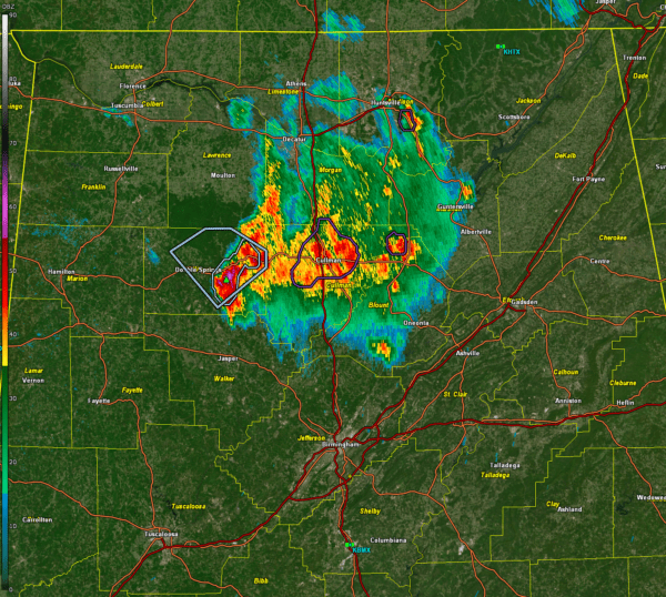

The storm over Winston County weakened a bit, but it still quite strong. The NWS decided not to issue a severe thunderstorm warning, since the hail is probably less than 1 inch in diameter now, but there probably is still hail to marble size.
There is a significant weather advisory for much of Winston County. The strongest part of the storm is passing over US-278 passing between Double Springs and Addison.
Strong storms are in the Cullman area and near Baileyton in Northeast Cullman County.
The storms will continue pushing to the east southeast. A large area of moderate rain continues back through Lawrence, Limestone, Morgan, Madison, and Marshall counties.
Areas from the rest of Cullman, through Blount and Marshall, into northern Walker and Jefferson, into Etowah, DeKalb, St. Clair, Cherokee, Calhoun, and Cleburne counties will experience heavy rain, some lightning and gusty winds as well as some small hail over the next few hours.
Hopefully, the storms will continue to weaken as we lose the heating of the day and instability values wane.
Category: Alabama’s Weather, ALL POSTS, Severe Weather, Social Media


