


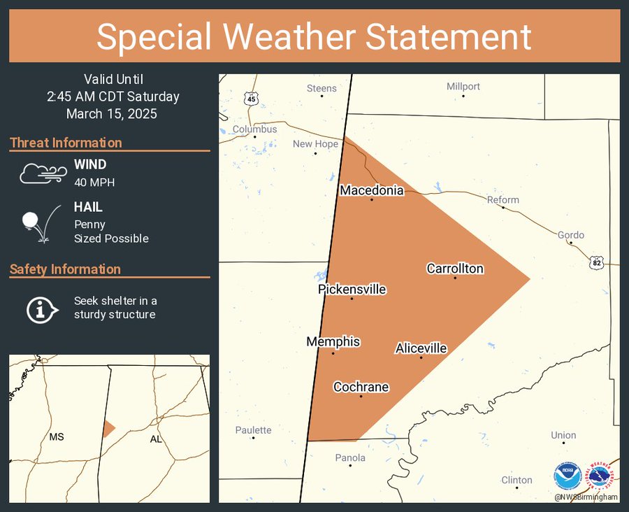
A special weather statement has been issued for western Pickens County. Details below:
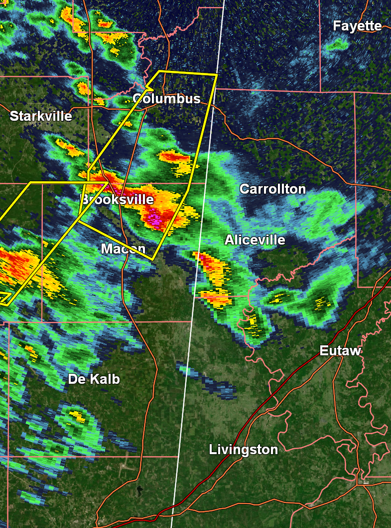
This comes as a cluster of severe storms continue to move across eastern Mississippi. Right now, this storm is expected to weaken slightly, but please note that it could strengthen at any time. We will continue to watch this area closely. Current radar imagery:
There is an active Tornado Warning in effect which includes several northeastern Mississippi counties, and the polygon for this warning goes to the MS/AL state line:
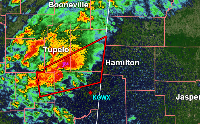
The NWS in Birmingham will soon have to decide if they will continue the warning for western AL counties. We will update if this occurs. This cell has a history of producing damaging tornadoes, so it is one to watch very closely.
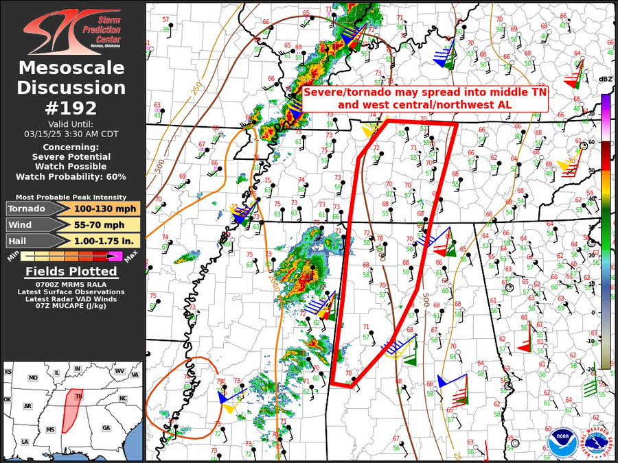
Additionally, the SPC has issued a new mesoscale discussion. They say that a new tornado watch may be needed for northwest AL. Here is the graphic for this MD:
Category: Alabama’s Weather, ALL POSTS, Severe Weather, Social Media


