
Sunday Weather Briefing Video: Springing Forward into Springlike Weather : The Alabama Weather Blog

March is living up to its reputation as a month of change, with cooler air arriving after last night’s rain, followed by a warming trend midweek. A second system brings another chance of showers late in the week, but overall, the week ahead features mild temperatures and hints of spring.
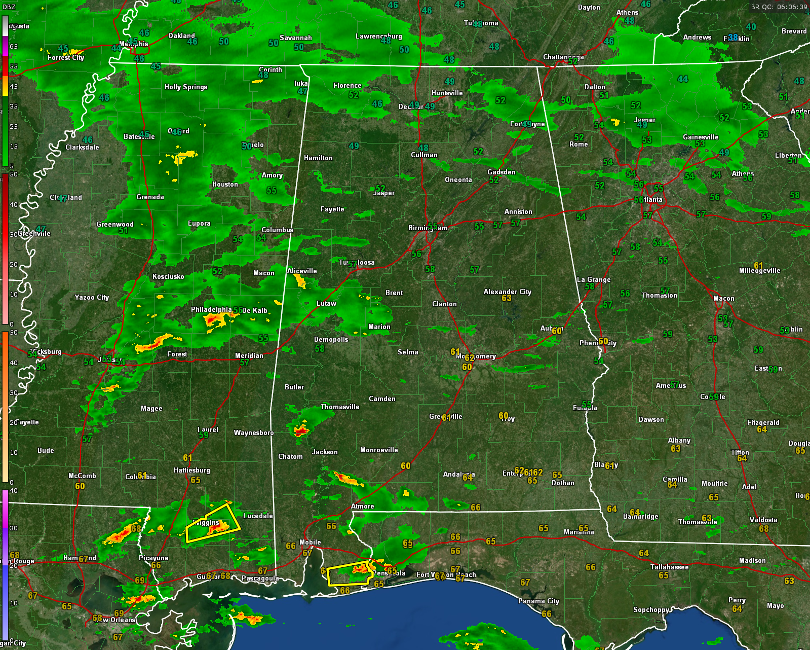
Radar just after midnight, early Sunday morning…showing strong storms over South Mississippi and Alabama
A RAINY START TO SUNDAY
A surface low tracking along the Gulf Coast is bringing light to moderate rain across Central Alabama today, with scattered showers continuing into the afternoon. Temperatures will remain on the cool side, ranging from the mid-50s north to the low 60s south. Rain coverage may decrease slightly this morning before picking up again later in the day. Winds will be out of the north, keeping things feeling cool and damp. There could be little thunder, but the only chance for severe weather will be over the far southeastern corner of the state as the stronger storms and better instability exit this morning.
A DRYING TREND TO START THE WORKWEEK
Rain will taper off tonight, with clearing conditions during the day on Monday. High pressure builds in from the west, bringing drier air and cooler temperatures. Monday morning lows will dip into the upper 30s to low 40s, with afternoon highs in the mid to upper 60s. Tuesday and Wednesday will be pleasant with mostly sunny skies and highs reaching the upper 60s to lower 70s.
MIDWEEK WARM-UP BEFORE THE NEXT FRONT
As high pressure shifts eastward, a return flow from the Gulf will increase temperatures and moisture levels. Highs will climb into the low to mid-70s on Wednesday, with a few clouds streaming in ahead of our next system. Overnight lows will be milder, staying in the 50s.
A WEAK SYSTEM BRINGS SHOWERS THURSDAY
A low-amplitude trough moving through the region will bring a chance of showers and perhaps a few thunderstorms on Thursday, perhaps starting late Wednesday. . Rainfall amounts should be light, and no severe weather is expected at this time. Highs will remain in the upper 60s to low 70s.
ANOTHER SYSTEM ARRIVES NEXT WEEKEND
After a brief break on Friday, another stronger system approaches over the weekend. While details remain uncertain, rain and thunderstorms appear likely by Saturday, with temperatures staying mild in the 60s. We will be monitoring this system for any potential severe weather threat.
GLANCING AHEAD TO WEEK TWO
The overall pattern looks active as we head deeper into March, with more chances of rain and fluctuating temperatures. There are some hints of another cool spell mid-month, but we should see another warm-up before the official start of spring.
BEACH FORECAST
Along the beautiful beaches of Alabama and Northwest Florida, a moderate rip current risk continues today and Monday, with surf heights of 2 to 3 feet and water temperatures in the lower 60s. Expect mostly cloudy skies with scattered showers and thunderstorms today, along with patchy fog tonight. Highs will be in the upper 60s to low 70s, cooling to the lower 60s Monday as breezy northwest winds move in. Sunshine returns Tuesday and Wednesday, with highs back in the upper 60s to low 70s and calmer surf. Always check local beach safety updates before swimming, as rip currents remain a concern.
WEATHERBRAINS PREVIEW
This week on WeatherBrains, we will talk to Alabama Weather Legend Rich Thomas from Montgomery. Tune into the show live on Monday evening on YouTube at YouTube.com/WeatherBrains or on ABC3340’s dot two channel. It will post late Monday night on all the major podcast audio platforms. The podcast’s webiste is weatherbrains.com.
TODAY IN WEATHER HISTORY
On this date in 1998, three days of heavy rain sent floodwaters from Beaver Dam Creek surging through Elba, Alabama, as a levee gave way, forcing 2,000 of the town’s 4,000 residents to evacuate. Downtown was submerged under six feet of water, and five people lost their lives across South Alabama. It was Elba’s third major flood in eight years, following a devastating levee break on the Pea River in 1990. Despite levee reinforcements by the Corps of Engineers after the 1990 flood, the 1998 flood struck suddenly with little warning, causing significant damage. Just three days later, temperatures plunged into the mid-20s.
Category: Alabama’s Weather, ALL POSTS, Severe Weather, Social Media


