


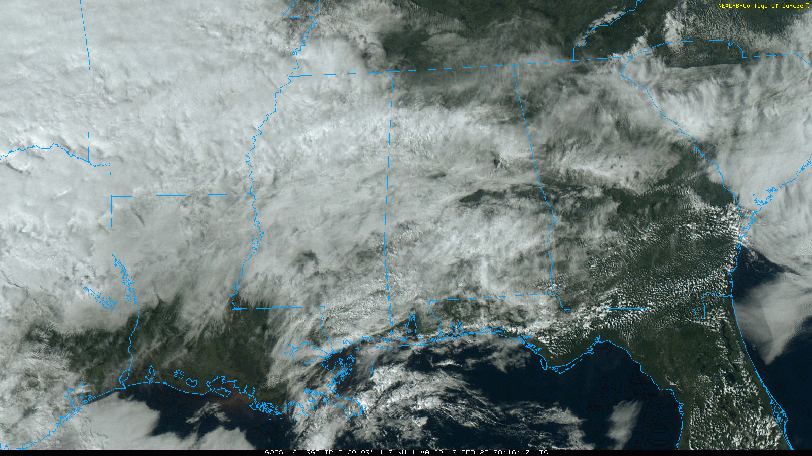
RADAR CHECK: We have some scattered light rain over North Alabama this afternoon… the rest of the state is dry. A surface front is stalled over the southern counties of the state; temperatures range from near 50 across the Tennessee Valley to the mid 70s at Dothan. The front will slowly drift northward tonight and tomorrow.
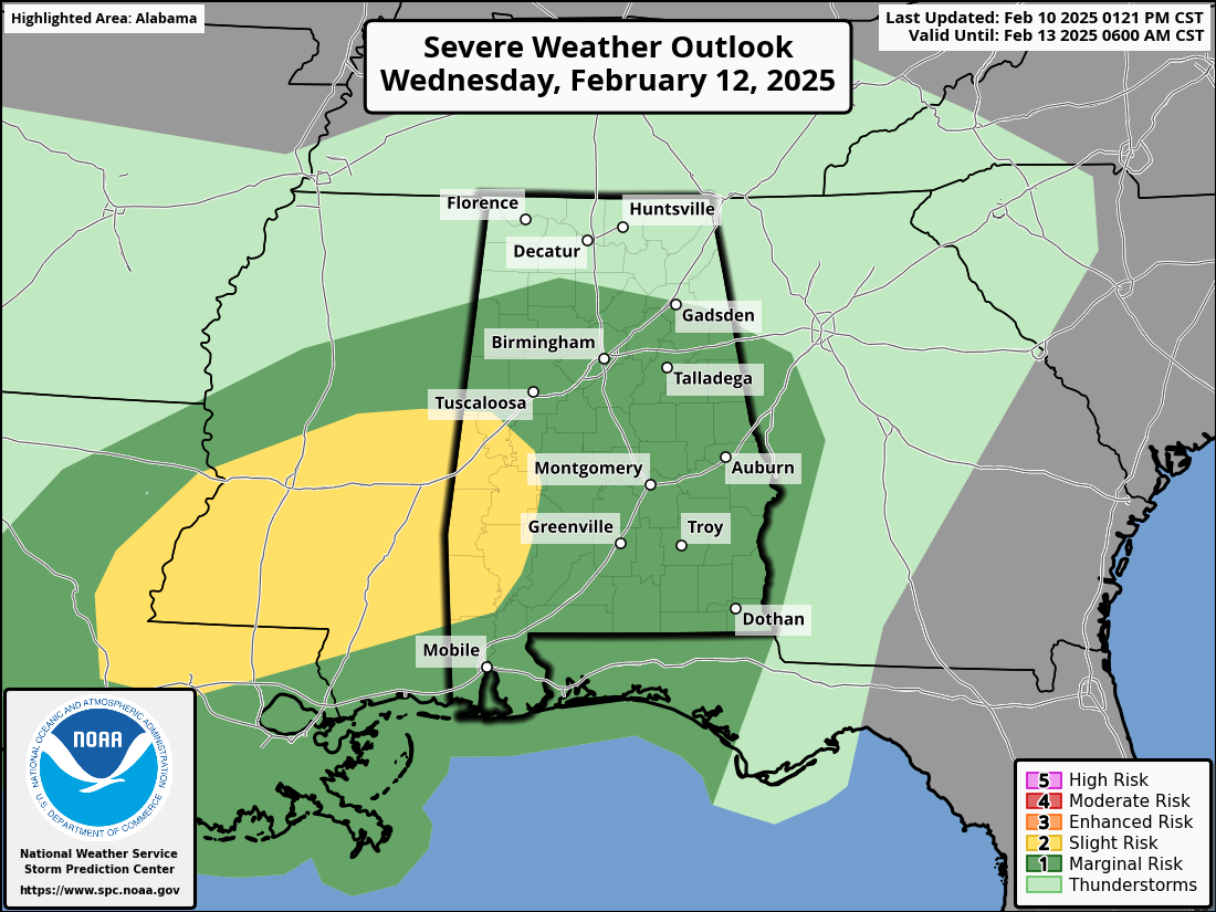
BIG SOAKING: We expect multiple waves of rain, along with a few thunderstorms, across Alabama tomorrow and Wednesday. The rain could be heavy at times; rain amounts for the northern half of the state will be in the 3-6 inch range, with 1-3 inches for the southern counties. A few flooding issues are possible by Wednesday and Wednesday night.
And, we also note SPC has now defined a “slight risk” (level 2/5) of severe thunderstorms for parts of West Alabama Wednesday… there is a “marginal risk” (level 1/5) for the rest of the southern 2/3 of the state. A few storms could produce gusty winds Wednesday afternoon/night; a brief isolated tornado can’t be ruled out.
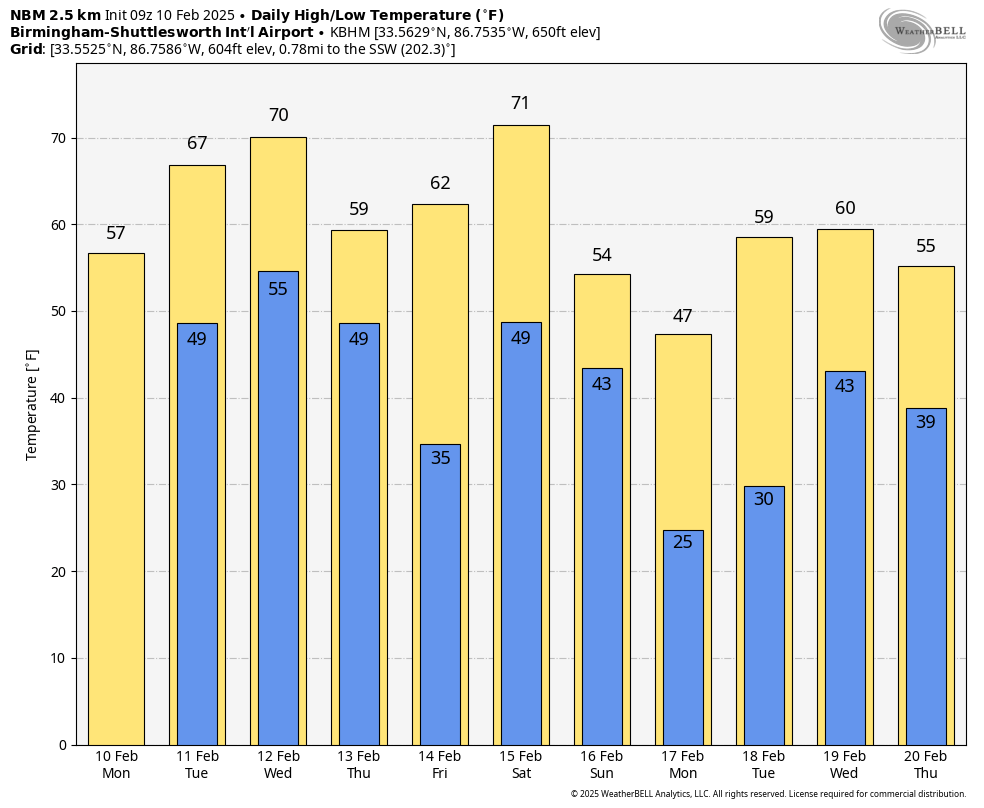
Rain will end early in the day Thursday for most of the state, followed by a clearing sky. Friday will be a mostly sunny day; the low Friday morning will be in the 30s over the northern half of the state; highs should be in the 60s statewide Friday afternoon.
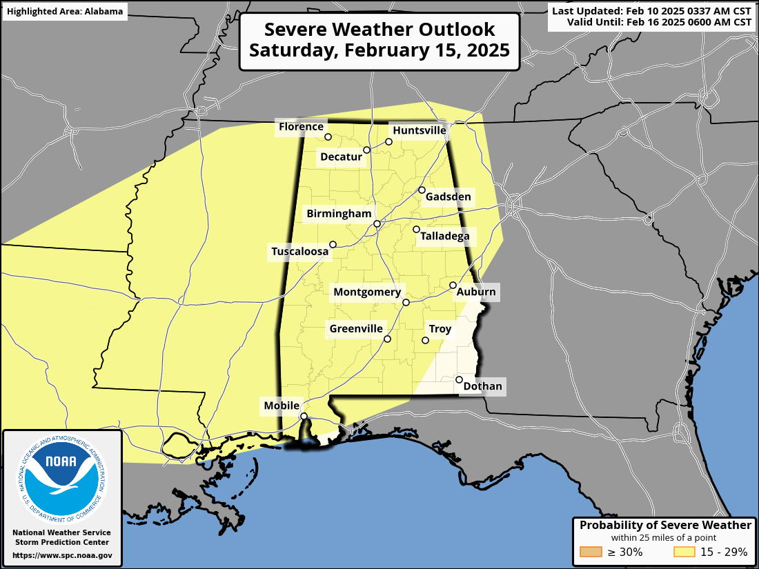
THE ALABAMA WEEKEND: More rain for the state. A dynamic system will bring rain and thunderstorms in here by Saturday afternoon, continuing Saturday night. More heavy rain is likely, and SPC has defined a severe weather threat for most all of Alabama. For now it looks like the core severe weather threat will come from about 3:00 p.m. until midnight Saturday… too early to know the magnitude of the threat. Once we get the mid-week system out of here we can focus on the weekend.
Additional rain amounts of 1-2 inches are likely before dry air returns Sunday. The sky becomes mostly sunny Sunday with a high in the 50s for the northern 2/3 of the state.
NEXT WEEK: Monday (February 17) will be cold and dry; a freeze is likely for much of the state with lows in the 20s and low 30s. Global models show potential for another big rain-maker by mid-week on Wednesday… See the video briefing for maps, graphics, and more details.
ON THIS DATE IN 1981: A morning tornado at Bay Minette struck the local middle school severely damaging the gymnasium. The tornado hurt 62 people were injured, 44 of whom were students.
ON THIS DATE IN 2013: In the afternoon hours of February 10, 2013, a large multiple-vortex EF-4 tornado devastated the cities of West Hattiesburg, Hattiesburg, and Petal, Mississippi. The tornado was one of eight that touched down in southern Mississippi and southwestern Alabama. While there were no fatalities, 71 were injured.
Look for the next video briefing here by 6:00 a.m. tomorrow…


