
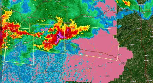
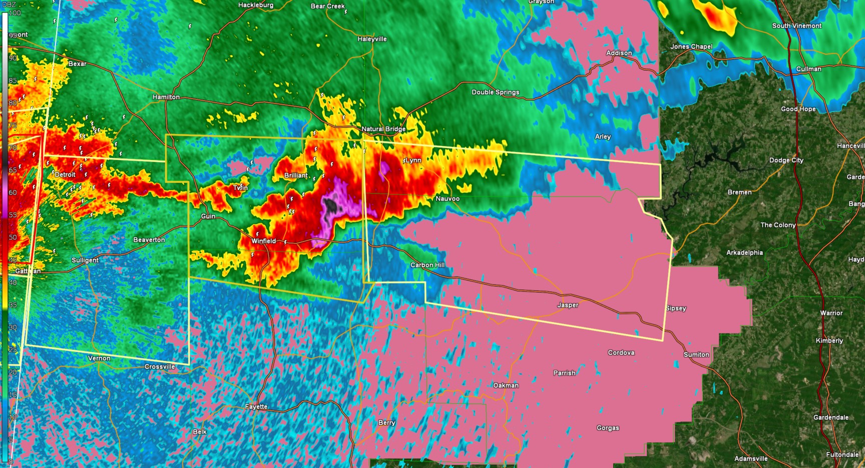
The National Weather Service in Birmingham has issued a

* Severe Thunderstorm Warning for...
  Northern Walker County in central Alabama...
  Southern Winston County in northwestern Alabama...

* Until 1045 PM CDT.

* At 915 PM CDT, a severe thunderstorm was located near Eldridge, or
  7 miles east of Winfield, moving east at 35 mph.

  HAZARD...60 mph wind gusts and half dollar size hail.

  SOURCE...Radar indicated.

  IMPACT...Hail damage to vehicles is expected. Expect wind damage
           to roofs, siding, and trees.

* Locations impacted include...
  Curry, Camp McDowell, Maple Branch, Lynn, Smith Dam, Ashbank,
  Little Dismal Creek, Coon Creek, Poplar Springs, Cedrum Area, Holly
  Grove, Powellville, Lupton, Battle Branch, Townley, Carbon Hill,
  Eldridge, Wilson Bend, Devils Branch, and Kansas.

PRECAUTIONARY/PREPAREDNESS ACTIONS...

For your protection move to an interior room on the lowest floor of a
building.
Category: Alabama’s Weather, ALL POSTS, Social Media


