
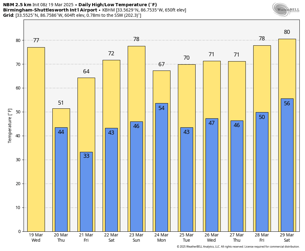
WINDY MARCH DAY: Strong south winds will gust to 30 mph across much of Alabama today ahead of a cold front; a wind advisory is in effect for areas along and north of I-20. Temperatures reach the upper 70s today in most areas with a mix of sun and clouds… some places could see 80 degree warmth.
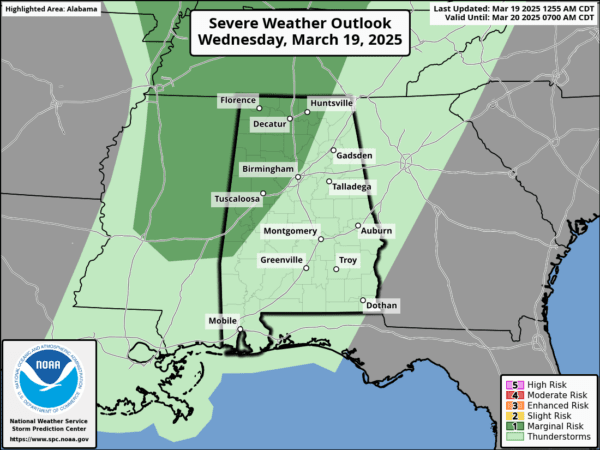
The front will push a fast moving band of showers and storms through the state tonight; SPC maintains a low end “marginal risk” (level 1/5) of severe thunderstorms for areas north and west of Birmingham.
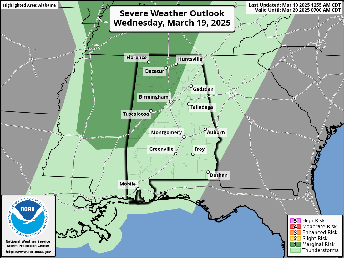
With very limited instability and weak dynamic support, the overall threat is low. But a few storms could produce small hail and gusty winds. No risk of a tornado.
MUCH COLDER: Following the front tomorrow will be a breezy, cold day with temperatures holding in the 40s over the northern third of the state where a few spotty showers will be possible as the upper trough passes overhead. The sky will clear across the southern counties with a high in the 50s.
Frost is likely across much of Alabama early Friday morning with a clear sky and diminishing wind; colder spots will see a freeze. Then, temperatures rise into the 60s Friday afternoon with a sunny sky.
THE ALABAMA WEEKEND: Most of the weekend will be dry. With a partly to mostly sunny sky Saturday we expect a high in the 70s. Temperatures rise into the 77-82 degree range Sunday with a mix of sun and clouds. Then, a batch of showers and storms will arrive late Sunday night into Monday morning. SPC has defined a risk of severe thunderstorms west of Alabama Sunday, but with very little instability available the overall severe weather threat here looks low at this point.
By Monday afternoon showers will be confined to the far southern part of the state, and the rest of next week looks mostly dry with seasonal temperatures. See the video briefing for maps, graphics, and more details.
STORM SURVEYS: NWS Birmingham has now confirmed 13 tornadoes from the weekend event, and more work will be done today in Sumter, Tuscaloosa, and Walker counties. Strongest tornado rating so far was an EF-3 that moved through Plantersville and Maplesville.
SPRING ARRIVES: The spring equinox is early tomorrow morning at 4:01a CT. This is when the sun is directly over the earth’s equator, meaning we have approximately 12 hours of daylight and 12 hours of darkness today and tomorrow.
ON THIS DATE IN 2018: An EF-3 tornado tore through the town of Jacksonville, in Calhoun County. The tornado first touched down west of US Highway 431 north of Wellington, where it rapidly intensified and widened. The tornado entered the City of Jacksonville where it gained strength into the EF3 category, with winds around 140 mph. It removed most of the roof and the top floor of two buildings in an apartment complex.
The tornado affected most of the campus of Jacksonville State University. Several buildings sustained significant damage. The most intense winds remained north of the campus however, mowing down trees and causing direct damage to homes.
As the tornado crossed Highway 21, it caused major damage to the Merrill Building. It then moved into a highly populated zone, where scores of homes suffered major damage and rendered many uninhabitable. The tornado maintained its strength as it crossed Choccolocco Mountain, with winds funneled up the valleys mowing down trees. Despite the damage, there were no fatalities and only one serious injury.
Also on March 19, 2018, very large and destructive hail in Cullman was responsible for major damage to vehicles, homes, and businesses. An Alabama record 5.38″ diameter hailstone confirmed by the NWS.
Look for the next video briefing here by 3:00 this afternoon…enjoy the day!


