
Forget Preikestolen, Kjerag, and Trolltunga: Rødøyløva is the most beautiful hike in all of Norway. And the best part is: you don’t even have to stand in line to take a photo. Why Rødøyløva has barely been discovered by tourism is a mystery to me, because it is one of the seven scenic hikes in Norway, alongside the aforementioned trails and three other hikes, including Besseggen. When I read that 60,000 hikers walk this latter trail annually, it makes my head spin. When I was at Rødøyløva in early July, I had to share the trail with a maximum of 15 other hikers. So, grab your calendar, block out a moment, and go do this hike!
About Rødøyløva
Rødøyløva, or the Lion of Rødøy, is located on the island of Rødøy in northern Norway. Rødøy is located, roughly speaking, between Mo i Rana and Bodø and is one of the islands on the Helgeland coast. This coast is relatively unknown to travelers, but oh oh how beautiful it is. I live in Swedish Lapland and Mo i Rana is about an hour and a half drive from me. If the weather is even remotely nice, I regularly try to go to Helgeland for a long weekend.
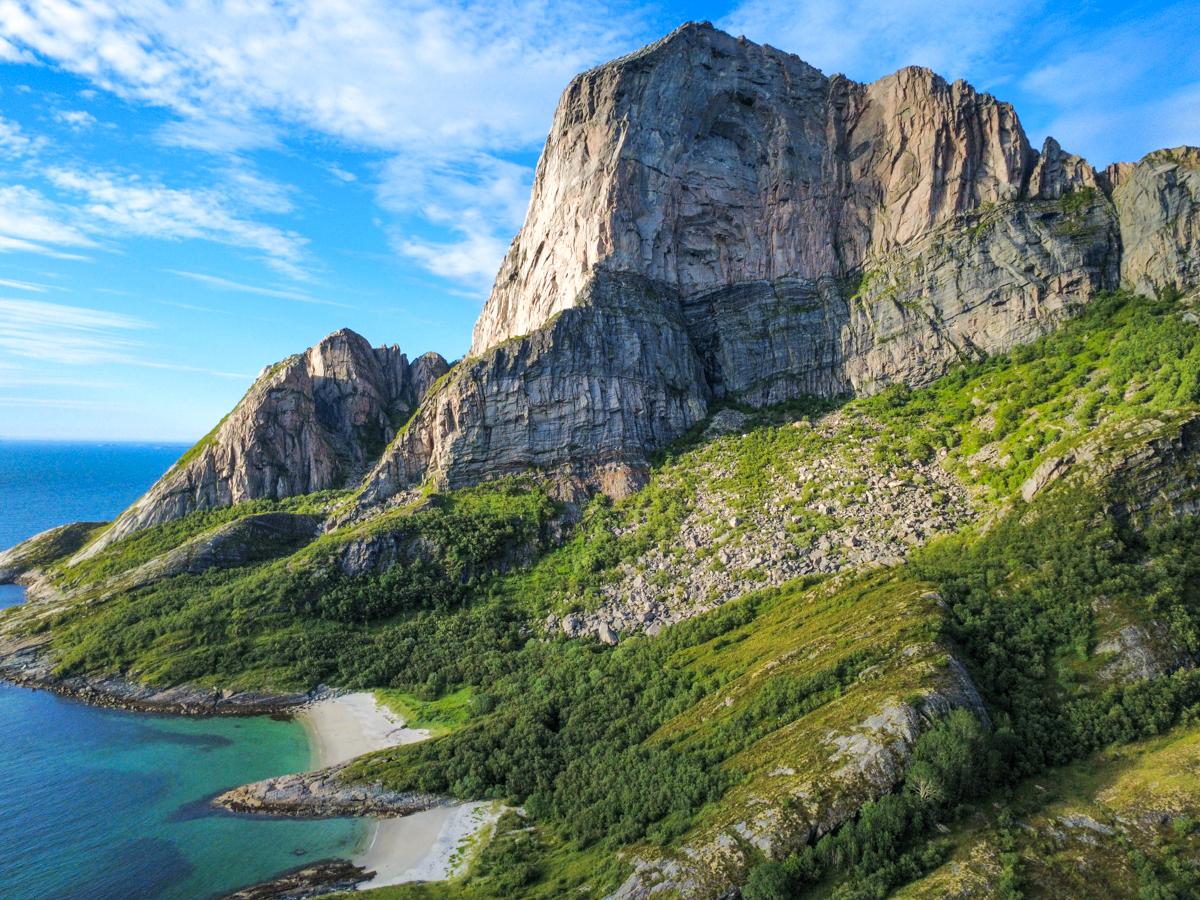
The Rødøyløva rock is located 440 meters above sea level and is clearly visible from the ferry to the island. To be honest, when I arrived by boat I thought the mountain looked quite intimidating. But actually the hike to the top was quite doable!


The Rødøyløva hike
The Rødøyløva hike looks tougher than it is. Admittedly, climbing 440 meters from sea level is not for the faint of heart, but I found the difficulty to be quite manageable. Of course, you do have to work for it, but because sherpa steps have been installed on the steepest part (by the sherpas from Nepal, yes) it’s technically not a very strenuous hike.
From the parking lot, you walk straight up into the forest. The first sherpa steps appear very quickly, helping you gain altitude rapidly in a short time. At an altitude of about 250 meters, you reach a plateau; from here, you have the first views of the surroundings. It’s a glorious day when I’m there (okay, I planned it this way because I live relatively close by) and the sea far below me is bright blue.
At the plateau, the trail transitions into a regular mountain trail, sometimes a bit steep, but nowhere technical. Just before the summit, there’s another series of sherpa steps that eventually lead you all the way to the top. Please note: the abyss is steep and it is advised not to get too close to it. I must honestly say that I started to feel quite dizzy as I stared into the depths; from the top, you look straight down about 440 meters.
Eventually, I took a break in the sun to the left of the summit. In the distance, I saw the ice of the Svartisen Glacier and even the southern part of the Lofoten Islands. After about half an hour, I started the descent, which was at least as physically demanding, because you have to go back down all those stairs as well.


Good to know about the Rødøyløva hike
The Rødøyløva hiking trail is not suitable for novice hikers and/or people with a fear of heights. You ascend 440 meters over 1.5 kilometers, so it takes a heavy toll on your body, and especially on the way back: on your knees. It took me about an hour and a half to reach the top (I also made quite a few photo stops), and I was back down in just under an hour.
Parking at the trailhead is paid; you can pay at the kiosk at the trailhead. You can also camp with your camper in the parking lot, and there are various tent spots at the back of the field. If you do not have a camper or tent, you can stay overnight at the facility located opposite named Klokkergården.
To get to the Rødøyløva hike, you need to take the ferry. It runs once or twice a day from Tonnes in the south and Jektvik in the east. View times here. Please note that you should search for ferjkai and not Hurtigrutenkaj, which is the pier for foot passengers. It’s line 18-412 and you pay on board. Reservations are not possible.


Conclusion and further reading
The hike to Rødøyløva is absolutely the most beautiful hike I have ever done in Norway. The fact that the hike is located on an isolated island and requires some effort to get there makes it extra special, in my opinion.
If you would like to read more about Northern Norway, you will probably find the following articles interesting as well:
Book your trip to Norway
You can easily book your trip to the north of Norway yourself using the links below.
- Your flight can be booked via Skyscanner. You can fly to Bodø, but also Tromsø is an option if you wish to explore more, for example Lofoten.
- For transportation in this region a rental car is a must. Find rates and options here. I live nearby so used my own car.
- Your accommondations can be booked via Booking. In high season (June – August) it’s an absolute must to book your accommodations well ahead.
This article contains affiliate links. If you make a purchase and/or reservation via such a link, we may receive a small commission at no extra cost to you. Thank you for considering!