

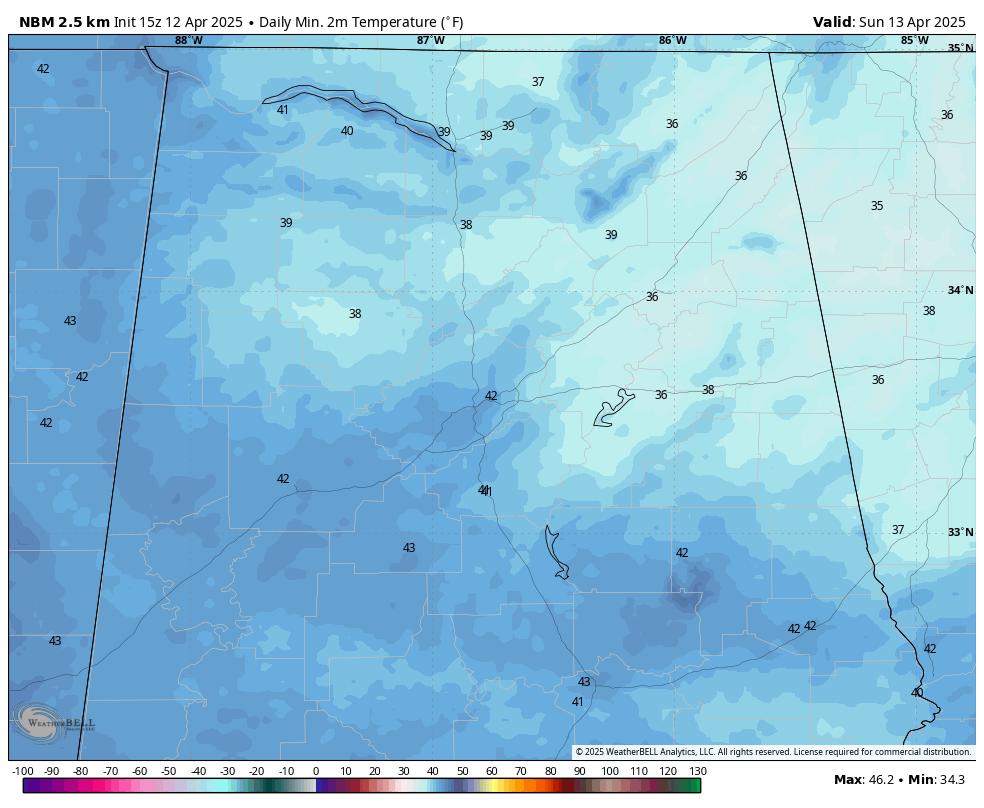
Lows by Sunday morning
Frost Advisory Issued for Parts of North and Central Alabama Late Tonight
The National Weather Service has issued a Frost Advisory for much of northeast and central Alabama, in effect from 1:00 AM to 8:00 AM CDT Sunday. A chilly air mass settling in overnight will cause temperatures to dip into the mid 30s, leading to frost formation in several areas.
?? What to Expect:
- Temperatures as low as 36°F across valleys and rural areas
- Frost development possible in open, sheltered locations
- Potential harm to sensitive outdoor vegetation
? Areas Included:
- From NWS Huntsville: Jackson and DeKalb Counties (including Scottsboro, Fort Payne, and Rainsville)
- From NWS Birmingham: Blount, Etowah, Calhoun, Cherokee, Cleburne, St. Clair, Talladega, Clay, and Randolph Counties (including Anniston, Gadsden, Centre, Heflin, Sylacauga, Roanoke, and Moody)
? Gardeners Take Note:
Frost may cause damage to tender plants, flowers, and early-season gardens. Take precautions this evening by covering plants or moving them indoors if possible.
Frost conditions should end by mid-morning Sunday as temperatures rise into the upper 60s and 70s with full sunshine expected by afternoon.
Stay warm tonight—and protect those spring blooms!
Category: Alabama’s Weather, ALL POSTS, Severe Weather, Social Media