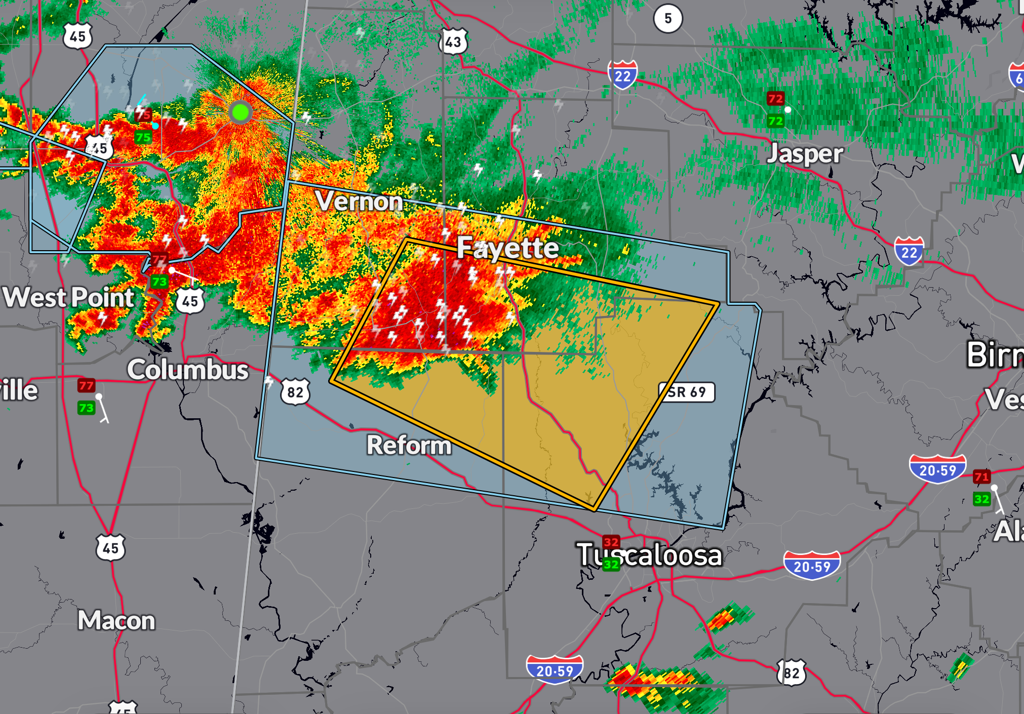
A severe thunderstorm warning is in effect until 2:15 AM CDT for parts of northwestern Tuscaloosa, northeastern Pickens, southern Fayette, and southeastern Lamar counties.
At 1:29 AM, a strong storm near Kennedy and Millport was moving east at 40 mph.
This storm is capable of producing 60 mph wind gusts and quarter-size hail.
Radar indicates the potential for damage to vehicles from hail and wind damage to roofs, siding, and trees.
Communities in the path include Fayette, Kennedy, Millport, Belk, and areas near Lake Tuscaloosa and Lake Lurleen State Park.
If you’re in the warning area, seek shelter in an interior room on the lowest floor of a sturdy building.
Category: Alabama’s Weather, ALL POSTS, Severe Weather