


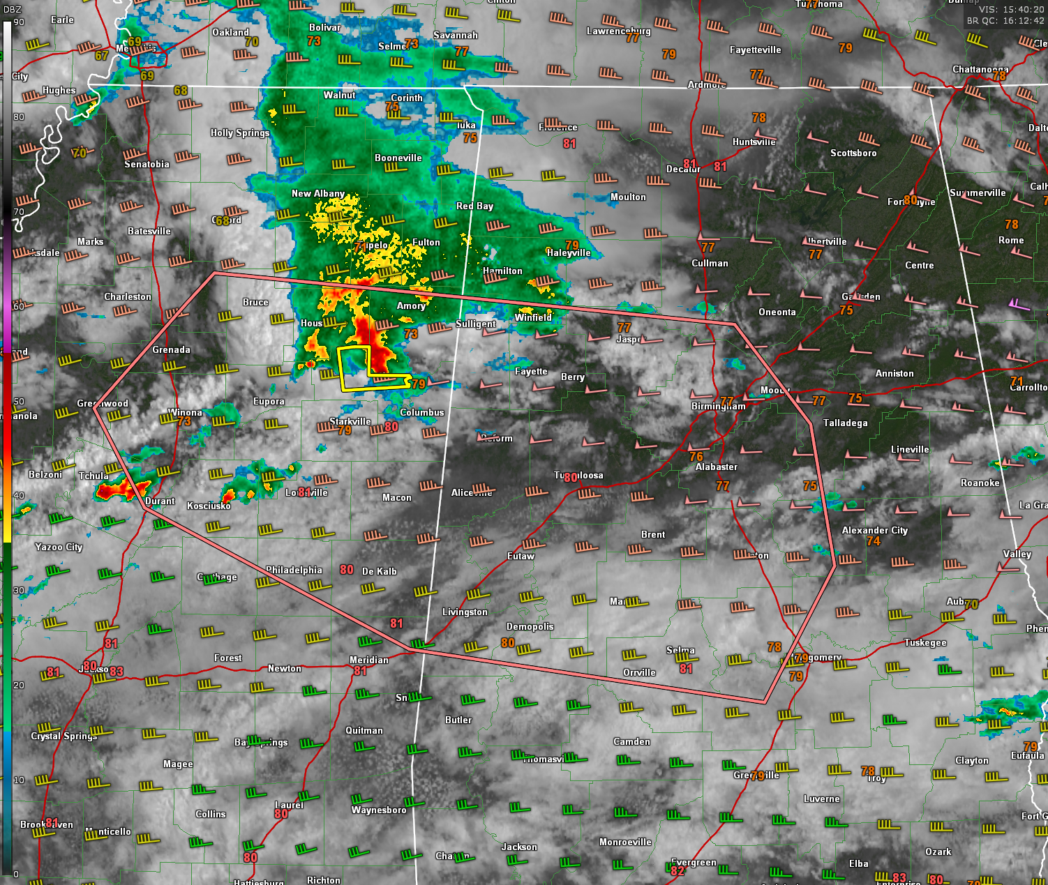
A cluster of strong to potentially severe thunderstorms is moving eastward across northern Mississippi this morning and will begin impacting northwest Alabama before midday. A Severe Thunderstorm Warning is already in effect for Clay County, MS, and this storm will approach Lamar County, AL, before 11:30 AM. So far, the storms have shown limited severe reports since crossing I-55, but environmental conditions become more favorable as the storms move east. Surface-based CAPE values across northwest Alabama are running high—between 2000 and 3000 J/kg—providing fuel for additional intensification. Meanwhile, bulk shear increases to over 50 knots across northern portions of the state, further enhancing the severe weather risk.
According to the Storm Prediction Center, damaging winds would be the primary threat, but hail up to 1.75 inches in diameter is also possible if the storms organize. There is no tornado threat at this time. The SPC estimates a 60 percent chance that a new severe thunderstorm watch may be issued for parts of northern and central Alabama later this by early afternoon. We will continue to monitor this evolving situation and provide updates as needed.
Category: Alabama’s Weather, ALL POSTS, Severe Weather, Social Media


